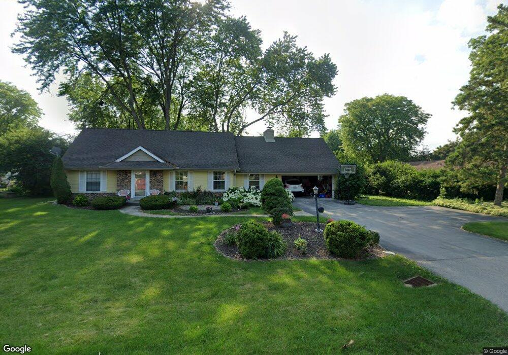
2415 Talbots Ln Brookfield, WI 53045
Estimated Value: $498,516 - $547,000
4
Beds
3
Baths
1,202
Sq Ft
$428/Sq Ft
Est. Value
About This Home
This home is located at 2415 Talbots Ln, Brookfield, WI 53045 and is currently estimated at $514,129, approximately $427 per square foot. 2415 Talbots Ln is a home located in Waukesha County with nearby schools including Brookfield Elementary School, Wisconsin Hills Middle School, and Brookfield Central High School.
Ownership History
Date
Name
Owned For
Owner Type
Purchase Details
Closed on
Oct 8, 2016
Sold by
Nielson Tiffaney M and Carlson Tiffaney M
Bought by
Nielson Peter J and Nielson Tiffaney M
Current Estimated Value
Purchase Details
Closed on
May 19, 2009
Sold by
Irussi Bruce G and Irussi Joy L
Bought by
Carlson Tiffaney M
Home Financials for this Owner
Home Financials are based on the most recent Mortgage that was taken out on this home.
Original Mortgage
$261,155
Interest Rate
5.21%
Mortgage Type
New Conventional
Create a Home Valuation Report for This Property
The Home Valuation Report is an in-depth analysis detailing your home's value as well as a comparison with similar homes in the area
Home Values in the Area
Average Home Value in this Area
Purchase History
| Date | Buyer | Sale Price | Title Company |
|---|---|---|---|
| Nielson Peter J | -- | None Available | |
| Carlson Tiffaney M | $274,900 | None Available |
Source: Public Records
Mortgage History
| Date | Status | Borrower | Loan Amount |
|---|---|---|---|
| Previous Owner | Carlson Tiffaney M | $261,155 |
Source: Public Records
Tax History Compared to Growth
Tax History
| Year | Tax Paid | Tax Assessment Tax Assessment Total Assessment is a certain percentage of the fair market value that is determined by local assessors to be the total taxable value of land and additions on the property. | Land | Improvement |
|---|---|---|---|---|
| 2024 | $3,803 | $347,200 | $125,000 | $222,200 |
| 2023 | $4,738 | $347,200 | $125,000 | $222,200 |
| 2022 | $4,922 | $290,100 | $110,000 | $180,100 |
| 2021 | $5,177 | $290,100 | $110,000 | $180,100 |
| 2020 | $5,293 | $290,100 | $110,000 | $180,100 |
| 2019 | $4,908 | $290,100 | $110,000 | $180,100 |
| 2018 | $4,333 | $281,600 | $110,000 | $171,600 |
| 2017 | $4,730 | $281,600 | $110,000 | $171,600 |
| 2016 | $5,364 | $281,600 | $110,000 | $171,600 |
| 2015 | $4,386 | $281,600 | $110,000 | $171,600 |
| 2014 | $4,550 | $281,600 | $110,000 | $171,600 |
| 2013 | $4,550 | $281,600 | $110,000 | $171,600 |
Source: Public Records
Map
Nearby Homes
- 21300 Astolat Dr
- 2410 Talbots Ln
- 20780 Tennyson Dr
- 21380 Woodchuck Ln
- 21945 Galahad Ln
- 21965 Valiant Dr
- 21330 Hollycrest Ct
- 21905 W North Ave
- N19W22081 Foxview Ct Unit 2B
- W223N2314 Meadowood Ln
- W222N2872 Timberwood Ct
- 7034 Stonewood Ln
- 7038 Stonewood Ln
- 7018 Stonewood Ln
- 7022 Stonewood Ln
- Lt119 Berwick Ct
- Lt117 Berwick Ct
- Lt115 Berwick Ct
- Lt120 Berwick Ct
- Lt116 Berwick Ct
- 21305 Ann Rita Dr
- 21320 Astolat Dr
- 21325 Ann Rita Dr
- 2420 Talbots Ln
- 21345 Ann Rita Dr
- 21340 Astolat Dr
- 21225 Ann Rita Dr
- 2400 Talbots Ln
- 21305 Astolat Dr
- 21300 Ann Rita Dr
- 21330 Ann Rita Dr
- 21375 Ann Rita Dr
- 21370 Astolat Dr
- 21325 Astolat Dr
- 2370 Talbots Ln
- 21220 Ann Rita Dr
- 2355 Talbots Ln
- 21185 Ann Rita Dr
- 2465 Talbots Ln
- 21345 Astolat Dr