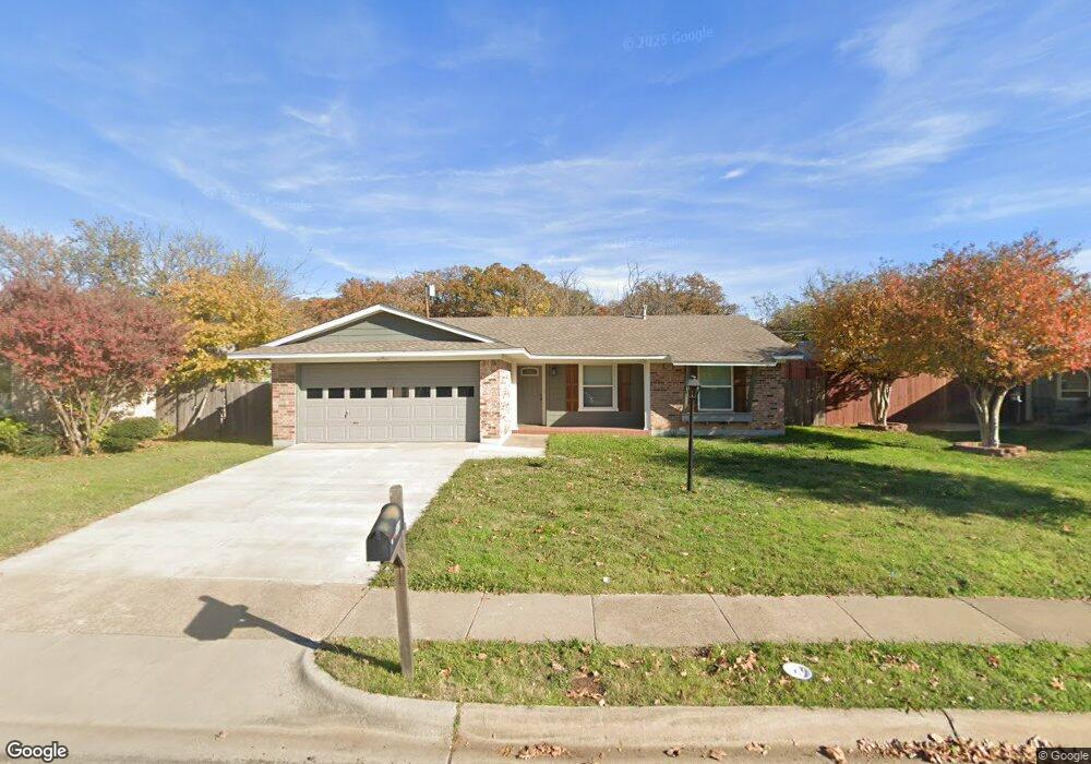
2415 Westwood Dr Denton, TX 76205
Denia NeighborhoodEstimated Value: $252,253 - $296,000
3
Beds
2
Baths
1,136
Sq Ft
$241/Sq Ft
Est. Value
About This Home
This home is located at 2415 Westwood Dr, Denton, TX 76205 and is currently estimated at $273,813, approximately $241 per square foot. 2415 Westwood Dr is a home located in Denton County with nearby schools including Borman Elementary School, McMath Middle School, and Denton High School.
Ownership History
Date
Name
Owned For
Owner Type
Purchase Details
Closed on
Mar 25, 2013
Sold by
Denton County Bail Bond Board
Bought by
Webb Randy
Current Estimated Value
Purchase Details
Closed on
Feb 14, 2013
Sold by
Webb Randy
Bought by
Denton County Bail Bond Board
Purchase Details
Closed on
Sep 30, 2008
Sold by
Parkes Ward Herrin
Bought by
Webb Randy
Purchase Details
Closed on
Sep 24, 2008
Sold by
Parkes Jack A
Bought by
Parkes Ward Herrin and Parkes Alesha
Purchase Details
Closed on
Sep 19, 2008
Sold by
Maxine Jones M and Maxine Parkes M
Bought by
Parkes Jack A
Purchase Details
Closed on
Oct 24, 2007
Sold by
Eveleth Robert G
Bought by
Parkes Ward Herrin and Parkes Alesha
Create a Home Valuation Report for This Property
The Home Valuation Report is an in-depth analysis detailing your home's value as well as a comparison with similar homes in the area
Home Values in the Area
Average Home Value in this Area
Purchase History
| Date | Buyer | Sale Price | Title Company |
|---|---|---|---|
| Webb Randy | -- | Title Resources | |
| Denton County Bail Bond Board | -- | Title Resources | |
| Webb Randy | -- | Title Resources | |
| Parkes Ward Herrin | -- | Title Resources | |
| Parkes Jack A | -- | Title Resources | |
| Parkes Ward Herrin | -- | None Available |
Source: Public Records
Tax History Compared to Growth
Tax History
| Year | Tax Paid | Tax Assessment Tax Assessment Total Assessment is a certain percentage of the fair market value that is determined by local assessors to be the total taxable value of land and additions on the property. | Land | Improvement |
|---|---|---|---|---|
| 2025 | $4,632 | $230,271 | $60,300 | $169,971 |
| 2024 | $4,632 | $239,983 | $60,300 | $179,683 |
| 2023 | $5,014 | $262,598 | $60,300 | $202,298 |
| 2022 | $4,703 | $221,547 | $60,300 | $161,247 |
| 2021 | $3,596 | $161,777 | $40,200 | $121,577 |
| 2020 | $3,578 | $156,538 | $40,200 | $116,338 |
| 2019 | $3,789 | $158,799 | $40,200 | $118,599 |
| 2018 | $3,368 | $139,435 | $40,200 | $99,235 |
| 2017 | $3,411 | $137,993 | $38,190 | $99,803 |
| 2016 | $2,616 | $105,851 | $24,120 | $81,731 |
| 2015 | $2,361 | $100,528 | $24,120 | $76,408 |
| 2014 | $2,361 | $94,368 | $28,140 | $66,228 |
| 2013 | -- | $92,931 | $28,140 | $64,791 |
Source: Public Records
Map
Nearby Homes
- 2421 Mercedes Rd
- 2302 Mercedes Rd
- 2605 Mccormick St
- 2609 Mccormick St
- 2314 Leslie St
- 2617 Mccormick St
- 2621 Mccormick St
- 2513 Goldfinch Dr
- 2700 Mccormick St
- 2512 Goldfinch Dr
- 2708 Mccormick St
- 2516 Goldfinch Dr
- 2600 Goldfinch Dr
- 2800 Mccormick St
- 2305 Bernard St
- 2700 Goldfinch Dr
- 2704 Goldfinch Dr
- 2713 Goldfinch Dr
- 2717 Goldfinch Dr
- 2216 Redwing Dr
- 2409 Westwood Dr
- 2421 Westwood Dr
- 2414 Mercedes Rd
- 2403 Westwood Dr
- 2408 Mercedes Rd
- 2420 Mercedes Rd
- 2414 Westwood Dr
- 2402 Mercedes Rd
- 2408 Westwood Dr
- 2420 Westwood Dr
- 2321 Westwood Dr
- 2402 Westwood Dr
- 2320 Mercedes Rd
- 2320 Westwood Dr
- 2315 Westwood Dr
- 2415 Mercedes Rd
- 2415 Mccormick St
- 2314 Mercedes Rd
- 2409 Mercedes Rd
- 2409 Mccormick St