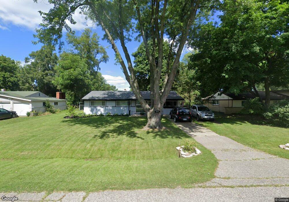
2416 Empire Dr Unit Bldg-Unit West Bloomfield, MI 48324
Estimated Value: $250,000 - $302,000
3
Beds
2
Baths
1,784
Sq Ft
$156/Sq Ft
Est. Value
About This Home
This home is located at 2416 Empire Dr Unit Bldg-Unit, West Bloomfield, MI 48324 and is currently estimated at $278,108, approximately $155 per square foot. 2416 Empire Dr Unit Bldg-Unit is a home located in Oakland County with nearby schools including Walt Whitman Elementary School, Pontiac Middle School, and Pontiac High School.
Ownership History
Date
Name
Owned For
Owner Type
Purchase Details
Closed on
Mar 16, 2018
Sold by
Puckett Ralph C
Bought by
Ruelle Craig
Current Estimated Value
Home Financials for this Owner
Home Financials are based on the most recent Mortgage that was taken out on this home.
Original Mortgage
$138,446
Outstanding Balance
$119,303
Interest Rate
4.62%
Mortgage Type
FHA
Estimated Equity
$158,805
Purchase Details
Closed on
Aug 23, 2017
Sold by
Puckett Barbara A
Bought by
Puckett Barbara A and Puckett Ralph C
Create a Home Valuation Report for This Property
The Home Valuation Report is an in-depth analysis detailing your home's value as well as a comparison with similar homes in the area
Home Values in the Area
Average Home Value in this Area
Purchase History
| Date | Buyer | Sale Price | Title Company |
|---|---|---|---|
| Ruelle Craig | $141,000 | None Available | |
| Puckett Barbara A | -- | None Available |
Source: Public Records
Mortgage History
| Date | Status | Borrower | Loan Amount |
|---|---|---|---|
| Open | Ruelle Craig | $138,446 |
Source: Public Records
Tax History Compared to Growth
Tax History
| Year | Tax Paid | Tax Assessment Tax Assessment Total Assessment is a certain percentage of the fair market value that is determined by local assessors to be the total taxable value of land and additions on the property. | Land | Improvement |
|---|---|---|---|---|
| 2024 | $1,478 | $114,920 | $0 | $0 |
| 2022 | $1,410 | $96,460 | $24,700 | $71,760 |
| 2021 | $2,318 | $86,240 | $0 | $0 |
| 2020 | $1,298 | $78,780 | $24,700 | $54,080 |
| 2018 | $1,542 | $66,670 | $17,900 | $48,770 |
| 2015 | -- | $53,280 | $0 | $0 |
| 2014 | -- | $49,410 | $0 | $0 |
| 2011 | -- | $56,850 | $0 | $0 |
Source: Public Records
Map
Nearby Homes
- 2314 Middlebelt Rd
- 2230 Middlebelt Rd
- 2216 Middlebelt Rd
- 2468 Walce Dr
- 2630 Depew Dr
- 2084 Woodrow Wilson Blvd Unit A6
- 2622 Pine Ridge Rd
- 2665 Middlebelt Rd
- 2360 Pineview
- 1796 Briarcliff St
- 2918 Nagle Ct
- 2411 Pine Lake Ave
- 1775 Woodland Ave
- 2952 Prynne St
- 2121 Uplong St
- 2825 Wall St
- 2300 Pine Lake Rd
- 2329 Fordham St
- 2820 Wall St
- 2372 Pine Lake Rd
- 2416 Empire Dr
- 2400 Empire Dr
- 2430 Empire Dr
- 2334 Saint Joseph St
- 2346 Saint Joseph St
- 2444 Empire Dr
- 2405 Lafay Dr
- 2358 Saint Joseph St
- 2431 Empire Dr
- 2415 Lafay Dr
- 2417 Empire Dr
- 2458 Empire Dr
- 2405 Empire Dr
- 2306 Saint Joseph St
- 2395 Empire Dr
- 2445 Empire Dr
- 2384 Saint Joseph St
- 2427 Lafay Dr
- 2472 Empire Dr
- 2459 Empire Dr