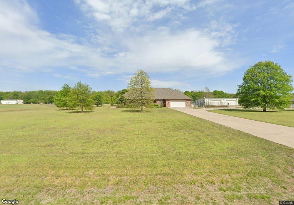
24162 N 3980 Rd Bartlesville, OK 74006
Estimated Value: $439,000 - $466,000
3
Beds
3
Baths
2,593
Sq Ft
$173/Sq Ft
Est. Value
About This Home
This home is located at 24162 N 3980 Rd, Bartlesville, OK 74006 and is currently estimated at $447,857, approximately $172 per square foot. 24162 N 3980 Rd is a home located in Washington County with nearby schools including Wayside Elementary School, Central Middle School, and Bartlesville High School.
Ownership History
Date
Name
Owned For
Owner Type
Purchase Details
Closed on
Mar 26, 2010
Sold by
Buster Lue A
Bought by
Steel Charles S and Steel Anne C
Current Estimated Value
Home Financials for this Owner
Home Financials are based on the most recent Mortgage that was taken out on this home.
Original Mortgage
$80,000
Outstanding Balance
$52,969
Interest Rate
4.96%
Mortgage Type
New Conventional
Estimated Equity
$394,888
Purchase Details
Closed on
Feb 19, 2004
Sold by
Buster Lue A and Buster Kristi B
Purchase Details
Closed on
Feb 13, 2004
Sold by
Love Burke and Love Etta
Create a Home Valuation Report for This Property
The Home Valuation Report is an in-depth analysis detailing your home's value as well as a comparison with similar homes in the area
Home Values in the Area
Average Home Value in this Area
Purchase History
| Date | Buyer | Sale Price | Title Company |
|---|---|---|---|
| Steel Charles S | $280,000 | -- | |
| -- | -- | -- | |
| -- | $239,000 | -- |
Source: Public Records
Mortgage History
| Date | Status | Borrower | Loan Amount |
|---|---|---|---|
| Open | Steel Charles S | $80,000 |
Source: Public Records
Tax History Compared to Growth
Tax History
| Year | Tax Paid | Tax Assessment Tax Assessment Total Assessment is a certain percentage of the fair market value that is determined by local assessors to be the total taxable value of land and additions on the property. | Land | Improvement |
|---|---|---|---|---|
| 2025 | $4,096 | $38,877 | $4,439 | $34,438 |
| 2024 | $4,096 | $39,955 | $4,439 | $35,516 |
| 2023 | $4,096 | $38,791 | $4,439 | $34,352 |
| 2022 | $3,848 | $37,662 | $4,440 | $33,222 |
| 2021 | $3,758 | $37,662 | $4,440 | $33,222 |
| 2020 | $3,850 | $37,662 | $4,440 | $33,222 |
| 2019 | $3,847 | $37,662 | $4,440 | $33,222 |
| 2018 | $3,848 | $37,662 | $4,440 | $33,222 |
| 2017 | $3,908 | $37,662 | $4,440 | $33,222 |
| 2016 | $3,694 | $37,830 | $4,440 | $33,390 |
| 2015 | $3,625 | $36,729 | $4,440 | $32,289 |
| 2014 | $3,511 | $35,659 | $4,440 | $31,219 |
Source: Public Records
Map
Nearby Homes
- 0 N 3967 Rd Unit 2544345
- 0 N 3967 Rd Unit 2544353
- 0 N 3967 Rd Unit 2544346
- 0 N 3967 Rd Unit 2544341
- 0 N 3967 Rd Unit 2544351
- 23861 US Highway 75
- 4015 Silver Lake Rd
- 397911 W 2400 Rd
- 24099 N 3983 Dr
- 24200 N 3983 Dr
- 24168 N 3983 Dr
- 24197 N 3983 Dr
- 24138 N 3983 Dr
- 24159 N 3983 Dr
- 24106 N 3983 Dr
- 24066 N 3983 Dr
- 24131 N 3983 Dr
- 2601 Rice Creek Rd
- 397843 W 2400 Rd
- 394440 Gap Rd
- 396515 W 2400 Rd
- 24100 N 3965 Rd
- 396520 W 2400 Rd
- 24034 N 3965 Rd
- 396569 W 2400 Rd
- 24158 N 3965 Rd
- 396310 W 2400 Rd
- 24125 N 3967 Rd
- 24161 N 3967 Rd
- 24193 N 3967 Rd
- 0 N 3965 Rd
- 24227 N 3967 Rd
- 24142 N 3967 Rd
- 24285 N 3967 Rd
- 0 3962 Dr
- 24098 N 3962 Rd
- 24290 N 3965 Rd
- 24228 N 3965 Rd
- 24327 N 3967 Rd
- 0 N 3967 Rd Unit 1121730