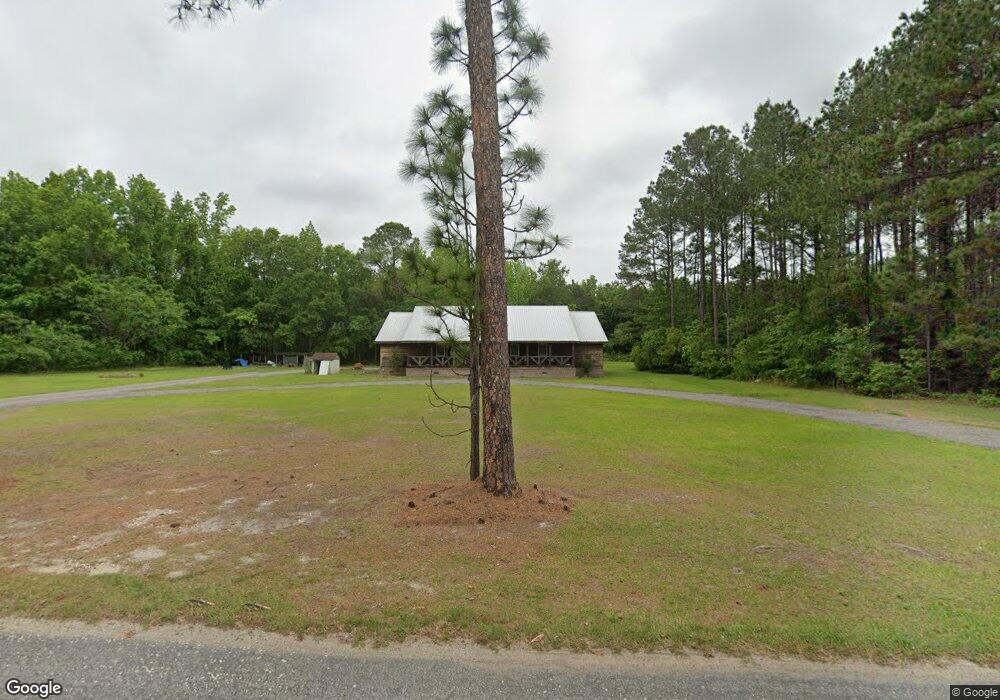
2417 Fire Tower Rd New Zion, SC 29111
Estimated Value: $304,000 - $399,000
--
Bed
--
Bath
2,868
Sq Ft
$123/Sq Ft
Est. Value
About This Home
This home is located at 2417 Fire Tower Rd, New Zion, SC 29111 and is currently estimated at $351,500, approximately $122 per square foot. 2417 Fire Tower Rd is a home with nearby schools including Walker-Gamble Elementary School and East Clarendon Middle-High School.
Ownership History
Date
Name
Owned For
Owner Type
Purchase Details
Closed on
May 6, 2021
Sold by
Floyd Sydney M
Bought by
Floyd Sydney M and Floyd William Travis
Current Estimated Value
Home Financials for this Owner
Home Financials are based on the most recent Mortgage that was taken out on this home.
Original Mortgage
$126,100
Outstanding Balance
$114,278
Interest Rate
3.1%
Mortgage Type
New Conventional
Estimated Equity
$237,222
Purchase Details
Closed on
Oct 28, 2016
Sold by
Daugherty Kenneth Wayne and Mcconnell Richard G
Bought by
Floyd Sydney M
Create a Home Valuation Report for This Property
The Home Valuation Report is an in-depth analysis detailing your home's value as well as a comparison with similar homes in the area
Home Values in the Area
Average Home Value in this Area
Purchase History
| Date | Buyer | Sale Price | Title Company |
|---|---|---|---|
| Floyd Sydney M | -- | None Available | |
| Floyd Sydney M | $15,500 | None Available |
Source: Public Records
Mortgage History
| Date | Status | Borrower | Loan Amount |
|---|---|---|---|
| Open | Floyd Sydney M | $126,100 |
Source: Public Records
Tax History Compared to Growth
Tax History
| Year | Tax Paid | Tax Assessment Tax Assessment Total Assessment is a certain percentage of the fair market value that is determined by local assessors to be the total taxable value of land and additions on the property. | Land | Improvement |
|---|---|---|---|---|
| 2024 | $2,197 | $10,892 | $320 | $10,572 |
| 2023 | $2,154 | $10,892 | $320 | $10,572 |
| 2022 | $2,128 | $10,892 | $320 | $10,572 |
| 2021 | $214 | $9,548 | $320 | $9,228 |
| 2020 | $214 | $420 | $0 | $0 |
| 2019 | $1,645 | $3,330 | $0 | $0 |
| 2018 | $1,606 | $3,330 | $0 | $0 |
| 2017 | $813 | $1,692 | $0 | $0 |
| 2016 | $428 | $913 | $0 | $0 |
| 2015 | $360 | $793 | $357 | $436 |
| 2014 | $358 | $793 | $357 | $436 |
| 2013 | -- | $793 | $357 | $436 |
Source: Public Records
Map
Nearby Homes
- 527 Tbd Hwy 527
- 0 Black River Rd
- 1275 Renegade Trail
- N Brewington Rd
- 8200 Salem Rd
- N Brewington Rd
- 1190 Whistle Top Ln
- N Brewington Rd
- 8367 Salem Rd
- 0000 N Brewington Rd Unit 10
- 0 N Brewington Rd Unit 24570399
- 0000 N Brewington Rd Unit 9
- 5120 N Brewington Rd Unit 5
- 0000 N Brewington Rd
- 0 N Brewington Rd Unit 3
- 0000 N Brewington Rd Unit 3
- 5120 N Brewington Rd
- 413 County Road S-45-78
- 10988 Highway 301
- 13964 U S 301
- 2446 Fire Tower Rd
- 2370 Fire Tower Rd
- 2472 Fire Tower Rd
- 2406 Fire Tower Rd
- 2508 Fire Tower Rd
- 2360 Fire Tower Rd
- 2591 Fire Tower Rd
- 2621 Fire Tower Rd
- 15874 Hwy 301
- 1984 Fire Tower Rd
- 2010 Fire Tower Rd
- 63.8 ac American Road Hwy 35
- 2843 Fire Tower Rd
- 2968 Fire Tower Rd
- 0 Hyway 527
- 1726 Fire Tower Rd
- 3235 Fire Tower Rd