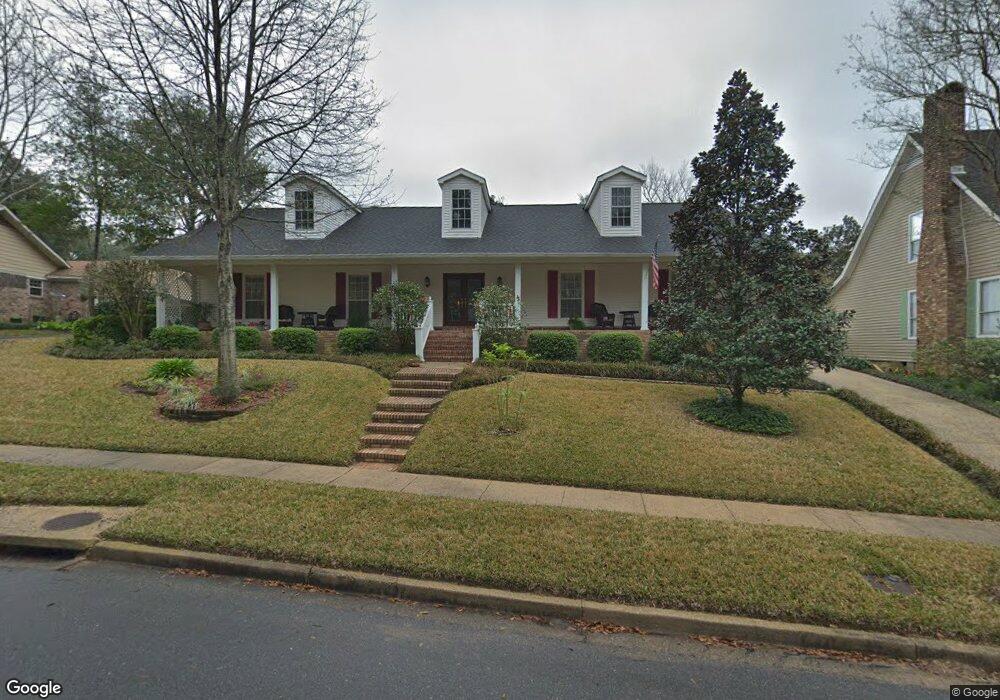
2417 Huffman Dr W Mobile, AL 36693
Rolling Acres NeighborhoodEstimated Value: $294,516 - $317,000
3
Beds
3
Baths
2,664
Sq Ft
$116/Sq Ft
Est. Value
About This Home
This home is located at 2417 Huffman Dr W, Mobile, AL 36693 and is currently estimated at $308,379, approximately $115 per square foot. 2417 Huffman Dr W is a home located in Mobile County with nearby schools including Olive J. Dodge Elementary School, Burns Middle School, and Murphy High School.
Ownership History
Date
Name
Owned For
Owner Type
Purchase Details
Closed on
May 1, 2024
Sold by
Jones Walter A
Bought by
Jones Walter A and Starling Marcia J
Current Estimated Value
Purchase Details
Closed on
Apr 30, 2024
Sold by
Jones Bonnie B
Bought by
Jones Walter A
Purchase Details
Closed on
Feb 7, 2003
Sold by
Debenedetto Lillian C Brining and Brining June Durst
Bought by
Bryan Charles L and Bryan Bonnie W
Home Financials for this Owner
Home Financials are based on the most recent Mortgage that was taken out on this home.
Original Mortgage
$156,279
Interest Rate
5.89%
Mortgage Type
FHA
Purchase Details
Closed on
May 22, 2001
Sold by
Brining June D
Bought by
Brining John M and Debenedetto Lillian C Brining
Create a Home Valuation Report for This Property
The Home Valuation Report is an in-depth analysis detailing your home's value as well as a comparison with similar homes in the area
Home Values in the Area
Average Home Value in this Area
Purchase History
| Date | Buyer | Sale Price | Title Company |
|---|---|---|---|
| Jones Walter A | $105,500 | None Listed On Document | |
| Jones Walter A | $105,000 | None Listed On Document | |
| Bryan Charles L | -- | -- | |
| Brining John M | -- | -- |
Source: Public Records
Mortgage History
| Date | Status | Borrower | Loan Amount |
|---|---|---|---|
| Previous Owner | Bryan Charles L | $156,279 |
Source: Public Records
Tax History Compared to Growth
Tax History
| Year | Tax Paid | Tax Assessment Tax Assessment Total Assessment is a certain percentage of the fair market value that is determined by local assessors to be the total taxable value of land and additions on the property. | Land | Improvement |
|---|---|---|---|---|
| 2024 | $1,278 | $21,770 | $3,250 | $18,520 |
| 2023 | $1,159 | $21,050 | $3,740 | $17,310 |
| 2022 | $1,167 | $21,190 | $3,740 | $17,450 |
| 2021 | $1,112 | $20,210 | $3,740 | $16,470 |
| 2020 | $1,096 | $19,910 | $3,250 | $16,660 |
| 2019 | $1,112 | $20,220 | $0 | $0 |
| 2018 | $1,123 | $20,420 | $0 | $0 |
| 2017 | $1,112 | $20,220 | $0 | $0 |
| 2016 | $1,135 | $20,640 | $0 | $0 |
| 2013 | $1,254 | $22,260 | $0 | $0 |
Source: Public Records
Map
Nearby Homes
- 2401 Huffman Dr W
- 2401 Huffman Dr E
- 2404 Pavan Dr
- 2403 West Rd
- 2311 Pavan Dr
- 2555 East Rd
- 2573 East Rd
- 2629 Mountbrook Dr
- 5654 Cottage Hill Rd
- 5758 Fairwood Dr
- 2605 Woodland Rd
- 6008 Booker Cir
- 5915 Antoine Rd
- 2805 Brookside Dr
- 5413 Greenleaf Rd
- 2298 Snowden Place
- 5612 Bentley Ln
- 2285 Snowden Place W
- 5912 Cansler Dr
- 2208 Pine Needle Dr E
- 2408 Huffman Dr E
- 2425 Huffman Dr W
- 2412 Huffman Dr E
- 2416 Huffman Dr W
- 2409 Huffman Dr W
- 2426 Huffman Dr W
- 2400 Huffman Dr E
- 2412 Huffman Dr W
- 2409 Huffman Dr E
- 2405 Huffman Dr E
- 2405 Huffman Dr W
- 5759 Huffman Dr S
- 2424 Huffman Dr W
- 2408 Huffman Dr W
- 2356 Huffman Dr E
- 5755 Huffman Dr S
- 5763 Huffman Dr S
- 2404 Huffman Dr W
- 5751 Huffman Dr S
- 2417 Huffman Dr E