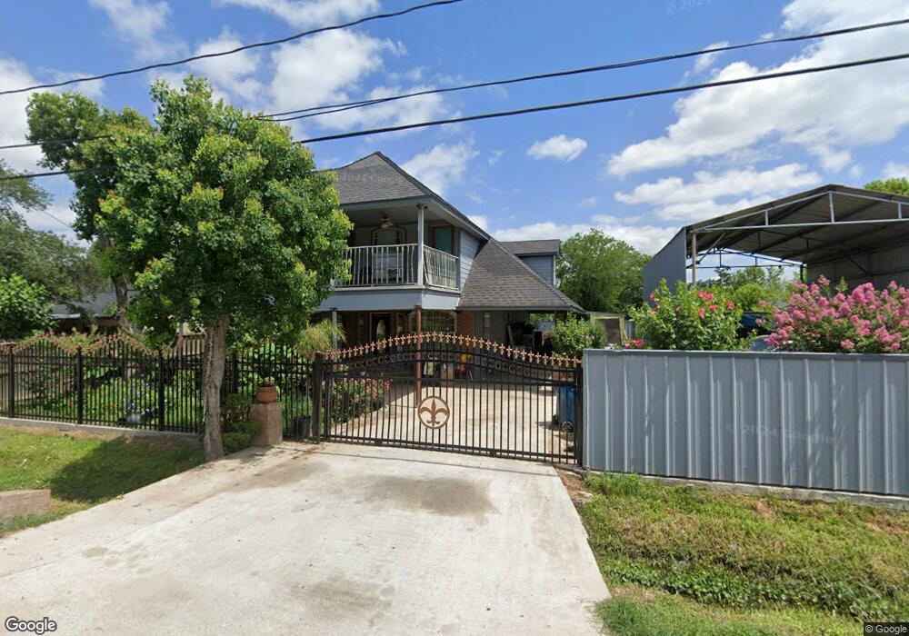
2417 Kowis St Houston, TX 77093
East Aldine NeighborhoodEstimated Value: $243,000 - $269,000
5
Beds
2
Baths
1,996
Sq Ft
$126/Sq Ft
Est. Value
About This Home
This home is located at 2417 Kowis St, Houston, TX 77093 and is currently estimated at $250,522, approximately $125 per square foot. 2417 Kowis St is a home located in Harris County with nearby schools including Scarborough Elementary School, Patrick Henry Middle School, and Sam Houston Math, Science & Technology Center.
Ownership History
Date
Name
Owned For
Owner Type
Purchase Details
Closed on
Apr 13, 2006
Sold by
Ortega Juan Jose and Gallegos Susana V
Bought by
Casanova Juan A and Casanova Marisela Julian
Current Estimated Value
Home Financials for this Owner
Home Financials are based on the most recent Mortgage that was taken out on this home.
Original Mortgage
$68,800
Interest Rate
6.32%
Mortgage Type
Fannie Mae Freddie Mac
Create a Home Valuation Report for This Property
The Home Valuation Report is an in-depth analysis detailing your home's value as well as a comparison with similar homes in the area
Home Values in the Area
Average Home Value in this Area
Purchase History
| Date | Buyer | Sale Price | Title Company |
|---|---|---|---|
| Casanova Juan A | -- | Fidelity Natl Title Ins Co |
Source: Public Records
Mortgage History
| Date | Status | Borrower | Loan Amount |
|---|---|---|---|
| Closed | Casanova Juan A | $68,800 |
Source: Public Records
Tax History Compared to Growth
Tax History
| Year | Tax Paid | Tax Assessment Tax Assessment Total Assessment is a certain percentage of the fair market value that is determined by local assessors to be the total taxable value of land and additions on the property. | Land | Improvement |
|---|---|---|---|---|
| 2025 | $1,024 | $190,818 | $63,090 | $127,728 |
| 2024 | $1,024 | $190,818 | $63,090 | $127,728 |
| 2023 | $1,024 | $190,818 | $63,090 | $127,728 |
| 2022 | $2,011 | $150,988 | $43,813 | $107,175 |
| 2021 | $1,941 | $128,428 | $43,813 | $84,615 |
| 2020 | $1,835 | $113,087 | $33,999 | $79,088 |
| 2019 | $1,740 | $131,539 | $33,999 | $97,540 |
| 2018 | $1,001 | $73,860 | $30,844 | $43,016 |
| 2017 | $1,582 | $73,860 | $30,844 | $43,016 |
| 2016 | $1,582 | $73,860 | $30,844 | $43,016 |
| 2015 | $1,270 | $82,264 | $19,278 | $62,986 |
| 2014 | $1,270 | $82,264 | $19,278 | $62,986 |
Source: Public Records
Map
Nearby Homes
- 2629 Kowis St
- 2152 William Tell St
- 2237 Cromwell St
- 2636 Lone Oak Rd
- 2122 Kowis St
- 2311 Warwick Rd
- 2817 Cromwell St
- 2131 Cromwell St Unit D
- 2306 Wardmont St
- 2326 Sunny Dr
- 2131 Warwick Rd
- 2123 Warwick Rd
- 1728 Little York Rd
- 1930 Cromwell St
- 2315 Langley Rd
- 1908 Little York Rd
- 11746 Somerset Ln
- 11716 Innsbury Dr
- 1925 Sunny Dr
- 1904 Little York Rd
- 2413 Kowis St
- 2427 Kowis St
- 2409 Kowis St
- 2422 William Tell St
- 2414 William Tell St
- 2405 Kowis St
- 2410 William Tell St
- 2418 Kowis St
- 2435 Kowis St
- 2401 Kowis St
- 2426 Kowis St
- 2410 Kowis St
- 2402 William Tell St
- 2430 William Tell St
- 2406 Kowis St
- 0 Kowis
- 2402 Kowis St
- 2438 Kowis St
- 2423 William Tell St
- 2325 Kowis St