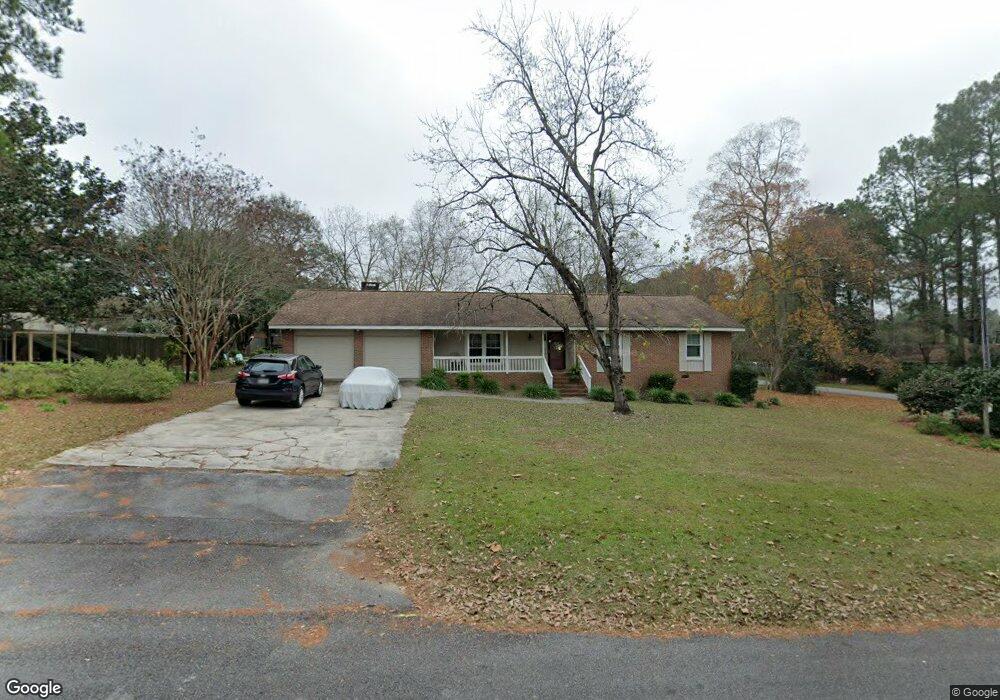
2417 Michael Dr Tifton, GA 31793
Estimated Value: $191,000 - $215,000
3
Beds
2
Baths
1,335
Sq Ft
$155/Sq Ft
Est. Value
About This Home
This home is located at 2417 Michael Dr, Tifton, GA 31793 and is currently estimated at $206,521, approximately $154 per square foot. 2417 Michael Dr is a home located in Tift County with nearby schools including Len Lastinger Primary School, Matt Wilson Elementary School, and J.T. Reddick School.
Ownership History
Date
Name
Owned For
Owner Type
Purchase Details
Closed on
Feb 25, 2020
Sold by
Youmans Brenda C
Bought by
Coleman Bryan G and Coleman Bryan G
Current Estimated Value
Purchase Details
Closed on
Jul 21, 2010
Sold by
Coleman Brenda J
Bought by
Youmans Brenda C
Home Financials for this Owner
Home Financials are based on the most recent Mortgage that was taken out on this home.
Original Mortgage
$82,000
Interest Rate
4.74%
Mortgage Type
New Conventional
Purchase Details
Closed on
Mar 5, 1999
Sold by
Carter Charles O
Bought by
Coleman Brenda J
Purchase Details
Closed on
Feb 3, 1989
Sold by
Gore Jarvis W
Bought by
Alverson William and Alverson Virginia H
Purchase Details
Closed on
Oct 5, 1976
Sold by
Brown Donald B
Bought by
Gore Jarvis W
Create a Home Valuation Report for This Property
The Home Valuation Report is an in-depth analysis detailing your home's value as well as a comparison with similar homes in the area
Home Values in the Area
Average Home Value in this Area
Purchase History
| Date | Buyer | Sale Price | Title Company |
|---|---|---|---|
| Coleman Bryan G | -- | -- | |
| Youmans Brenda C | -- | -- | |
| Coleman Brenda J | $75,000 | -- | |
| Alverson William | $64,000 | -- | |
| Gore Jarvis W | -- | -- |
Source: Public Records
Mortgage History
| Date | Status | Borrower | Loan Amount |
|---|---|---|---|
| Previous Owner | Youmans Brenda C | $82,000 |
Source: Public Records
Tax History Compared to Growth
Tax History
| Year | Tax Paid | Tax Assessment Tax Assessment Total Assessment is a certain percentage of the fair market value that is determined by local assessors to be the total taxable value of land and additions on the property. | Land | Improvement |
|---|---|---|---|---|
| 2024 | $1,436 | $73,188 | $8,000 | $65,188 |
| 2023 | $1,556 | $40,218 | $6,000 | $34,218 |
| 2022 | $976 | $40,218 | $6,000 | $34,218 |
| 2021 | $982 | $40,218 | $6,000 | $34,218 |
| 2020 | $1,000 | $40,218 | $6,000 | $34,218 |
| 2019 | $998 | $40,218 | $6,000 | $34,218 |
| 2018 | $996 | $40,218 | $6,000 | $34,218 |
| 2017 | $996 | $40,218 | $6,000 | $34,218 |
| 2016 | $997 | $40,218 | $6,000 | $34,218 |
| 2015 | $995 | $40,218 | $6,000 | $34,218 |
| 2014 | $1,168 | $40,218 | $6,000 | $34,218 |
| 2013 | -- | $40,218 | $6,000 | $34,218 |
Source: Public Records
Map
Nearby Homes
- 0 Carpenter Rd N
- 106 Mill Ridge Cir
- 1610 Mallard Ln
- 1607 Mallard Ln
- 131 Oak Point Ave
- Tract 1 Whiddon Mill Rd
- 1901 Melba Dr
- 523 Alabama Dr Unit 15 & PT 16
- 523 Alabama Dr
- W Hutchinson Rd
- 100 Elizabeth Dr
- 307 Fulwood Blvd
- 0 N U S Hwy 41
- 0 US Highway 41 Unit 137727
- 0 W Hutchinson Rd
- 225 Alabama Dr
- 222 Alabama Dr
- 2609 Emmett Dr
- 2202 Emory Dr
- 1808 Rutland Rd
- 2421 Michael Dr
- 2418 Madison Dr
- 2411 Madison Dr
- 2420 Madison Dr
- 2418 Michael Dr
- 2420 Michael Dr
- 2423 Michael Dr
- 2422 Michael Dr
- 2424 Madison Dr
- 2407 Madison Dr
- 2415 Madison Dr
- 2601 Kaycee Dr
- 2425 Michael Dr
- 2426 Michael Dr
- 2800 Teresa Dr
- 2804 Teresa Dr
- 2417 Madison Dr
- 2419 Madison Dr
- 2605 Kaycee Dr
- 2423 Madison Dr