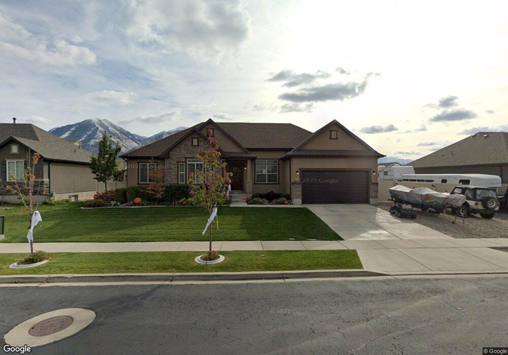
2418 E 1250 S Unit 2 Spanish Fork, UT 84660
Estimated Value: $641,000 - $768,000
3
Beds
4
Baths
1,794
Sq Ft
$395/Sq Ft
Est. Value
About This Home
This home is located at 2418 E 1250 S Unit 2, Spanish Fork, UT 84660 and is currently estimated at $708,688, approximately $395 per square foot. 2418 E 1250 S Unit 2 is a home located in Utah County with nearby schools including East Meadows Elementary School, Spanish Fork Jr High School, and Spanish Fork High School.
Ownership History
Date
Name
Owned For
Owner Type
Purchase Details
Closed on
Aug 23, 2024
Sold by
Stephenson Lamar Corless and Stephenson Valynne Webb
Bought by
Lamar And Valynne Stephenson Family Trust and Stephenson
Current Estimated Value
Home Financials for this Owner
Home Financials are based on the most recent Mortgage that was taken out on this home.
Original Mortgage
$540,800
Outstanding Balance
$534,704
Interest Rate
6.89%
Mortgage Type
New Conventional
Estimated Equity
$173,984
Purchase Details
Closed on
Sep 14, 2017
Sold by
Holland Steven Y
Bought by
Garrett Brandon Alan and Garrett Magan Lynn
Purchase Details
Closed on
Mar 2, 2017
Sold by
Richins Benjamin
Bought by
Garrett Brandon Alan and Garrett Megan Lynn
Home Financials for this Owner
Home Financials are based on the most recent Mortgage that was taken out on this home.
Original Mortgage
$315,250
Interest Rate
4.09%
Mortgage Type
New Conventional
Purchase Details
Closed on
Aug 8, 2013
Sold by
Salisbury Developers Inc
Bought by
Richins Benjamin
Home Financials for this Owner
Home Financials are based on the most recent Mortgage that was taken out on this home.
Original Mortgage
$229,375
Interest Rate
4.46%
Mortgage Type
New Conventional
Purchase Details
Closed on
May 6, 2013
Sold by
Amherst Meadows Llc
Bought by
Salibury Developments Inc
Home Financials for this Owner
Home Financials are based on the most recent Mortgage that was taken out on this home.
Original Mortgage
$206,300
Interest Rate
3.5%
Mortgage Type
Construction
Purchase Details
Closed on
May 5, 2010
Sold by
Environmental Graphics Supply Inc
Bought by
Amherst Meadows Llc
Home Financials for this Owner
Home Financials are based on the most recent Mortgage that was taken out on this home.
Original Mortgage
$1,441,460
Interest Rate
5.21%
Mortgage Type
Purchase Money Mortgage
Create a Home Valuation Report for This Property
The Home Valuation Report is an in-depth analysis detailing your home's value as well as a comparison with similar homes in the area
Home Values in the Area
Average Home Value in this Area
Purchase History
| Date | Buyer | Sale Price | Title Company |
|---|---|---|---|
| Lamar And Valynne Stephenson Family Trust | -- | Prospect Title | |
| Stephenson Lamar Corless | -- | First American Title Insurance | |
| Garrett Brandon Alan | -- | Cottonwood Title Ins Agency | |
| Garrett Brandon Alan | -- | Title West | |
| Richins Benjamin | -- | Provo Land Tite Co | |
| Salibury Developments Inc | -- | Provo Land Title Company | |
| Amherst Meadows Llc | -- | Provo Land Title Co |
Source: Public Records
Mortgage History
| Date | Status | Borrower | Loan Amount |
|---|---|---|---|
| Open | Stephenson Lamar Corless | $540,800 | |
| Previous Owner | Garrett Brandon Alan | $315,250 | |
| Previous Owner | Richins Benjamin | $229,375 | |
| Previous Owner | Salibury Developments Inc | $206,300 | |
| Previous Owner | Amherst Meadows Llc | $1,441,460 |
Source: Public Records
Tax History Compared to Growth
Tax History
| Year | Tax Paid | Tax Assessment Tax Assessment Total Assessment is a certain percentage of the fair market value that is determined by local assessors to be the total taxable value of land and additions on the property. | Land | Improvement |
|---|---|---|---|---|
| 2025 | $1,286 | $369,490 | $267,100 | $404,700 |
| 2024 | $1,286 | $342,815 | $0 | $0 |
| 2023 | $545 | $350,955 | $0 | $0 |
| 2022 | $3,576 | $361,955 | $0 | $0 |
| 2021 | $3,065 | $496,200 | $159,500 | $336,700 |
| 2020 | $2,848 | $448,300 | $145,000 | $303,300 |
| 2019 | $2,290 | $379,200 | $145,000 | $234,200 |
| 2018 | $2,104 | $336,800 | $123,800 | $213,000 |
| 2017 | $1,949 | $167,695 | $0 | $0 |
| 2016 | $1,870 | $158,785 | $0 | $0 |
| 2015 | $1,754 | $147,125 | $0 | $0 |
| 2014 | $1,643 | $138,325 | $0 | $0 |
Source: Public Records
Map
Nearby Homes
- 3170 E 1089 S
- 3509 E 1120 S Unit 109
- 3462 E 1120 S Unit 117
- 1184 S 2300 E
- 2834 E 1320 S
- 1246 S 2130 E
- 1236 S 2130 E
- 1547 S 2120 E
- 1503 S 3740 E Unit 1320
- 1613 S 3170 E
- 2744 E 1060 S
- 2746 E 1060 S
- 2748 E 1060 S
- 2741 E 1060 S
- 2743 E 1060 S
- 1072 S 2760 E
- 2745 E 1060 S
- 2747 E 1060 S
- 1068 S 2760 E
- 972 S High Ridge Rd
- 2418 E 1250 S Unit AM02B
- 2418 E 1250 S Unit MELBOU
- 2418 E 1250 S
- 2436 E 1250 S Unit 2
- 2436 E 1250 S Unit AM03B
- 2436 E 1250 S Unit 3
- 2408 E 1250 S Unit AM01A
- 2407 E 1330 S
- 2419 E 1330 S
- 2393 E 1330 S
- 2411 E 1250 S Unit AM 17B
- 2431 E 1330 S
- 2458 E 1250 S Unit AM 04B
- 2458 E 1250 S Unit 4
- 2443 E 1250 S Unit RANDOL
- 2443 E 1250 S Unit 13
- 1235 S 2360 E
- 2443 E 1330 S
- 2463 E 1250 S Unit 12
- 1266 S 2370 E Unit AM 31A