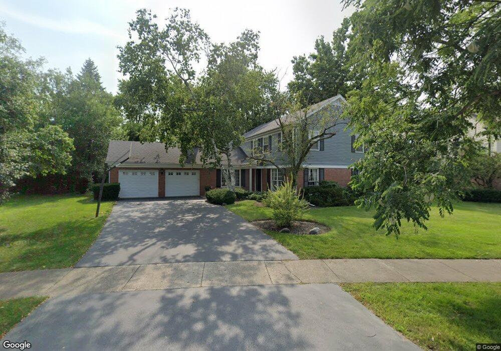
2418 Newport Rd Northbrook, IL 60062
Estimated Value: $890,000 - $947,000
5
Beds
4
Baths
2,860
Sq Ft
$323/Sq Ft
Est. Value
About This Home
This home is located at 2418 Newport Rd, Northbrook, IL 60062 and is currently estimated at $924,148, approximately $323 per square foot. 2418 Newport Rd is a home located in Cook County with nearby schools including Wescott Elementary School, Maple School, and Glenbrook North High School.
Ownership History
Date
Name
Owned For
Owner Type
Purchase Details
Closed on
Nov 29, 2018
Sold by
Breen Adrienne
Bought by
Breen Adrienne and The Adrienne Breen Declaration Of Trust
Current Estimated Value
Create a Home Valuation Report for This Property
The Home Valuation Report is an in-depth analysis detailing your home's value as well as a comparison with similar homes in the area
Home Values in the Area
Average Home Value in this Area
Purchase History
| Date | Buyer | Sale Price | Title Company |
|---|---|---|---|
| Breen Adrienne | -- | Attorney |
Source: Public Records
Tax History Compared to Growth
Tax History
| Year | Tax Paid | Tax Assessment Tax Assessment Total Assessment is a certain percentage of the fair market value that is determined by local assessors to be the total taxable value of land and additions on the property. | Land | Improvement |
|---|---|---|---|---|
| 2024 | $13,511 | $63,132 | $33,502 | $29,630 |
| 2023 | $13,100 | $63,132 | $33,502 | $29,630 |
| 2022 | $13,100 | $63,132 | $33,502 | $29,630 |
| 2021 | $13,989 | $59,859 | $17,617 | $42,242 |
| 2020 | $16,840 | $71,076 | $17,617 | $53,459 |
| 2019 | $16,202 | $78,106 | $17,617 | $60,489 |
| 2018 | $15,348 | $69,752 | $15,415 | $54,337 |
| 2017 | $16,675 | $69,752 | $15,415 | $54,337 |
| 2016 | $14,080 | $69,752 | $15,415 | $54,337 |
| 2015 | $12,289 | $53,948 | $12,478 | $41,470 |
| 2014 | $13,390 | $59,919 | $12,478 | $47,441 |
| 2013 | $13,204 | $59,919 | $12,478 | $47,441 |
Source: Public Records
Map
Nearby Homes
- 2566 Brian Dr Unit 55
- 2571 Essex Dr
- 2439 Greenwood Rd
- 2510 Salceda Dr Unit 8A2510S
- 2378 Salceda Dr Unit 25B2378S
- 2100 Pfingsten Rd
- 2960 Willow Rd
- 2509 Astor Ct
- 3822 Joanne Dr
- 2050 Valencia Dr Unit 307C
- 3550 Ari Dr E
- 3065 Lexington Ln Unit 17L41
- 117 Dartmouth Ct Unit 38LK11
- 3155 Kayjay Dr
- 3134 Maple Leaf Dr
- 114 Penn Ct Unit 20MI11
- 3263 Doriann Dr
- 2515 Pebbleford Ln
- 187 Princeton Ln Unit 35RG18
- 1746 Ellendale Dr
- 2426 Newport Rd
- 2559 Kingston Dr
- 2408 Newport Rd
- 2602 Prince St
- 2590 Prince St
- 2415 Newport Rd
- 2429 Newport Rd
- 2432 Newport Rd
- 2610 Prince St
- 2580 Prince St
- 2569 Kingston Dr
- 2541 Kingston Dr
- 2437 Newport Rd
- 2616 Prince St
- 2598 Kingston Dr
- 2440 The Strand
- 2584 Kingston Dr
- 2450 The Strand
- 2612 Kingston Dr
- 2570 Kingston Dr