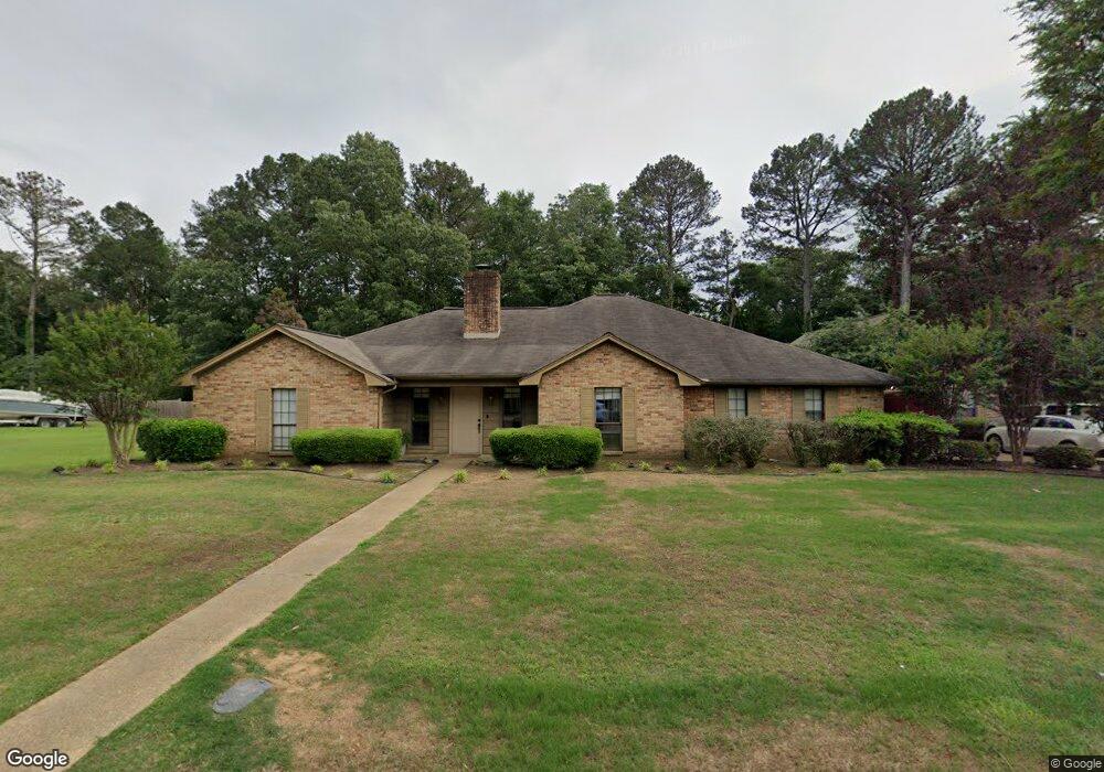
2418 William Dr Tupelo, MS 38801
Estimated Value: $287,000 - $366,189
7
Beds
5
Baths
4,499
Sq Ft
$70/Sq Ft
Est. Value
About This Home
This home is located at 2418 William Dr, Tupelo, MS 38801 and is currently estimated at $314,797, approximately $69 per square foot. 2418 William Dr is a home located in Lee County with nearby schools including Lawndale Elementary School, Parkway Elementary School, and Tupelo Middle School.
Ownership History
Date
Name
Owned For
Owner Type
Purchase Details
Closed on
Sep 21, 2009
Sold by
Cain Yvonne O
Bought by
Cochran Joshua and Cochran Vickie
Current Estimated Value
Home Financials for this Owner
Home Financials are based on the most recent Mortgage that was taken out on this home.
Original Mortgage
$172,050
Outstanding Balance
$111,258
Interest Rate
5.05%
Mortgage Type
Purchase Money Mortgage
Estimated Equity
$203,539
Purchase Details
Closed on
Apr 4, 2008
Sold by
O'Cain Dec'D James Calvin and O'Cain Exec Yvonne
Bought by
O'Cain Yvonne
Create a Home Valuation Report for This Property
The Home Valuation Report is an in-depth analysis detailing your home's value as well as a comparison with similar homes in the area
Purchase History
| Date | Buyer | Sale Price | Title Company |
|---|---|---|---|
| Cochran Joshua | -- | -- | |
| O'Cain Yvonne | -- | -- |
Source: Public Records
Mortgage History
| Date | Status | Borrower | Loan Amount |
|---|---|---|---|
| Open | Cochran Joshua | $172,050 |
Source: Public Records
Tax History
| Year | Tax Paid | Tax Assessment Tax Assessment Total Assessment is a certain percentage of the fair market value that is determined by local assessors to be the total taxable value of land and additions on the property. | Land | Improvement |
|---|---|---|---|---|
| 2025 | $3,112 | $22,889 | $0 | $0 |
| 2024 | $3,112 | $22,889 | $0 | $0 |
| 2023 | $2,714 | $20,280 | $0 | $0 |
| 2022 | $2,414 | $20,280 | $0 | $0 |
| 2021 | $2,414 | $20,280 | $0 | $0 |
| 2020 | $2,714 | $20,280 | $0 | $0 |
| 2019 | $2,360 | $19,878 | $0 | $0 |
| 2018 | $2,354 | $19,831 | $0 | $0 |
| 2017 | $2,344 | $19,831 | $0 | $0 |
| 2016 | $2,344 | $19,831 | $0 | $0 |
| 2015 | $2,192 | $18,758 | $0 | $0 |
| 2014 | $2,192 | $18,758 | $0 | $0 |
Source: Public Records
Map
Nearby Homes
- 2411 William Dr
- 103 Hinton Cir
- 1213 Winwood Cove
- 1913 Pheasant Run
- 1585 Cedar Grove Rd
- 0 S Thomas St
- 0 (3 Acres) S Thomas St
- 1914 Cardinal Dr
- Lot 3 Cliff Gookin Blvd
- 0 Cliff Gookin Blvd
- 2 ac Cliff Gookin Blvd
- Lot 4 Cliff Gookin Blvd
- Lot 2 Cliff Gookin Blvd
- Lot 1 Cliff Gookin Blvd
- 2010 Lawndale Dr
- 1904 Bob White Dr
- 2102 Fillmore Dr
- 1015 Taft St
- 0 Mitchell Rd
- 1009 Taft St
- 2420 William Dr
- 2416 William Dr
- 2420 William Dr
- 2415 William Dr
- 2413 William Dr
- 2417 William Dr
- 2417 William Dr
- 2411 William Dr
- 2414 William Dr
- 2414 William Dr
- 262 Tyler Willis
- 259 Tyler Willis
- 2409 William Dr
- 2701 William Dr
- 2409 William Dr
- 2321 Shady Wood Dr
- 2320 Shady Wood Dr
- 2321 Shadywood Dr
- 2412 William Dr
- 2340 Shady Wood Dr
Your Personal Tour Guide
Ask me questions while you tour the home.