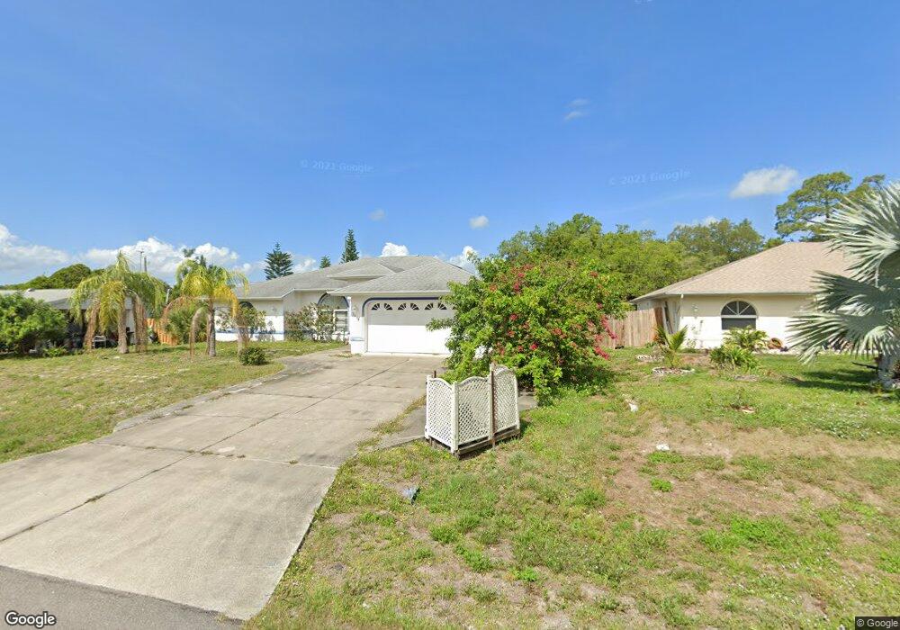
2419 Sunninglow St Port Charlotte, FL 33948
Estimated Value: $288,654 - $401,000
3
Beds
2
Baths
1,904
Sq Ft
$181/Sq Ft
Est. Value
About This Home
This home is located at 2419 Sunninglow St, Port Charlotte, FL 33948 and is currently estimated at $344,164, approximately $180 per square foot. 2419 Sunninglow St is a home located in Charlotte County with nearby schools including Liberty Elementary School, Murdock Middle School, and Port Charlotte High School.
Ownership History
Date
Name
Owned For
Owner Type
Purchase Details
Closed on
Apr 18, 2005
Sold by
Jordan Mary Jean
Bought by
Jordan Mary Jean and Mary Jean Jordan Revocable Trust
Current Estimated Value
Purchase Details
Closed on
Aug 31, 2004
Sold by
Nester Ronnie J
Bought by
Jordan Mary Jean
Purchase Details
Closed on
Mar 27, 2000
Sold by
Ciliberti Domenico and Ciliberti Rose
Bought by
Nester Ronnie J
Home Financials for this Owner
Home Financials are based on the most recent Mortgage that was taken out on this home.
Original Mortgage
$96,000
Interest Rate
8.29%
Create a Home Valuation Report for This Property
The Home Valuation Report is an in-depth analysis detailing your home's value as well as a comparison with similar homes in the area
Home Values in the Area
Average Home Value in this Area
Purchase History
| Date | Buyer | Sale Price | Title Company |
|---|---|---|---|
| Jordan Mary Jean | -- | -- | |
| Jordan Mary Jean | $182,000 | Safetitle Company | |
| Nester Ronnie J | $120,000 | -- |
Source: Public Records
Mortgage History
| Date | Status | Borrower | Loan Amount |
|---|---|---|---|
| Previous Owner | Nester Ronnie J | $96,000 |
Source: Public Records
Tax History Compared to Growth
Tax History
| Year | Tax Paid | Tax Assessment Tax Assessment Total Assessment is a certain percentage of the fair market value that is determined by local assessors to be the total taxable value of land and additions on the property. | Land | Improvement |
|---|---|---|---|---|
| 2023 | $5,232 | $239,916 | $0 | $0 |
| 2022 | $4,962 | $341,710 | $13,175 | $328,535 |
| 2021 | $3,987 | $203,009 | $5,270 | $197,739 |
| 2020 | $3,687 | $186,102 | $4,760 | $181,342 |
| 2019 | $3,474 | $182,251 | $4,335 | $177,916 |
| 2018 | $3,006 | $161,719 | $4,675 | $157,044 |
| 2017 | $2,881 | $157,195 | $3,672 | $153,523 |
| 2016 | $2,608 | $123,114 | $0 | $0 |
| 2015 | $2,501 | $111,922 | $0 | $0 |
| 2014 | $2,351 | $101,747 | $0 | $0 |
Source: Public Records
Map
Nearby Homes
- 2455 Pellam Blvd
- 2605 Cannolot Blvd
- 2387 Alvet St
- 18506 Limberlos Ave
- 2368 Pellam Blvd
- 2707 Auburn Blvd
- 18458 Evenglow Ave
- 18411 Evenglow Ave
- 2128 Pellam Blvd
- 3157 Pellam Blvd
- 2322 Sunninglow St
- 2626 Auburn Blvd
- 18418 Locklane Ave
- 2445 Cannolot Blvd
- 18410 Locklane Ave
- 18378 Inwood Ave
- 3038 Yukon Dr
- 2490 Woodyglen St
- 3069 Pellam Blvd
- 2586 Auburn Blvd
- 2427 Sunninglow St
- 2411 Sunninglow St
- 2418 Whisperlow St
- 2410 Whisperlow St
- 2403 Sunninglow St
- 2426 Whisperlow St
- 2418 Sunninglow St
- 2410 Sunninglow St
- 2426 Sunninglow St
- 2402 Whisperlow St
- 2434 Sunninglow St
- 2581 Cannolot Blvd
- 2582 Cannolot Blvd
- 2394 Whisperlow St
- 2402 & 2410 Sunninglow St
- 2442 Sunninglow St
- 2394 Sunninglow St
- 2417 Pellam Blvd
- 2409 Pellam Blvd