Estimated Value: $236,000 - $319,000
3
Beds
2
Baths
1,170
Sq Ft
$248/Sq Ft
Est. Value
About This Home
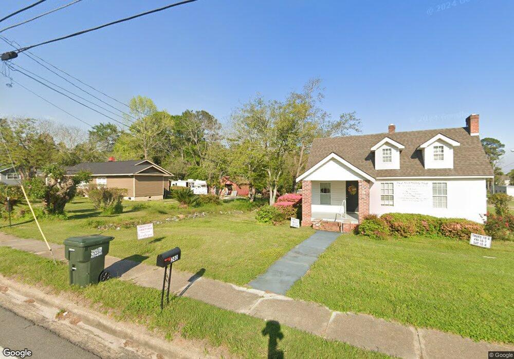
This home is located at 242 5th St NE, Cairo, GA 39828 and is currently estimated at $289,667, approximately $247 per square foot. 242 5th St NE is a home located in Grady County with nearby schools including Cairo High School.
Ownership History
Date
Name
Owned For
Owner Type
Purchase Details
Closed on
Nov 1, 2024
Sold by
Sunshine Holdings Of Grady County Llc
Bought by
Gurley Timothy A and Higdon Annette
Current Estimated Value
Home Financials for this Owner
Home Financials are based on the most recent Mortgage that was taken out on this home.
Original Mortgage
$220,505
Outstanding Balance
$163,247
Interest Rate
6.12%
Mortgage Type
New Conventional
Estimated Equity
$126,420
Purchase Details
Closed on
Aug 30, 2017
Sold by
Lyle Freddie
Bought by
Sunshine Holdings Of Grady Cou
Purchase Details
Closed on
Apr 7, 1994
Bought by
Lyle Freddie
Create a Home Valuation Report for This Property
The Home Valuation Report is an in-depth analysis detailing your home's value as well as a comparison with similar homes in the area
Purchase History
| Date | Buyer | Sale Price | Title Company |
|---|---|---|---|
| Gurley Timothy A | $240,000 | -- | |
| Sunshine Holdings Of Grady Cou | $200,000 | -- | |
| Lyle Freddie | $30,000 | -- |
Source: Public Records
Mortgage History
| Date | Status | Borrower | Loan Amount |
|---|---|---|---|
| Open | Gurley Timothy A | $220,505 |
Source: Public Records
Tax History
| Year | Tax Paid | Tax Assessment Tax Assessment Total Assessment is a certain percentage of the fair market value that is determined by local assessors to be the total taxable value of land and additions on the property. | Land | Improvement |
|---|---|---|---|---|
| 2024 | $2,735 | $101,154 | $5,060 | $96,094 |
| 2023 | $2,735 | $73,895 | $14,994 | $58,901 |
| 2022 | $2,965 | $77,015 | $14,994 | $62,021 |
| 2021 | $2,973 | $77,015 | $14,994 | $62,021 |
| 2020 | $2,981 | $77,015 | $14,994 | $62,021 |
| 2019 | $2,980 | $77,015 | $14,994 | $62,021 |
| 2018 | $2,833 | $77,015 | $14,994 | $62,021 |
| 2017 | $2,725 | $77,015 | $14,994 | $62,021 |
| 2016 | $2,682 | $74,136 | $14,994 | $59,142 |
| 2015 | $2,584 | $72,136 | $14,994 | $57,142 |
| 2014 | $2,585 | $72,136 | $14,994 | $57,142 |
| 2013 | -- | $70,372 | $14,994 | $55,378 |
Source: Public Records
Map
Nearby Homes
- 00 Blackberry Ln
- 00 Meridian Rd
- Lot #15, 3 64 Acres Oakbend Cir
- 711 2nd Ave NE
- 4761 Hadley Ferry Rd
- 309 3rd St SE
- 471 4th St SE
- 00 Hwy 111 South Tract 1
- X 1st St
- 0 1st St
- 2975 U S 84
- 125 6th Ave NW
- 530 6th Ave SE
- 00 00 Hwy 111 South Tract 2
- 112 9th Ave NW
- 220 8th Ave NW
- 408 Bay Tree Rd NE
- 460 2nd St SW
- 0 20th St NE
- 00 20th St NE
- 531 1st Ave NE
- N State Route 188
- 166.ACR Waterfall Lane (Parcel 00180021)
- 47+/- Ac Holton Ln
- 421 1st Ave NE
- 240 5th St NE
- 246 5th St NE
- 216 4th St NE
- 401 1st Ave NE
- 350 5th St NE
- 601 1st Ave NE
- 202 6th St NE
- 311 5th St SE
- 00 SW 4th St
- 315 6th St NE
- 351 5th St NE
- 601 3rd Ave NE Unit one
- 601 3rd Ave NE
- 508 4th Ave NE
- 391 5th St NE
Your Personal Tour Guide
Ask me questions while you tour the home.