Estimated Value: $773,851 - $910,000
3
Beds
3
Baths
2,109
Sq Ft
$394/Sq Ft
Est. Value
About This Home
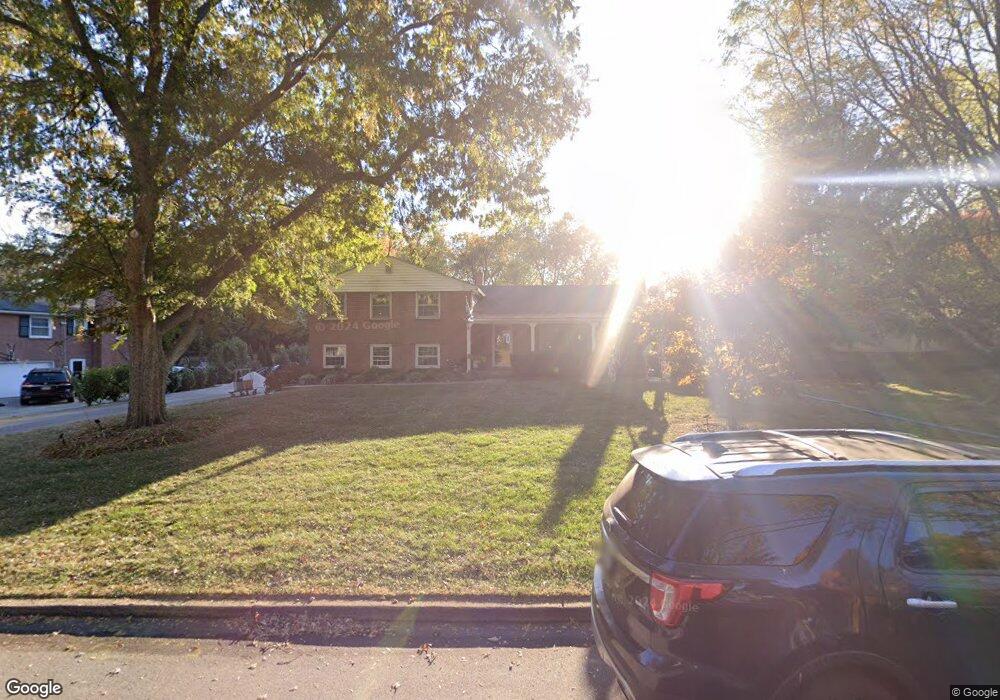
This home is located at 242 Brookmead Rd, Wayne, PA 19087 and is currently estimated at $831,963, approximately $394 per square foot. 242 Brookmead Rd is a home located in Chester County with nearby schools including Valley Forge Elementary School, Valley Forge Middle School, and Conestoga Senior High School.
Ownership History
Date
Name
Owned For
Owner Type
Purchase Details
Closed on
Dec 17, 2010
Sold by
Terrill Helen P and Estate Of William R Terrill
Bought by
White Brooks B and White Bradley L
Current Estimated Value
Home Financials for this Owner
Home Financials are based on the most recent Mortgage that was taken out on this home.
Original Mortgage
$312,000
Outstanding Balance
$206,237
Interest Rate
4.23%
Mortgage Type
New Conventional
Estimated Equity
$625,726
Create a Home Valuation Report for This Property
The Home Valuation Report is an in-depth analysis detailing your home's value as well as a comparison with similar homes in the area
Home Values in the Area
Average Home Value in this Area
Purchase History
| Date | Buyer | Sale Price | Title Company |
|---|---|---|---|
| White Brooks B | $390,000 | None Available |
Source: Public Records
Mortgage History
| Date | Status | Borrower | Loan Amount |
|---|---|---|---|
| Open | White Brooks B | $312,000 |
Source: Public Records
Tax History Compared to Growth
Tax History
| Year | Tax Paid | Tax Assessment Tax Assessment Total Assessment is a certain percentage of the fair market value that is determined by local assessors to be the total taxable value of land and additions on the property. | Land | Improvement |
|---|---|---|---|---|
| 2025 | $7,033 | $199,680 | $61,000 | $138,680 |
| 2024 | $7,033 | $199,680 | $61,000 | $138,680 |
| 2023 | $6,607 | $199,680 | $61,000 | $138,680 |
| 2022 | $6,436 | $199,680 | $61,000 | $138,680 |
| 2021 | $6,314 | $199,680 | $61,000 | $138,680 |
| 2020 | $6,140 | $199,680 | $61,000 | $138,680 |
| 2019 | $5,946 | $199,680 | $61,000 | $138,680 |
| 2018 | $5,828 | $199,680 | $61,000 | $138,680 |
| 2017 | $5,689 | $199,680 | $61,000 | $138,680 |
| 2016 | -- | $199,680 | $61,000 | $138,680 |
| 2015 | -- | $199,680 | $61,000 | $138,680 |
| 2014 | -- | $199,680 | $61,000 | $138,680 |
Source: Public Records
Map
Nearby Homes
- 481 Red Coat Ln
- 1586 Salomon Ln
- 204 Camsten Ct
- 463 Old Forge Crossing Unit 463
- 275 Old Forge Crossing Unit 275
- 363 Old Forge Crossing
- 304 Ap Even Rd
- 366 Drummers Ln Unit 366
- 118 Drummers Ln Unit 118
- 262 Drummers Ln Unit 262
- 356 Drummers Ln Unit 356
- 71 Drummers Ln Unit 71
- 170, 200, 220 Old State Rd
- 68 Amity Dr
- 1211 Reed Aly
- 808 Berwyn Baptist Rd
- 1008 Morton Aly
- 306 Devonshire Rd
- 387 Devonshire Rd
- 274 Radcliffe Rd
- 250 Brookmead Rd
- 236 Brookmead Rd
- 241 Brookmead Rd
- 254 Brookmead Rd
- 228 Brookmead Rd
- 233 Brookmead Rd
- 251 Brookmead Rd
- 260 Brookmead Rd
- 257 Brookmead Rd
- 335 Red Coat Ln
- 1413 Woodford Dr
- 322 Red Coat Ln
- 214 Brookmead Rd
- 1416 Woodford Dr
- 268 Brookmead Rd
- 263 Brookmead Rd
- 1369 Anthony Wayne Dr
- 1375 Anthony Wayne Dr
- 217 Brookmead Rd
- 1361 Anthony Wayne Dr