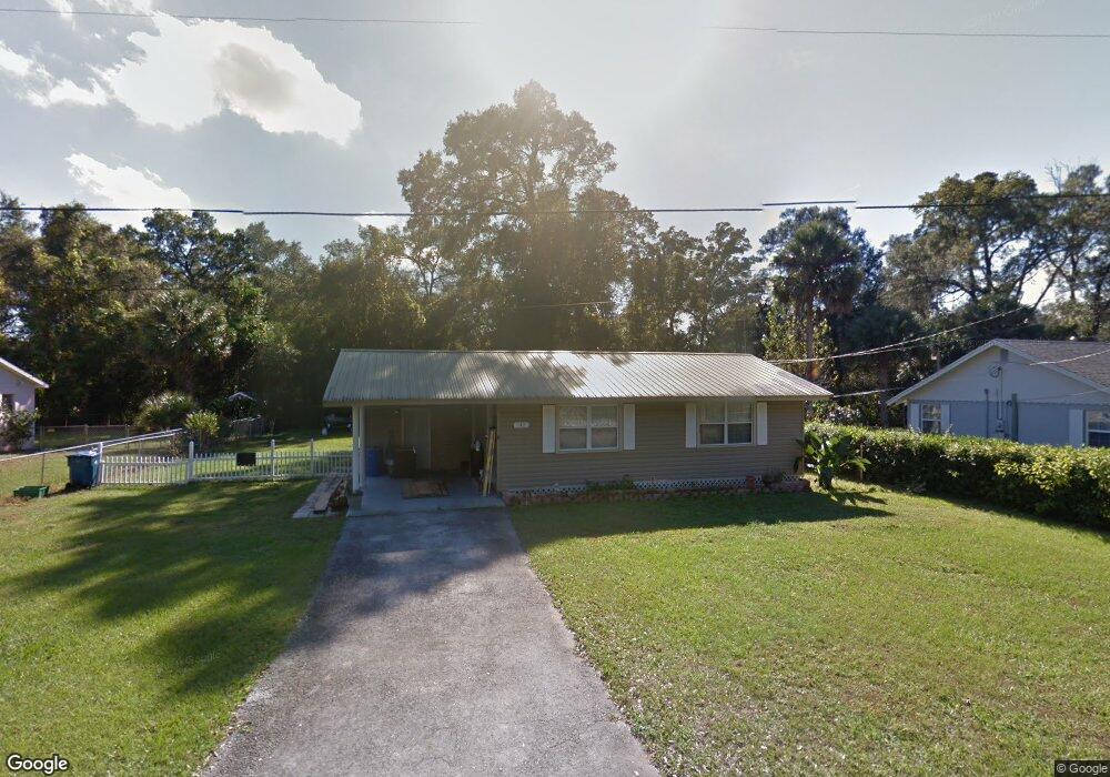
242 Citra St de Leon Springs, FL 32130
DeLeon Springs NeighborhoodEstimated Value: $154,000 - $198,000
2
Beds
1
Bath
1,008
Sq Ft
$167/Sq Ft
Est. Value
About This Home
This home is located at 242 Citra St, de Leon Springs, FL 32130 and is currently estimated at $168,300, approximately $166 per square foot. 242 Citra St is a home located in Volusia County with nearby schools including Louise S. McInnis Elementary School and T. Dewitt Taylor Middle/High School.
Ownership History
Date
Name
Owned For
Owner Type
Purchase Details
Closed on
Feb 27, 2007
Sold by
Sappa Amelia T
Bought by
Sappa Amelia T
Current Estimated Value
Purchase Details
Closed on
Jun 7, 2004
Sold by
Aleno Lorelei B
Bought by
Sappa Amelia T
Purchase Details
Closed on
Apr 15, 1992
Bought by
Sappa John J and Sappa Amelia T
Purchase Details
Closed on
Mar 15, 1991
Bought by
Sappa John J and Sappa Amelia T
Purchase Details
Closed on
Jan 15, 1986
Bought by
Sappa John J and Sappa Amelia T
Purchase Details
Closed on
Feb 15, 1973
Bought by
Sappa John J and Sappa Amelia T
Create a Home Valuation Report for This Property
The Home Valuation Report is an in-depth analysis detailing your home's value as well as a comparison with similar homes in the area
Home Values in the Area
Average Home Value in this Area
Purchase History
| Date | Buyer | Sale Price | Title Company |
|---|---|---|---|
| Sappa Amelia T | -- | None Available | |
| Sappa Amelia T | $60,000 | -- | |
| Sappa John J | $100 | -- | |
| Sappa John J | $100 | -- | |
| Sappa John J | $100 | -- | |
| Sappa John J | $6,000 | -- |
Source: Public Records
Tax History Compared to Growth
Tax History
| Year | Tax Paid | Tax Assessment Tax Assessment Total Assessment is a certain percentage of the fair market value that is determined by local assessors to be the total taxable value of land and additions on the property. | Land | Improvement |
|---|---|---|---|---|
| 2025 | $357 | $84,344 | -- | -- |
| 2024 | $357 | $81,967 | -- | -- |
| 2023 | $357 | $79,580 | $0 | $0 |
| 2022 | $334 | $77,262 | $0 | $0 |
| 2021 | $334 | $75,012 | $0 | $0 |
| 2020 | $327 | $73,976 | $9,775 | $64,201 |
| 2019 | $1,509 | $69,516 | $7,650 | $61,866 |
| 2018 | $1,415 | $63,163 | $9,775 | $53,388 |
| 2017 | $1,232 | $43,072 | $6,375 | $36,697 |
| 2016 | $1,120 | $40,709 | $0 | $0 |
| 2015 | $1,093 | $40,735 | $0 | $0 |
| 2014 | $1,031 | $39,011 | $0 | $0 |
Source: Public Records
Map
Nearby Homes
- 1909 S Farm Rd
- 1806 Glenwood Oaks Ln
- 1955 Hillcrest Oak Dr
- 4155 N Us Hwy 17
- 0 Philadelphia Ave
- 0 Garden St Unit MFRO6109460
- 235 Garden St
- 30 High Ridge Ave
- 226 Garden St
- 0 North St
- 0 Reynolds Rd Unit MFRO6225952
- 0 Reynolds Rd Unit MFRO6292104
- 0 Reynolds Rd Unit MFRO6225958
- 0 Reynolds Rd Unit 1219410
- 0 E Berlin St
- 2053 Bond Rd
- 0 No Name Parcel 05163011380050 Unit V4910400
- 290 E Baxter St
- 1056 Reynolds Rd
- 2015 Hawk Haven Trail
- 260 Citra St
- 230 Citra St
- 276 Citra St
- 182 Citra St
- 4605 Burrows St
- 4545 & 452 Us Highway 17
- 4545 N Us Hwy 17
- 4580 Fairport Ave
- 4598 Fairport Ave
- 180 Citra St
- 4545 Us Highway 17
- 4570 Fairport Ave
- 104 Citra St
- 4600 Fairport Ave
- 4560 Fairport Ave
- 177 Citra St
- 4550 Fairport Ave
- 4579 Fairport Ave
- 4610 Fairport Ave
- 4620 Fairport Ave