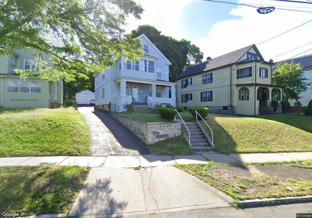
242 Cornwall St Unit 244 Hartford, CT 06112
Blue Hills NeighborhoodEstimated Value: $309,945 - $438,000
4
Beds
2
Baths
2,484
Sq Ft
$157/Sq Ft
Est. Value
About This Home
This home is located at 242 Cornwall St Unit 244, Hartford, CT 06112 and is currently estimated at $390,736, approximately $157 per square foot. 242 Cornwall St Unit 244 is a home located in Hartford County with nearby schools including Rawson School, Noah Webster Micro Society School, and McKinley School.
Ownership History
Date
Name
Owned For
Owner Type
Purchase Details
Closed on
Nov 1, 2004
Sold by
Lawrence Sarah Lee and Lawrence Offie
Bought by
Thomas Clive and Campbell Margaret
Current Estimated Value
Home Financials for this Owner
Home Financials are based on the most recent Mortgage that was taken out on this home.
Original Mortgage
$206,755
Interest Rate
5.74%
Mortgage Type
Purchase Money Mortgage
Create a Home Valuation Report for This Property
The Home Valuation Report is an in-depth analysis detailing your home's value as well as a comparison with similar homes in the area
Home Values in the Area
Average Home Value in this Area
Purchase History
| Date | Buyer | Sale Price | Title Company |
|---|---|---|---|
| Thomas Clive | $210,000 | -- |
Source: Public Records
Mortgage History
| Date | Status | Borrower | Loan Amount |
|---|---|---|---|
| Open | Thomas Clive | $182,378 | |
| Closed | Thomas Clive | $206,261 | |
| Closed | Thomas Clive | $206,755 | |
| Previous Owner | Thomas Clive | $81,200 |
Source: Public Records
Tax History Compared to Growth
Tax History
| Year | Tax Paid | Tax Assessment Tax Assessment Total Assessment is a certain percentage of the fair market value that is determined by local assessors to be the total taxable value of land and additions on the property. | Land | Improvement |
|---|---|---|---|---|
| 2025 | $6,697 | $97,130 | $6,505 | $90,625 |
| 2024 | $6,697 | $97,130 | $6,505 | $90,625 |
| 2023 | $6,697 | $97,130 | $6,505 | $90,625 |
| 2022 | $6,697 | $97,131 | $6,505 | $90,626 |
| 2021 | $4,537 | $61,075 | $7,700 | $53,375 |
| 2020 | $4,537 | $61,075 | $7,700 | $53,375 |
| 2019 | $4,537 | $61,075 | $7,700 | $53,375 |
| 2018 | $4,384 | $59,016 | $7,440 | $51,576 |
| 2016 | $4,324 | $58,203 | $7,086 | $51,117 |
| 2015 | $4,119 | $55,439 | $6,750 | $48,689 |
| 2014 | $4,018 | $54,084 | $6,585 | $47,499 |
Source: Public Records
Map
Nearby Homes
- 83 Colebrook St Unit 85
- 211 Holcomb St Unit 213
- 218 Holcomb St Unit 220
- 102 Thomaston St Unit 104
- 157 Pembroke St Unit 159
- 355 Cornwall St Unit 357
- 181 Westminster St
- 90 Manchester St
- 179 Manchester St
- 111 Westbourne Pkwy Unit 113
- 25 Cornwall St
- 86 Hartland St
- 109 Blue Hills Ave
- 11 Pershing St Unit 13
- 10 Baltic St Unit 12
- 138 Kent St Unit 140
- 36 Baltic St Unit 38
- 77 Harold St
- 103 Baltimore St
- 70 Burnham St Unit 72
- 238 Cornwall St Unit 240
- 246 Cornwall St Unit 248
- 250 Cornwall St Unit 252
- 110 Colebrook St
- 225 Holcomb St
- 234 Cornwall St Unit 236
- 106 Colebrook St Unit 108
- 230 Cornwall St Unit 232
- 219 Holcomb St Unit 221
- 102 Colebrook St
- 260 Cornwall St Unit 262
- 239 Cornwall St
- 215 Holcomb St Unit 217
- 98 Colebrook St Unit 100
- 249 Cornwall St
- 243 Cornwall St
- 107 Colebrook St Unit 109
- 235 Cornwall St
- 264 Cornwall St Unit 266
- 222 Cornwall St Unit 224