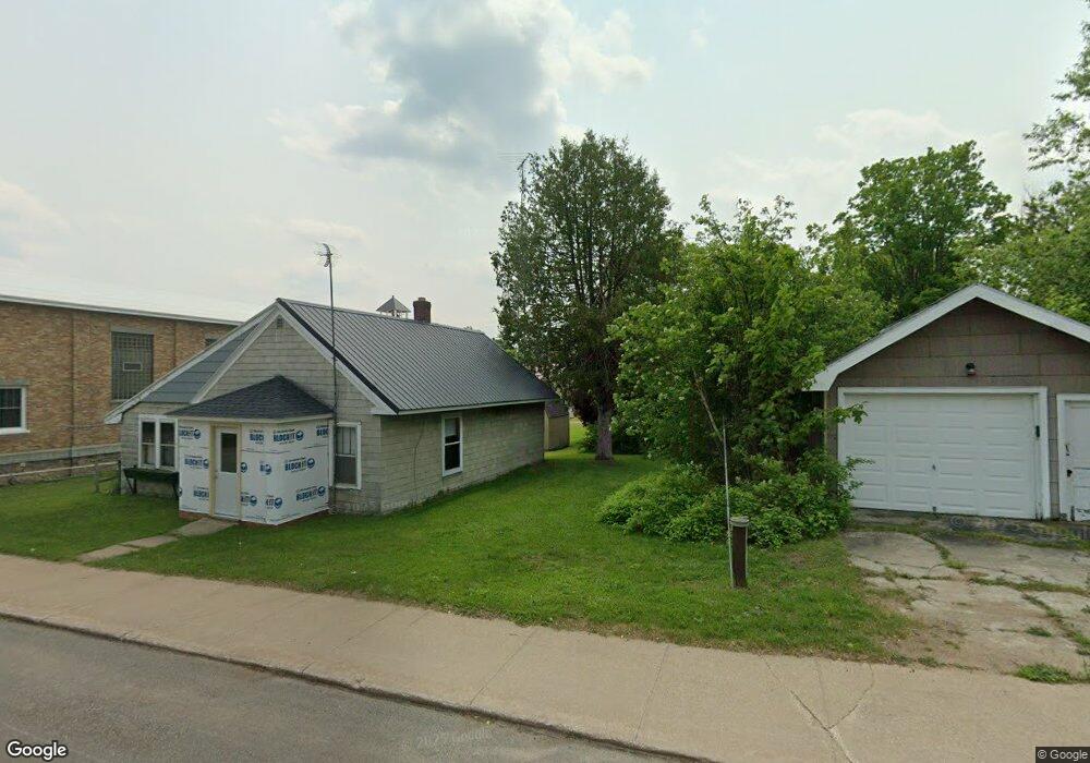
242 E Main St Michigamme, MI 49861
Estimated Value: $190,033 - $342,000
2
Beds
1
Bath
2,253
Sq Ft
$127/Sq Ft
Est. Value
About This Home
This home is located at 242 E Main St, Michigamme, MI 49861 and is currently estimated at $285,258, approximately $126 per square foot. 242 E Main St is a home with nearby schools including Republic-Michigamme School.
Ownership History
Date
Name
Owned For
Owner Type
Purchase Details
Closed on
Sep 11, 2023
Sold by
Deroche Norman W and Deroche Audry
Bought by
Deroche Christopher H and Deroche Debra Kay
Current Estimated Value
Purchase Details
Closed on
Jun 16, 2020
Sold by
Deroche Norman W
Bought by
Deroche Norman W and Fugaj-Deroche Audry
Purchase Details
Closed on
Feb 20, 2020
Sold by
Deroche Norman W
Bought by
Deroche Norman W and Deroche Christopher H
Purchase Details
Closed on
Jun 8, 2018
Sold by
Deroche Christopher H
Bought by
Deroche Norman H
Purchase Details
Closed on
Feb 13, 2018
Sold by
Deroche Norman W
Bought by
Deroche Christopher H
Create a Home Valuation Report for This Property
The Home Valuation Report is an in-depth analysis detailing your home's value as well as a comparison with similar homes in the area
Purchase History
| Date | Buyer | Sale Price | Title Company |
|---|---|---|---|
| Deroche Christopher H | -- | None Listed On Document | |
| Deroche Norman W | -- | Graybill & Mead Pllc | |
| Deroche Norman W | -- | Graybill & Mead Pllc | |
| Deroche Norman H | -- | Graybill & Mead Pllc | |
| Deroche Christopher H | -- | Bruce W Brouillette Pc |
Source: Public Records
Tax History
| Year | Tax Paid | Tax Assessment Tax Assessment Total Assessment is a certain percentage of the fair market value that is determined by local assessors to be the total taxable value of land and additions on the property. | Land | Improvement |
|---|---|---|---|---|
| 2025 | $294 | $98,600 | $0 | $0 |
| 2024 | $3 | $60,500 | $0 | $0 |
| 2023 | $180 | $48,800 | $0 | $0 |
| 2022 | $491 | $53,600 | $0 | $0 |
| 2021 | $492 | $58,900 | $0 | $0 |
| 2020 | $485 | $53,600 | $0 | $0 |
| 2019 | $538 | $49,900 | $0 | $0 |
| 2018 | $541 | $46,350 | $0 | $0 |
| 2017 | $708 | $45,650 | $0 | $0 |
| 2016 | $465 | $45,400 | $0 | $0 |
| 2015 | -- | $45,400 | $0 | $0 |
| 2014 | -- | $45,300 | $0 | $0 |
| 2012 | -- | $45,100 | $0 | $0 |
Source: Public Records
Map
Nearby Homes
- 279 Black Rd
- 1 E Ramsey Island
- Lake Arvid Off Indian Lake Rd
- 16629 Holli Blue Rd
- Off Indian Lake Rd
- LOTS 59, 60, 61 Maple Dr
- Lots 59 Unit 60 61on Maple Drive
- 410 Pesheeke Grade Rd
- 0 Fence Lake Rd Unit Lot 7
- Lot 7 Fence Lake Rd
- 21415 Petticoat Lake Rd
- 24760 Ruth Lake Rd
- 24773 Pine Ave
- Off S Arfelin Lake Rd
- 6766 Co Rd Af Unit Also Known As Blackh
- 6766 Blackhill St
- TBD 80 Acres County Rd Af (Blackhill Street) St
- 484 County Road Fd
- 0 Tbd Blackberry Ln
- 19495 S Nestoria Rd
Your Personal Tour Guide
Ask me questions while you tour the home.