242 Interstate Ln Crossville, TN 38571
Estimated payment $9,779/month
Highlights
- Home fronts a pond
- No HOA
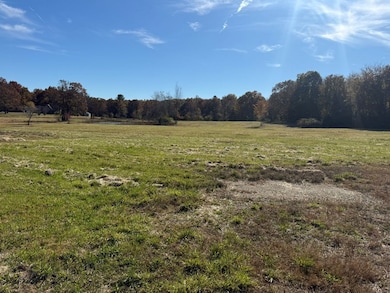
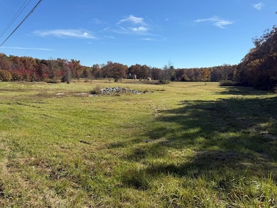
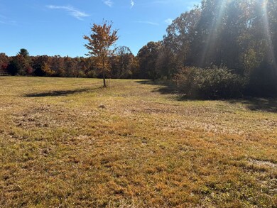
- Lot Has A Rolling Slope
About This Lot
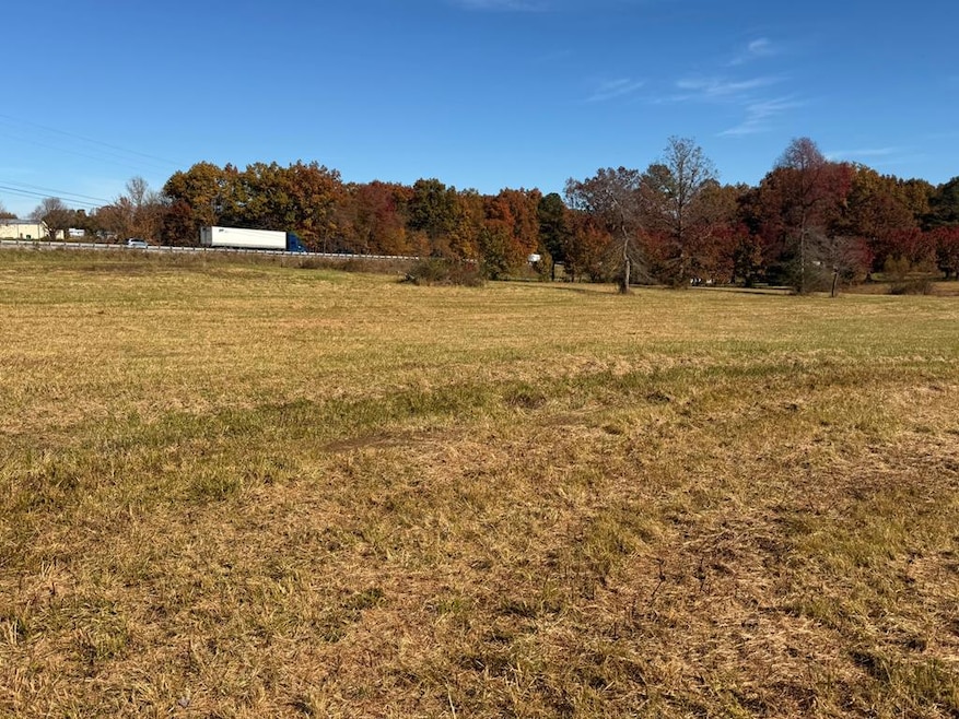
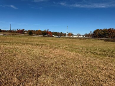
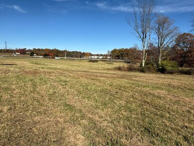
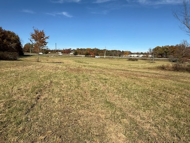
Prime 19.8 acre unrestricted and undeveloped tract offering prime visibility from Interstate 40. With water, electric, fiber, and natural gas available, this property presents a rare opportunity for commercial development, investment, or a custom build. Ideally situated midway between Knoxville and Nashville, it provides convenient access and outstanding exposure in a growing area.
Listing Agent
RE/MAX COUNTRY LIVING, LLC Brokerage Phone: 9318643380 License #341825 Listed on: 11/08/2025

Property Details
Property Type
- Land
Est. Annual Taxes
- $340
Lot Details
- 19.8 Acre Lot
- Home fronts a pond
- Property fronts a county road
- Lot Has A Rolling Slope
Community Details
- No Home Owners Association
Listing and Financial Details
- Assessor Parcel Number 047.00
Map
Home Values in the Area
Average Home Value in this Area
Tax History
| Year | Tax Paid | Tax Assessment Tax Assessment Total Assessment is a certain percentage of the fair market value that is determined by local assessors to be the total taxable value of land and additions on the property. | Land | Improvement |
|---|---|---|---|---|
| 2024 | $340 | $29,950 | $10,550 | $19,400 |
| 2023 | $340 | $29,950 | $0 | $0 |
| 2022 | $340 | $29,950 | $10,550 | $19,400 |
| 2021 | $286 | $18,250 | $9,025 | $9,225 |
| 2020 | $286 | $18,250 | $9,025 | $9,225 |
| 2019 | $286 | $18,250 | $9,025 | $9,225 |
| 2018 | $286 | $18,250 | $9,025 | $9,225 |
| 2017 | $292 | $18,250 | $9,025 | $9,225 |
| 2016 | $251 | $16,450 | $5,850 | $10,600 |
| 2015 | $246 | $16,450 | $5,850 | $10,600 |
| 2014 | $246 | $16,439 | $0 | $0 |
Property History
| Date | Event | Price | List to Sale | Price per Sq Ft |
|---|---|---|---|---|
| 11/08/2025 11/08/25 | For Sale | $1,850,000 | -- | -- |
Purchase History
| Date | Type | Sale Price | Title Company |
|---|---|---|---|
| Warranty Deed | $300,000 | Ledbetter Title Company Llc | |
| Deed | $81,000 | -- | |
| Warranty Deed | $60,000 | -- |
Source: Upper Cumberland Association of REALTORS®
MLS Number: 240497
APN: 048-047.00
Disclaimer: Certain information contained herein is derived from information provided by parties other than Homes.com. All information provided is deemed reliable, but is not guaranteed to be accurate and should be independently verified.
![]() Copyright 2025 Upper Cumberland Board of Realtors. All rights reserved. Information deemed to be reliable but not guaranteed. The data relating to real estate for sale on this website comes from Upper Cumberland Board of Realtors.
Copyright 2025 Upper Cumberland Board of Realtors. All rights reserved. Information deemed to be reliable but not guaranteed. The data relating to real estate for sale on this website comes from Upper Cumberland Board of Realtors.
Some or all of the listings displayed may not belong to the firm whose website is being visited.
- 0 Interstate Ln
- 484 Interstate Ln
- 1 Interstate Ln
- 0 Stanley Hood Rd Unit RTC2884239
- 1149 Stanley Hood Rd
- 11.49 ac Off Stanley Hood Rd
- 7055 Plateau Rd
- 11158 Highway 70 N
- 384 Miller Ct
- 311 Dykes Ln
- Lot 602 Stonecrest Ave
- 0 Stonecrest Ave
- 602 Stonecrest Ave
- 804 Linder Loop
- 1.91 AC Plateau Rd
- 545 Randolph Rd
- 3358 Plateau Rd
- 185 Tanglewood Trail
- 175 Sky View Meadow Dr
- 168 Sky View Meadow Dr
- 157 Sky View Meadow Dr
- 158 Sky View Meadow Dr
- 141 Sky View Meadow Dr
- 127 Sky View Meadow Dr
- 1260 Davidson Dr
- 40 Heather Ridge Cir
- 28 Jacobs Crossing Dr
- 95 N Hills Dr
- 317 Storie Ave
- 620 Allie Ln
- 360 Oak Hill Dr
- 8005 Cherokee Trail
- 178 Fairview Rd
- 202 Lakeview Dr
- 134 Glenwood Dr
- 6 Lakeshore Ct Unit 97
- 43 Wilshire Heights Dr
- 122 Lee Cir