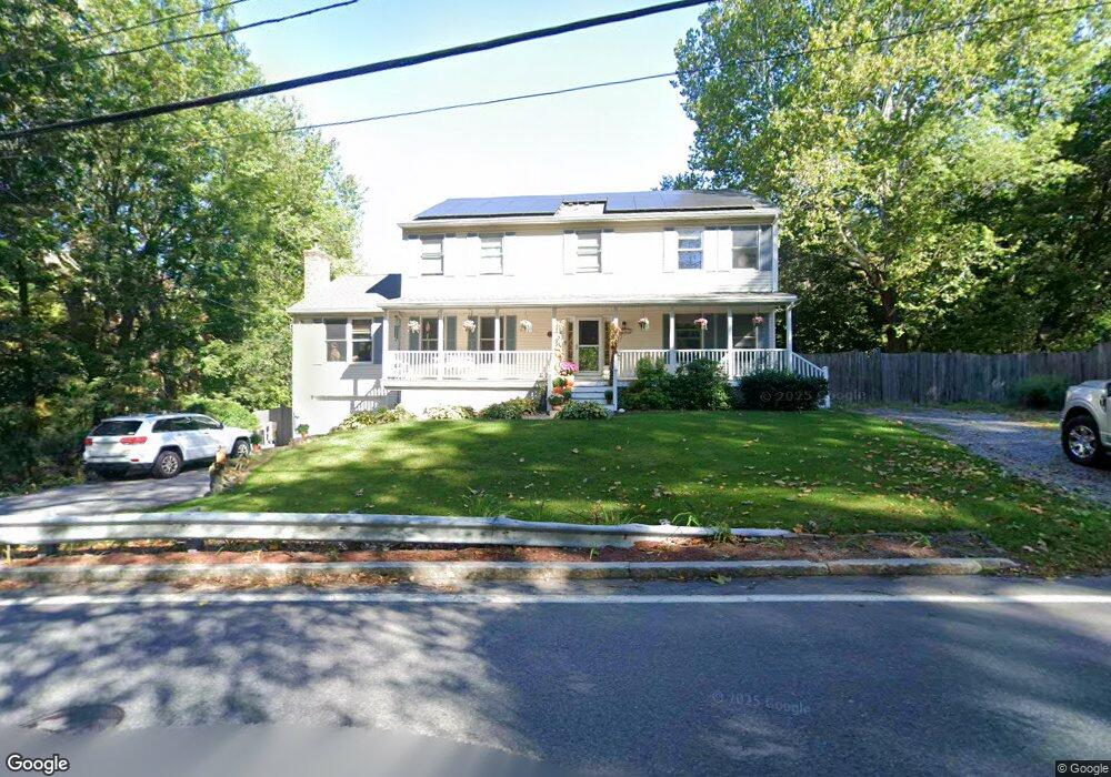
242 Mill St Lancaster, MA 01523
Estimated Value: $703,000 - $853,000
5
Beds
3
Baths
2,460
Sq Ft
$327/Sq Ft
Est. Value
About This Home
This home is located at 242 Mill St, Lancaster, MA 01523 and is currently estimated at $805,198, approximately $327 per square foot. 242 Mill St is a home located in Worcester County with nearby schools including Mary Rowlandson Elementary School, Luther Burbank Middle School, and Nashoba Regional High School.
Ownership History
Date
Name
Owned For
Owner Type
Purchase Details
Closed on
Dec 8, 2005
Sold by
Christoph Kristen H
Bought by
Riley Dana H and Riley James E
Current Estimated Value
Home Financials for this Owner
Home Financials are based on the most recent Mortgage that was taken out on this home.
Original Mortgage
$260,000
Outstanding Balance
$144,433
Interest Rate
6.17%
Mortgage Type
Purchase Money Mortgage
Estimated Equity
$660,765
Purchase Details
Closed on
Sep 30, 2005
Sold by
Christoph Kristen H and Christoph Roy E
Bought by
Spruce Acre Llc
Create a Home Valuation Report for This Property
The Home Valuation Report is an in-depth analysis detailing your home's value as well as a comparison with similar homes in the area
Home Values in the Area
Average Home Value in this Area
Purchase History
| Date | Buyer | Sale Price | Title Company |
|---|---|---|---|
| Riley Dana H | $445,000 | -- | |
| Spruce Acre Llc | $35,000 | -- |
Source: Public Records
Mortgage History
| Date | Status | Borrower | Loan Amount |
|---|---|---|---|
| Open | Riley Dana H | $260,000 |
Source: Public Records
Tax History
| Year | Tax Paid | Tax Assessment Tax Assessment Total Assessment is a certain percentage of the fair market value that is determined by local assessors to be the total taxable value of land and additions on the property. | Land | Improvement |
|---|---|---|---|---|
| 2025 | $11,950 | $739,500 | $133,000 | $606,500 |
| 2024 | $11,848 | $678,600 | $124,000 | $554,600 |
| 2023 | $11,050 | $642,800 | $113,000 | $529,800 |
| 2022 | $10,845 | $557,600 | $113,800 | $443,800 |
| 2021 | $10,699 | $535,500 | $113,800 | $421,700 |
| 2020 | $9,971 | $502,300 | $113,800 | $388,500 |
| 2019 | $9,525 | $482,300 | $113,800 | $368,500 |
| 2018 | $9,109 | $455,900 | $113,800 | $342,100 |
| 2016 | $8,283 | $423,700 | $112,800 | $310,900 |
| 2015 | $8,009 | $426,900 | $112,800 | $314,100 |
| 2014 | $7,736 | $409,100 | $112,800 | $296,300 |
Source: Public Records
Map
Nearby Homes
- 132 Kilbourn Rd
- 76 Mill St Unit 3
- 113 Parker Rd Unit 1
- 73 Prescott St
- 0 Parker Rd
- 12 Woodruff Rd
- 46 Woodruff Rd
- 201 Stone St Unit 203
- 201-203 Stone St
- 861 Main St
- 508 High St
- 920 Ridgefield Cir Unit C
- 93 Forest St
- 101 Woodruff Rd
- 300 Greeley St
- 110 Ridgefield Cir Unit C
- 610 Ridgefield Cir Unit B
- 0 Magnolia Ave
- 719 Main St
- 57 Clark St
- 254 Mill St
- 245 Mill St
- 267 Mill St
- 207 Mill St
- 279 Mill St
- 201 Mill St
- 201 Mill St
- 284 Mill St
- 186 Mill St
- 291 Mill St
- 176 Mill St
- 170 Mill St
- 113 Carter St
- 23 Mill St Ct Unit 3
- 23 Mill Street Ct Unit 3
- 21 Mill Street Ct Unit 2
- 21 Mill Street Ct Unit 1
- 21 Mill Street Ct Unit 2
- 21 Mill Street Ct Unit 1
- 296 Mill St
Your Personal Tour Guide
Ask me questions while you tour the home.