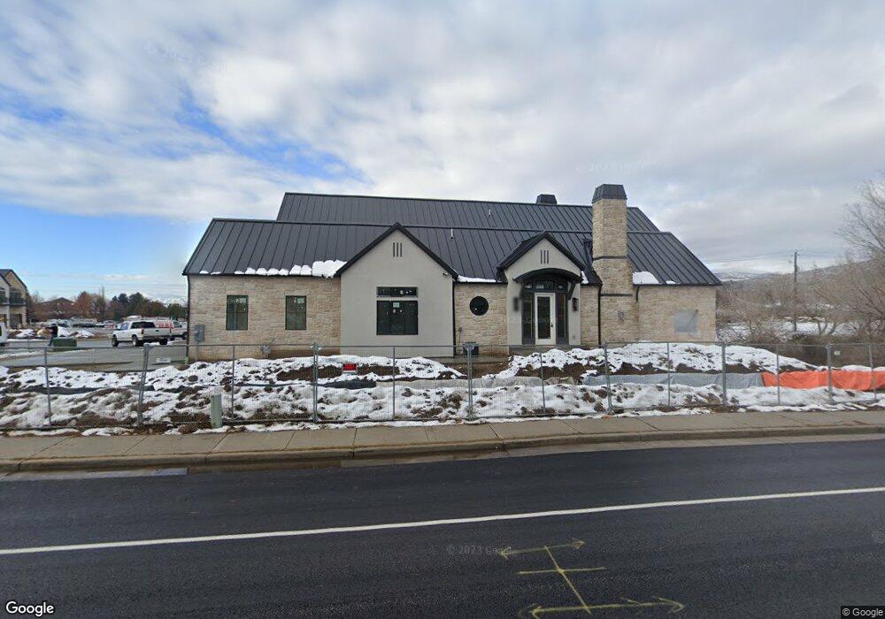
242 S Main St Alpine, UT 84004
--
Bed
--
Bath
1,626
Sq Ft
0.59
Acres
About This Home
This home is located at 242 S Main St, Alpine, UT 84004. 242 S Main St is a home located in Utah County with nearby schools including Westfield School, Timberline Middle School, and Lone Peak High School.
Ownership History
Date
Name
Owned For
Owner Type
Purchase Details
Closed on
Jun 1, 2019
Sold by
Jemal Llc
Bought by
Cottle Capital Group Llc
Home Financials for this Owner
Home Financials are based on the most recent Mortgage that was taken out on this home.
Original Mortgage
$1,972,709
Outstanding Balance
$1,734,494
Interest Rate
4.1%
Mortgage Type
Unknown
Purchase Details
Closed on
Jun 22, 2016
Sold by
Jemal Llc
Bought by
Lovenland Llc
Purchase Details
Closed on
May 9, 2013
Sold by
Loveland Llc
Bought by
Jemal Llc
Purchase Details
Closed on
May 15, 2008
Sold by
Loveland Lynnette C
Bought by
Loveland Llc
Purchase Details
Closed on
Jul 14, 2006
Sold by
Lind Laralee Beck
Bought by
Dll Properties Llc
Purchase Details
Closed on
Jul 30, 2004
Sold by
Jones Will S
Bought by
Lind Laralee Beck
Purchase Details
Closed on
Sep 18, 2002
Sold by
Camel Lot Llc
Bought by
Jones Will S
Create a Home Valuation Report for This Property
The Home Valuation Report is an in-depth analysis detailing your home's value as well as a comparison with similar homes in the area
Home Values in the Area
Average Home Value in this Area
Purchase History
| Date | Buyer | Sale Price | Title Company |
|---|---|---|---|
| Cottle Capital Group Llc | -- | Inwest Title Orem | |
| Lovenland Llc | -- | None Available | |
| Jemal Llc | -- | Select Title Insurance Agenc | |
| Loveland Llc | -- | Select Title Insurance Agen | |
| Loveland Lynnette C | -- | Select Title Insurance Agen | |
| Dll Properties Llc | -- | Select Title Insurance Agen | |
| Lind Laralee Beck | -- | Signature Title Insurance A | |
| Jones Will S | -- | Signature Title |
Source: Public Records
Mortgage History
| Date | Status | Borrower | Loan Amount |
|---|---|---|---|
| Open | Cottle Capital Group Llc | $1,972,709 |
Source: Public Records
Tax History Compared to Growth
Tax History
| Year | Tax Paid | Tax Assessment Tax Assessment Total Assessment is a certain percentage of the fair market value that is determined by local assessors to be the total taxable value of land and additions on the property. | Land | Improvement |
|---|---|---|---|---|
| 2020 | $3,173 | $322,400 | $322,400 | $0 |
| 2019 | $2,813 | $298,400 | $298,400 | $0 |
| 2018 | $2,590 | $271,400 | $271,400 | $0 |
| 2017 | $2,552 | $258,800 | $0 | $0 |
| 2016 | $3,002 | $283,800 | $0 | $0 |
| 2015 | $3,044 | $272,200 | $0 | $0 |
| 2014 | $2,949 | $260,900 | $0 | $0 |
Source: Public Records
Map
Nearby Homes
- 250 S Main St Unit 7
- 250 S Main St Unit 20
- 250 S Main St Unit 25
- 201 E Red Pine Dr Unit 17
- 177 W Canyon Crest Rd
- 30 S Main St
- 259 Twin River Loop
- 48 N 100 E
- 88 W Cascade Ave
- 629 S Pheasant Ridge Cir
- 546 River Meadow Dr
- 475 Grove Dr
- 35 Sledhill Cir Unit 2
- 501 W Devey Dr
- 501 S 800 W
- 659 E Pioneer Rd
- 1249 E Pioneer Rd
- 443 Lupine Dr Unit 7
- 682 Healey Blvd
- 909 Ridge Ln
- 250 S Main St Unit 1
- 264 S Main
- 255 S Main St
- 215 S 100 W
- 273 S Main St
- 250 S Main St Unit 21
- 250 S Main St Unit 9
- 250 S Main St Unit 8
- 250 S Main St Unit 6
- 250 S Main St Unit 5
- 250 S Main St Unit 4
- 250 S Main St Unit 3
- 250 S Main St Unit 1
- 250 S Main St
- 250 S Main St Unit 24
- 250 S Main St Unit 2
- 433 E Dry Creek Cir
- 225 S 100 W
- 50 Red Pine Dr Unit 4
- 50 Red Pine Dr