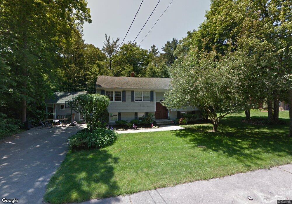
242 Shaw Ave Abington, MA 02351
Estimated Value: $598,000 - $615,091
4
Beds
2
Baths
1,144
Sq Ft
$530/Sq Ft
Est. Value
About This Home
This home is located at 242 Shaw Ave, Abington, MA 02351 and is currently estimated at $605,773, approximately $529 per square foot. 242 Shaw Ave is a home located in Plymouth County with nearby schools including Beaver Brook Elementary School, Abington Middle School, and Woodsdale School.
Ownership History
Date
Name
Owned For
Owner Type
Purchase Details
Closed on
Apr 25, 1997
Sold by
Hamilton Charles R and Hamilton Phyllis A
Bought by
Rangel Jeffrey M and Rangel Mary M
Current Estimated Value
Home Financials for this Owner
Home Financials are based on the most recent Mortgage that was taken out on this home.
Original Mortgage
$144,000
Outstanding Balance
$19,331
Interest Rate
7.77%
Mortgage Type
Purchase Money Mortgage
Estimated Equity
$586,442
Purchase Details
Closed on
Oct 18, 1988
Sold by
Houle Alec R
Bought by
Hamilton Charles R
Home Financials for this Owner
Home Financials are based on the most recent Mortgage that was taken out on this home.
Original Mortgage
$136,000
Interest Rate
10.63%
Mortgage Type
Purchase Money Mortgage
Create a Home Valuation Report for This Property
The Home Valuation Report is an in-depth analysis detailing your home's value as well as a comparison with similar homes in the area
Home Values in the Area
Average Home Value in this Area
Purchase History
| Date | Buyer | Sale Price | Title Company |
|---|---|---|---|
| Rangel Jeffrey M | $160,000 | -- | |
| Hamilton Charles R | $177,000 | -- |
Source: Public Records
Mortgage History
| Date | Status | Borrower | Loan Amount |
|---|---|---|---|
| Open | Hamilton Charles R | $144,000 | |
| Previous Owner | Hamilton Charles R | $7,000 | |
| Previous Owner | Hamilton Charles R | $136,000 |
Source: Public Records
Tax History Compared to Growth
Tax History
| Year | Tax Paid | Tax Assessment Tax Assessment Total Assessment is a certain percentage of the fair market value that is determined by local assessors to be the total taxable value of land and additions on the property. | Land | Improvement |
|---|---|---|---|---|
| 2025 | $6,890 | $527,600 | $255,600 | $272,000 |
| 2024 | $7,034 | $525,700 | $254,500 | $271,200 |
| 2023 | $6,561 | $461,700 | $221,900 | $239,800 |
| 2022 | $6,155 | $404,400 | $185,600 | $218,800 |
| 2021 | $5,981 | $362,900 | $177,000 | $185,900 |
| 2020 | $5,889 | $346,400 | $163,800 | $182,600 |
| 2019 | $5,819 | $334,600 | $163,800 | $170,800 |
| 2018 | $6,244 | $313,800 | $163,800 | $150,000 |
| 2017 | $5,582 | $304,200 | $163,800 | $140,400 |
| 2016 | $4,915 | $274,100 | $149,600 | $124,500 |
| 2015 | $4,661 | $274,200 | $149,600 | $124,600 |
Source: Public Records
Map
Nearby Homes
- 676 Bedford St
- 0 Bedford St
- 1210 Washington St
- 1353 Washington St
- 337 Randolph St
- 20 Cleverly St Unit B2
- 451 Lincoln St
- 332 Hancock St
- 209 Hancock St
- 133 Andrew Ford Way
- 1077 Bedford St
- 89 Andrew Ford Way
- 1085 Bedford St
- 164 Hancock St
- 89 Presidential Dr
- 116 Hancock St
- 257 Rockland St Unit 257
- 29 West St
- 353 Plymouth St
- 57 Battery St