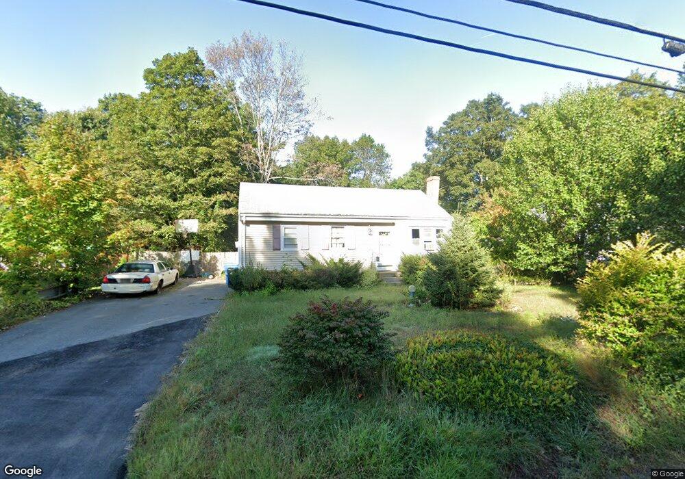
242 Taunton St Wrentham, MA 02093
Estimated Value: $479,000 - $548,624
3
Beds
1
Bath
874
Sq Ft
$602/Sq Ft
Est. Value
About This Home
This home is located at 242 Taunton St, Wrentham, MA 02093 and is currently estimated at $525,906, approximately $601 per square foot. 242 Taunton St is a home located in Norfolk County with nearby schools including Delaney Elementary School, Charles E Roderick, and Cadence Academy Preschool - North Attleborough.
Ownership History
Date
Name
Owned For
Owner Type
Purchase Details
Closed on
Aug 19, 2025
Sold by
Orlando Edward and Orlando Kristen L
Bought by
Orlando Kristen L
Current Estimated Value
Purchase Details
Closed on
Dec 30, 1992
Sold by
Keohane Michael J and Keohane Joan M
Bought by
Orlando Edward and Orlando Kristen L
Purchase Details
Closed on
Jul 2, 1991
Sold by
Mccarthy John A
Bought by
Keohane Michael J and Keohane Joan M
Create a Home Valuation Report for This Property
The Home Valuation Report is an in-depth analysis detailing your home's value as well as a comparison with similar homes in the area
Home Values in the Area
Average Home Value in this Area
Purchase History
| Date | Buyer | Sale Price | Title Company |
|---|---|---|---|
| Orlando Kristen L | -- | -- | |
| Orlando Edward | $110,000 | -- | |
| Orlando Edward | $110,000 | -- | |
| Keohane Michael J | $112,000 | -- | |
| Keohane Michael J | $112,000 | -- |
Source: Public Records
Mortgage History
| Date | Status | Borrower | Loan Amount |
|---|---|---|---|
| Previous Owner | Keohane Michael J | $128,300 | |
| Previous Owner | Keohane Michael J | $25,000 |
Source: Public Records
Tax History Compared to Growth
Tax History
| Year | Tax Paid | Tax Assessment Tax Assessment Total Assessment is a certain percentage of the fair market value that is determined by local assessors to be the total taxable value of land and additions on the property. | Land | Improvement |
|---|---|---|---|---|
| 2025 | $5,286 | $456,100 | $251,500 | $204,600 |
| 2024 | $4,871 | $405,900 | $251,500 | $154,400 |
| 2023 | $4,572 | $362,300 | $228,600 | $133,700 |
| 2022 | $4,496 | $328,900 | $205,700 | $123,200 |
| 2021 | $4,239 | $301,300 | $183,800 | $117,500 |
| 2020 | $4,078 | $286,200 | $167,700 | $118,500 |
| 2019 | $3,800 | $269,100 | $152,500 | $116,600 |
| 2018 | $3,976 | $279,200 | $152,500 | $126,700 |
| 2017 | $3,753 | $263,400 | $149,600 | $113,800 |
| 2016 | $3,667 | $256,800 | $145,200 | $111,600 |
| 2015 | $3,528 | $235,500 | $139,600 | $95,900 |
| 2014 | $3,471 | $226,700 | $134,300 | $92,400 |
Source: Public Records
Map
Nearby Homes
- 319 Taunton St
- 10 Nature View Dr
- 15 Nature View Dr
- 11 Earle Stewart Ln
- Lot 1 - Blueberry 2 Car Plan at King Philip Estates
- Lot 8 - Blueberry 2 Car Plan at King Philip Estates
- Lot 5 - Hughes 2 car Plan at King Philip Estates
- Lot 6 - Blueberry 3 Car Plan at King Philip Estates
- Lot 2 - Camden 2 Car Plan at King Philip Estates
- Lot 7 - Cedar Plan at King Philip Estates
- Lot 4 - Hemingway 2 Car Plan at King Philip Estates
- Lot 3 - Blueberry 2 Car Plan at King Philip Estates
- Lot 3 - 14 Earle Stewart Ln
- 131 Creek St Unit 7
- 362 East St
- 1 Lorraine Metcalf Dr
- 120 Hawes St
- 270 Dedham St
- 791 South St Unit 5
- 483 Thurston St
- 248 Taunton St
- 236 Taunton St
- 256 Taunton St
- 249 Taunton St
- 262 Taunton St
- 239 Taunton St
- 267 Taunton St
- 235 Taunton St
- 227 Taunton St
- 226 Taunton St
- 224 Taunton St Unit 224
- 224 Taunton St Unit 1
- 224 Taunton St
- 224 Taunton St
- 268 Taunton St
- 277 Taunton St
- 276 Taunton St
- 221 Taunton St
- 288 Taunton St
- 215 Taunton St