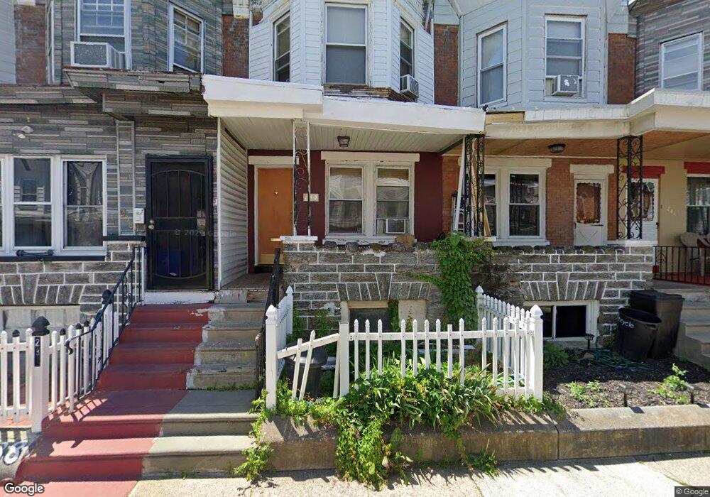
242 W Sulis St Philadelphia, PA 19120
Olney NeighborhoodEstimated Value: $139,000 - $165,000
3
Beds
1
Bath
1,120
Sq Ft
$132/Sq Ft
Est. Value
About This Home
This home is located at 242 W Sulis St, Philadelphia, PA 19120 and is currently estimated at $148,112, approximately $132 per square foot. 242 W Sulis St is a home located in Philadelphia County with nearby schools including Andrew J. Morrison School, Birney Preparatory Academy, and Olney Charter High School.
Ownership History
Date
Name
Owned For
Owner Type
Purchase Details
Closed on
Nov 7, 2005
Sold by
Bennett Mayfield and Moore Linda
Bought by
Mayfield Bennett Marilyn and Mayfield Bennett
Current Estimated Value
Home Financials for this Owner
Home Financials are based on the most recent Mortgage that was taken out on this home.
Original Mortgage
$68,000
Outstanding Balance
$37,304
Interest Rate
6.06%
Mortgage Type
Fannie Mae Freddie Mac
Estimated Equity
$110,808
Create a Home Valuation Report for This Property
The Home Valuation Report is an in-depth analysis detailing your home's value as well as a comparison with similar homes in the area
Home Values in the Area
Average Home Value in this Area
Purchase History
| Date | Buyer | Sale Price | Title Company |
|---|---|---|---|
| Mayfield Bennett Marilyn | $15,044 | None Available |
Source: Public Records
Mortgage History
| Date | Status | Borrower | Loan Amount |
|---|---|---|---|
| Open | Mayfield Bennett Marilyn | $68,000 |
Source: Public Records
Tax History Compared to Growth
Tax History
| Year | Tax Paid | Tax Assessment Tax Assessment Total Assessment is a certain percentage of the fair market value that is determined by local assessors to be the total taxable value of land and additions on the property. | Land | Improvement |
|---|---|---|---|---|
| 2025 | $1,355 | $127,900 | $25,580 | $102,320 |
| 2024 | $1,355 | $127,900 | $25,580 | $102,320 |
| 2023 | $1,355 | $96,800 | $19,360 | $77,440 |
| 2022 | $396 | $51,800 | $19,360 | $32,440 |
| 2021 | $1,026 | $0 | $0 | $0 |
| 2020 | $1,026 | $0 | $0 | $0 |
| 2019 | $953 | $0 | $0 | $0 |
| 2018 | $1,009 | $0 | $0 | $0 |
| 2017 | $1,009 | $0 | $0 | $0 |
| 2016 | $1,009 | $0 | $0 | $0 |
| 2015 | $966 | $0 | $0 | $0 |
| 2014 | -- | $72,100 | $4,823 | $67,277 |
| 2012 | -- | $9,600 | $934 | $8,666 |
Source: Public Records
Map
Nearby Homes
- 263 W Sulis St
- 253 W Albanus St
- 207 W Albanus St
- 234 W Roosevelt Blvd Unit 38
- 222 W Roosevelt Blvd
- 4987 N 2nd St
- 4993 N 2nd St
- 2511 N Leithgow St
- 205 W Loudon St
- 4937 N 5th St
- 437 W Roosevelt Blvd
- 163 W Roosevelt Blvd
- 182 1/2 W Roosevelt Blvd
- 161 W Roosevelt Blvd
- 159 W Roosevelt Blvd
- 429 W Ashdale St
- 313 Lindley Ave
- 157 W Roosevelt Blvd
- 155 W Roosevelt Blvd
- 153 W Roosevelt Blvd
- 244 W Sulis St
- 240 W Sulis St
- 238 W Sulis St
- 246 W Sulis St
- 236 W Sulis St
- 248 W Sulis St
- 234 W Sulis St
- 250 W Sulis St
- 232 W Sulis St
- 252 W Sulis St
- 239 W Rockland St
- 241 W Rockland St
- 237 W Rockland St
- 243 W Rockland St
- 235 W Rockland St
- 230 W Sulis St
- 254 W Sulis St
- 233 W Rockland St
- 245 W Rockland St
- 247 W Rockland St