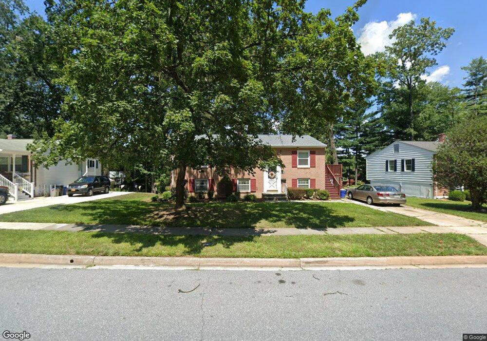
242 Walgrove Rd Reisterstown, MD 21136
Estimated Value: $327,000 - $387,000
--
Bed
2
Baths
1,176
Sq Ft
$312/Sq Ft
Est. Value
About This Home
This home is located at 242 Walgrove Rd, Reisterstown, MD 21136 and is currently estimated at $366,449, approximately $311 per square foot. 242 Walgrove Rd is a home located in Baltimore County with nearby schools including Reisterstown Elementary, Franklin Middle, and Franklin High.
Ownership History
Date
Name
Owned For
Owner Type
Purchase Details
Closed on
May 21, 2004
Sold by
Porter David H
Bought by
Rechy Sondra J and Rechy Mariano E
Current Estimated Value
Purchase Details
Closed on
Nov 2, 2001
Sold by
Porter David H
Bought by
Porter David H and Porter Jennifer
Purchase Details
Closed on
Nov 18, 1997
Sold by
Kolzow Carolyn
Bought by
Porter David H
Create a Home Valuation Report for This Property
The Home Valuation Report is an in-depth analysis detailing your home's value as well as a comparison with similar homes in the area
Home Values in the Area
Average Home Value in this Area
Purchase History
| Date | Buyer | Sale Price | Title Company |
|---|---|---|---|
| Rechy Sondra J | $246,000 | -- | |
| Rechy Sondra J | $246,000 | -- | |
| Porter David H | -- | -- | |
| Porter David H | $108,000 | -- |
Source: Public Records
Tax History Compared to Growth
Tax History
| Year | Tax Paid | Tax Assessment Tax Assessment Total Assessment is a certain percentage of the fair market value that is determined by local assessors to be the total taxable value of land and additions on the property. | Land | Improvement |
|---|---|---|---|---|
| 2025 | $3,632 | $276,733 | -- | -- |
| 2024 | $3,632 | $253,600 | $51,700 | $201,900 |
| 2023 | $1,734 | $239,667 | $0 | $0 |
| 2022 | $3,194 | $225,733 | $0 | $0 |
| 2021 | $2,953 | $211,800 | $51,700 | $160,100 |
| 2020 | $2,956 | $204,500 | $0 | $0 |
| 2019 | $2,390 | $197,200 | $0 | $0 |
| 2018 | $3,090 | $189,900 | $51,700 | $138,200 |
| 2017 | $2,817 | $184,067 | $0 | $0 |
| 2016 | $2,504 | $178,233 | $0 | $0 |
| 2015 | $2,504 | $172,400 | $0 | $0 |
| 2014 | $2,504 | $172,400 | $0 | $0 |
Source: Public Records
Map
Nearby Homes
- 225 Highmeadow Rd
- 215 Greenview Ave
- 13 Bellinger Ct
- 10 Simpson Ct
- 611 Brickston Rd
- 1 Brampton Ct
- 15 Gloucester Ct
- 3 Meadow Mist Ct
- 7 Putman Ct
- 10944 Baskerville Rd
- 570 Kennington Rd
- 208 Parkholme Cir
- 105 Fitz Ct Unit 202
- 101 Fitz Ct Unit 202
- 105 Fitz Ct Unit 101
- 65A Bond Ave
- 203 Cork Ln Unit T4
- 10 Pennyborough Ct
- 12314 Bonfire Dr
- 223 New Ave
- 240 Walgrove Rd
- 244 Walgrove Rd
- 249 Chartley Dr
- 247 Chartley Dr
- 238 Walgrove Rd
- 246 Walgrove Rd
- 245 Chartley Dr
- 241 Walgrove Rd
- 251 Chartley Dr
- 243 Walgrove Rd
- 239 Walgrove Rd
- 236 Walgrove Rd
- 245 Walgrove Rd
- 243 Chartley Dr
- 237 Walgrove Rd
- 234 Walgrove Rd
- 235 Walgrove Rd
- 241 Chartley Dr
- 250 Chartley Dr
- 248 Chartley Dr