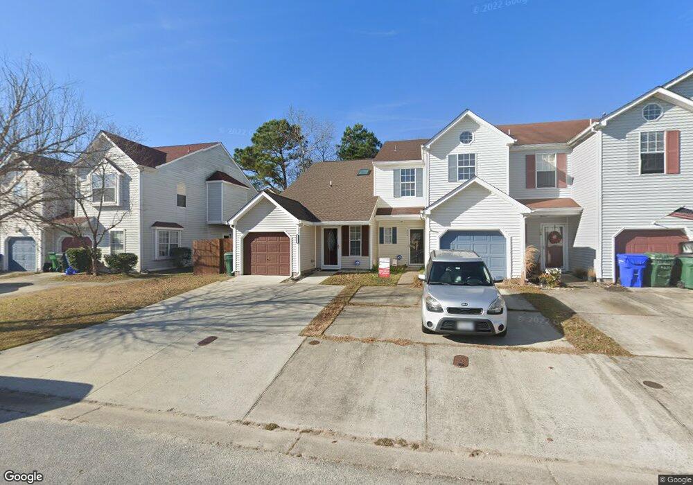
242 Wexford Dr W Suffolk, VA 23434
Chuckatuck NeighborhoodEstimated Value: $241,000 - $273,000
4
Beds
2
Baths
1,310
Sq Ft
$193/Sq Ft
Est. Value
About This Home
This home is located at 242 Wexford Dr W, Suffolk, VA 23434 and is currently estimated at $253,297, approximately $193 per square foot. 242 Wexford Dr W is a home located in Suffolk City with nearby schools including Oakland Elementary School, King's Fork Middle School, and King's Fork High School.
Ownership History
Date
Name
Owned For
Owner Type
Purchase Details
Closed on
Aug 23, 2012
Sold by
Deutsche Jerome M
Bought by
Hulin Nancy F
Current Estimated Value
Home Financials for this Owner
Home Financials are based on the most recent Mortgage that was taken out on this home.
Original Mortgage
$135,800
Outstanding Balance
$93,810
Interest Rate
3.61%
Mortgage Type
New Conventional
Estimated Equity
$159,487
Purchase Details
Closed on
Apr 19, 2011
Sold by
Equity Trustees Llc
Bought by
Deutsche Bank National Trust
Create a Home Valuation Report for This Property
The Home Valuation Report is an in-depth analysis detailing your home's value as well as a comparison with similar homes in the area
Home Values in the Area
Average Home Value in this Area
Purchase History
| Date | Buyer | Sale Price | Title Company |
|---|---|---|---|
| Hulin Nancy F | $140,000 | -- | |
| Deutsche Bank National Trust | $101,610 | -- |
Source: Public Records
Mortgage History
| Date | Status | Borrower | Loan Amount |
|---|---|---|---|
| Open | Deutsche Bank National Trust | $135,800 |
Source: Public Records
Tax History Compared to Growth
Tax History
| Year | Tax Paid | Tax Assessment Tax Assessment Total Assessment is a certain percentage of the fair market value that is determined by local assessors to be the total taxable value of land and additions on the property. | Land | Improvement |
|---|---|---|---|---|
| 2024 | $450 | $217,300 | $55,000 | $162,300 |
| 2023 | $393 | $188,700 | $50,000 | $138,700 |
| 2022 | $1,812 | $166,200 | $50,000 | $116,200 |
| 2021 | $1,717 | $154,700 | $43,800 | $110,900 |
| 2020 | $1,547 | $139,400 | $43,800 | $95,600 |
| 2019 | $1,460 | $131,500 | $43,800 | $87,700 |
| 2018 | $135 | $128,400 | $43,800 | $84,600 |
| 2017 | $1,374 | $128,400 | $43,800 | $84,600 |
| 2016 | $1,374 | $128,400 | $43,800 | $84,600 |
| 2015 | $856 | $128,400 | $43,800 | $84,600 |
| 2014 | $856 | $128,400 | $43,800 | $84,600 |
Source: Public Records
Map
Nearby Homes
- 285 Wexford Dr W
- 269 Mccormick Dr
- 253 Mccormick Dr
- 265 Mccormick Dr
- 132 Ashford Dr
- 102 Chalmers Dr
- 136 Ashford Dr
- 279 Mccormick Dr
- 201 Station Dr
- 286 Mccormick Dr
- 312 Stonehenge Dr
- 1007 Robinson Rd Unit 4C
- 1005 Robinson Rd Unit 3C
- 1011 Robinson Rd Unit 5C
- 1011 Robinson Rd Unit 5D
- 1011 Robinson Rd Unit 5B
- 1012 Robinson Rd Unit D
- 1012 Robinson Rd Unit 6C
- 1012 Robinson Rd Unit B
- 1014 Robinson Rd Unit B
- 244 Wexford Dr W
- 240 Wexford Dr W
- 246 Wexford Dr W
- 238 Wexford Dr W
- 248 Wexford Dr W
- 236 Wexford Dr W
- 250 Wexford Dr W
- 246 Craftsman Cir
- 250 Craftsman Cir
- 248 Craftsman Cir
- 234 Wexford Dr W
- 244 Craftsman Cir
- 252 Wexford Dr W
- 232 Wexford Dr W
- 232 Wexford Dr W Unit 232
- 254 Wexford Dr W
- 242 Craftsman Cir
- 230 Wexford Dr W
- 243 Wexford Dr W
- 241 Wexford Dr W