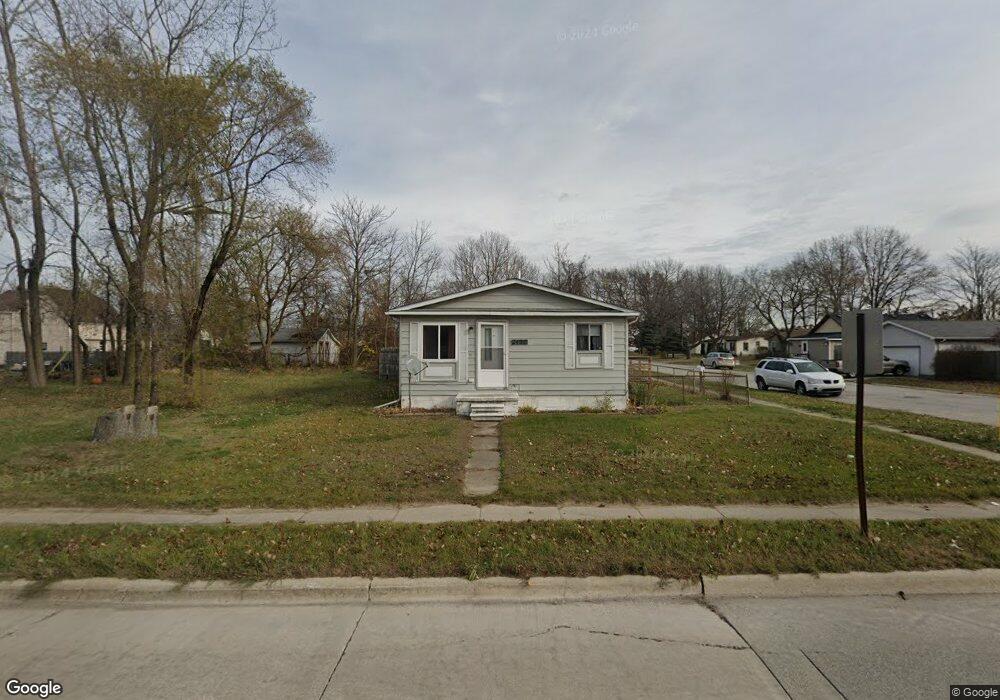
2420 16th St Port Huron, MI 48060
Estimated Value: $110,373 - $225,000
3
Beds
1
Bath
960
Sq Ft
$156/Sq Ft
Est. Value
About This Home
This home is located at 2420 16th St, Port Huron, MI 48060 and is currently estimated at $150,093, approximately $156 per square foot. 2420 16th St is a home located in St. Clair County with nearby schools including Michigamme Elementary School, Central Middle School, and Port Huron High School.
Ownership History
Date
Name
Owned For
Owner Type
Purchase Details
Closed on
Aug 19, 2024
Sold by
Laber Properties Llc
Bought by
Asset Link Llc
Current Estimated Value
Purchase Details
Closed on
Apr 17, 2018
Sold by
Laber Ricky L and Laber Patricia G
Bought by
Laber Frederick and Laber Ricky L
Home Financials for this Owner
Home Financials are based on the most recent Mortgage that was taken out on this home.
Interest Rate
4.42%
Create a Home Valuation Report for This Property
The Home Valuation Report is an in-depth analysis detailing your home's value as well as a comparison with similar homes in the area
Home Values in the Area
Average Home Value in this Area
Purchase History
| Date | Buyer | Sale Price | Title Company |
|---|---|---|---|
| Asset Link Llc | $215,000 | Liberty Title | |
| Asset Link Llc | $215,000 | Liberty Title | |
| Laber Frederick | -- | -- |
Source: Public Records
Mortgage History
| Date | Status | Borrower | Loan Amount |
|---|---|---|---|
| Previous Owner | Laber Frederick | -- |
Source: Public Records
Tax History Compared to Growth
Tax History
| Year | Tax Paid | Tax Assessment Tax Assessment Total Assessment is a certain percentage of the fair market value that is determined by local assessors to be the total taxable value of land and additions on the property. | Land | Improvement |
|---|---|---|---|---|
| 2025 | $1,487 | $37,800 | $0 | $0 |
| 2024 | $1,258 | $35,700 | $0 | $0 |
| 2023 | $1,191 | $33,600 | $0 | $0 |
| 2022 | $1,146 | $31,400 | $0 | $0 |
| 2021 | $1,094 | $26,700 | $0 | $0 |
| 2020 | $1,099 | $23,700 | $23,700 | $0 |
| 2019 | $1,079 | $16,800 | $0 | $0 |
| 2018 | $1,055 | $16,800 | $0 | $0 |
| 2017 | $969 | $15,900 | $0 | $0 |
| 2016 | $853 | $15,900 | $0 | $0 |
| 2015 | $889 | $15,800 | $15,800 | $0 |
| 2014 | $889 | $16,500 | $16,500 | $0 |
| 2013 | -- | $18,100 | $0 | $0 |
Source: Public Records
Map
Nearby Homes
- 1414 Beard St
- 1403 Catherine McAuley Dr
- 1319 Minnie St
- 2411 10th St
- 2718 Electric Ave
- 2710 Electric Ave
- 1322 Division St
- 1325 Division St
- 1309 Division St
- 2815 Military St
- 1112 Minnie St
- 1127 Minnie St
- 2203 VL Railroad St
- 2200 VL Railroad St
- 9999 24th St
- Lot 3 24th St
- 1535 Oak St
- 1624 15th St
- 1610 16th St
- 2704 Military St
- 1523 Columbus St
- 2504 16th St
- 1534 Beard St
- 1524 Columbus St
- 2400 16th St Unit 2414
- 2510 16th St
- 1522 Beard St
- 1516 Columbus St
- 1518 Beard St
- 1508 Columbus St
- 1525 Beard St
- 1500 Columbus St
- 1521 Beard St
- 1508 Beard St
- 1504 Beard St
- 1500 Beard St
- 1500 Beard St Unit 1535
- 1500 Beard St
- 1517 Beard St
- 1505 Beard St