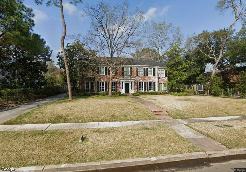
2420 Brentwood Dr Houston, TX 77019
River Oaks NeighborhoodEstimated Value: $3,536,765 - $4,406,000
5
Beds
5
Baths
5,502
Sq Ft
$726/Sq Ft
Est. Value
About This Home
This home is located at 2420 Brentwood Dr, Houston, TX 77019 and is currently estimated at $3,995,255, approximately $726 per square foot. 2420 Brentwood Dr is a home located in Harris County with nearby schools including River Oaks Elementary School, Lanier Middle School, and Lamar High School.
Ownership History
Date
Name
Owned For
Owner Type
Purchase Details
Closed on
Sep 15, 1999
Sold by
Prudential Residential Svcs Ltd Prtnrshp
Bought by
Harris Warren W and Beck Lauren L
Current Estimated Value
Home Financials for this Owner
Home Financials are based on the most recent Mortgage that was taken out on this home.
Original Mortgage
$750,000
Outstanding Balance
$223,715
Interest Rate
7.9%
Estimated Equity
$3,771,540
Create a Home Valuation Report for This Property
The Home Valuation Report is an in-depth analysis detailing your home's value as well as a comparison with similar homes in the area
Home Values in the Area
Average Home Value in this Area
Purchase History
| Date | Buyer | Sale Price | Title Company |
|---|---|---|---|
| Harris Warren W | -- | Texas American Title Company | |
| Prudential Residential Svcs Ltd Prtnrshp | -- | Texas American Title Company |
Source: Public Records
Mortgage History
| Date | Status | Borrower | Loan Amount |
|---|---|---|---|
| Open | Harris Warren W | $750,000 |
Source: Public Records
Tax History Compared to Growth
Tax History
| Year | Tax Paid | Tax Assessment Tax Assessment Total Assessment is a certain percentage of the fair market value that is determined by local assessors to be the total taxable value of land and additions on the property. | Land | Improvement |
|---|---|---|---|---|
| 2025 | $52,864 | $3,013,499 | $2,357,550 | $655,949 |
| 2024 | $52,864 | $3,204,493 | $2,205,450 | $999,043 |
| 2023 | $52,864 | $3,100,000 | $2,129,400 | $970,600 |
| 2022 | $60,552 | $3,048,272 | $1,977,300 | $1,070,972 |
| 2021 | $58,267 | $2,500,000 | $1,901,250 | $598,750 |
| 2020 | $58,118 | $2,400,000 | $1,901,250 | $498,750 |
| 2019 | $63,261 | $2,500,000 | $1,901,250 | $598,750 |
| 2018 | $45,472 | $2,250,000 | $1,977,300 | $272,700 |
| 2017 | $50,023 | $1,978,300 | $1,977,300 | $1,000 |
| 2016 | $49,699 | $2,425,000 | $1,901,250 | $523,750 |
| 2015 | $33,400 | $1,950,000 | $1,496,550 | $453,450 |
| 2014 | $33,400 | $1,748,546 | $1,360,500 | $388,046 |
Source: Public Records
Map
Nearby Homes
- 2413 Brentwood Dr
- 1561 Kirby Dr
- 2525 Inwood Dr
- 2204 Inwood Dr
- 2247 Chilton Rd
- 2131 Brentwood Dr
- 2249 Pelham Dr
- 2233 Pelham Dr
- 2217 Pelham Dr
- 2105 Del Monte Dr
- 2323 San Felipe St Unit 901
- 2323 San Felipe St Unit 1101
- 2323 San Felipe St Unit 602
- 1216 S Shepherd Dr
- 1913 Revere St
- 2117 Chilton Rd
- 2116 Looscan Ln
- 1915 Spann St
- 2336 Welch St
- 1915 Kirby Dr
- 2428 Brentwood Dr
- 2412 Brentwood Dr
- 2425 Pine Valley Ct
- 2436 Brentwood Dr
- 2404 Brentwood Dr
- 2421 Brentwood Dr
- 2435 Pine Valley Ct
- 2405 Brentwood Dr
- 2429 Brentwood Dr
- 2415 Pine Valley Ct
- 2504 Brentwood Dr
- 2437 Brentwood Dr
- 2445 Pine Valley Ct
- 1537 Kirby Dr
- 2410 Inwood Dr
- 2409 Pine Valley Ct
- 2414 Inwood Dr
- 2404 Inwood Dr
- 2235 Brentwood Dr
- 2232 Brentwood Dr