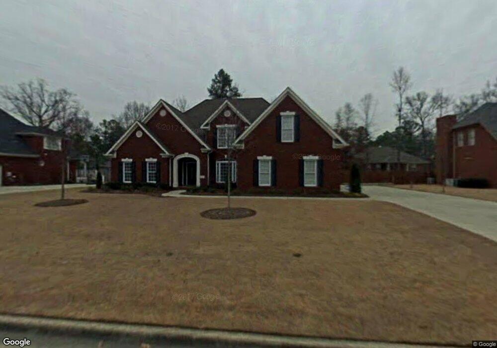
2420 Jarvis St SW Decatur, AL 35603
Westmead NeighborhoodEstimated Value: $439,000 - $500,000
--
Bed
--
Bath
3,353
Sq Ft
$139/Sq Ft
Est. Value
About This Home
This home is located at 2420 Jarvis St SW, Decatur, AL 35603 and is currently estimated at $467,597, approximately $139 per square foot. 2420 Jarvis St SW is a home located in Morgan County with nearby schools including Julian Harris Elementary School, Cedar Ridge Middle School, and Austin High School.
Ownership History
Date
Name
Owned For
Owner Type
Purchase Details
Closed on
Jun 5, 2007
Sold by
Rodriguez Mark A and Rodriguez Rosa E
Bought by
Drake James W and Drake Doris S
Current Estimated Value
Home Financials for this Owner
Home Financials are based on the most recent Mortgage that was taken out on this home.
Original Mortgage
$150,000
Outstanding Balance
$91,436
Interest Rate
6.12%
Mortgage Type
New Conventional
Estimated Equity
$376,161
Create a Home Valuation Report for This Property
The Home Valuation Report is an in-depth analysis detailing your home's value as well as a comparison with similar homes in the area
Home Values in the Area
Average Home Value in this Area
Purchase History
| Date | Buyer | Sale Price | Title Company |
|---|---|---|---|
| Drake James W | -- | None Available |
Source: Public Records
Mortgage History
| Date | Status | Borrower | Loan Amount |
|---|---|---|---|
| Open | Drake James W | $150,000 |
Source: Public Records
Tax History Compared to Growth
Tax History
| Year | Tax Paid | Tax Assessment Tax Assessment Total Assessment is a certain percentage of the fair market value that is determined by local assessors to be the total taxable value of land and additions on the property. | Land | Improvement |
|---|---|---|---|---|
| 2024 | $1,478 | $38,640 | $4,280 | $34,360 |
| 2023 | $1,478 | $39,100 | $4,280 | $34,820 |
| 2022 | $1,457 | $38,100 | $4,040 | $34,060 |
| 2021 | $1,253 | $32,840 | $4,040 | $28,800 |
| 2020 | $1,412 | $57,140 | $4,000 | $53,140 |
| 2019 | $1,412 | $36,960 | $0 | $0 |
| 2015 | $1,272 | $33,340 | $0 | $0 |
| 2014 | $1,272 | $33,340 | $0 | $0 |
| 2013 | -- | $32,780 | $0 | $0 |
Source: Public Records
Map
Nearby Homes
- 1923 W Brownstone Ct SW
- 1712 Brookline Ave SW
- 2406 Auburn Dr SW
- 2409 Brookline Ct SW
- 1829 Brownstone Ave SW
- 1904 W Brownstone Ct SW
- 2313 Cumberland Ct SW
- 1962 E Brownstone Ct SW
- 2414 Brookline Ct SW
- 1812 Brownstone Ave SW
- 2410 Kathy Ln SW
- 1827 N Brownstone Ct SW
- 1901 Shepard Dr SW
- 1824 Scobee Ave SW
- 2415 Gaslight Place SW
- 1903 Cumberland Ave SW
- 2413 Gaslight Place SW
- 1406 Goldridge Dr SW
- 1711 Wilshire Ave SW
- 2006 Jefferson Ave SW
- 2418 Jarvis St SW
- 2422 Jarvis St SW
- 2410 Mcnair St SW
- 2408 Mcnair St SW
- 2412 Mcnair St SW
- 2416 Jarvis St SW
- 2424 Jarvis St SW
- 2406 Mcnair St SW
- 2413 Jarvis St SW
- 2414 Mcnair St SW
- 2404 Mcnair St SW
- 2411 Jarvis St SW
- 2414 Jarvis St SW
- 1815 Pin Oak Cir SW
- 1826 Brookline Ave SW
- 2502 Jarvis St SW
- 1824 Brookline Ave SW
- 2402 Mcnair St SW
- 1822 Brookline Ave SW
- 2501 Jarvis St SW