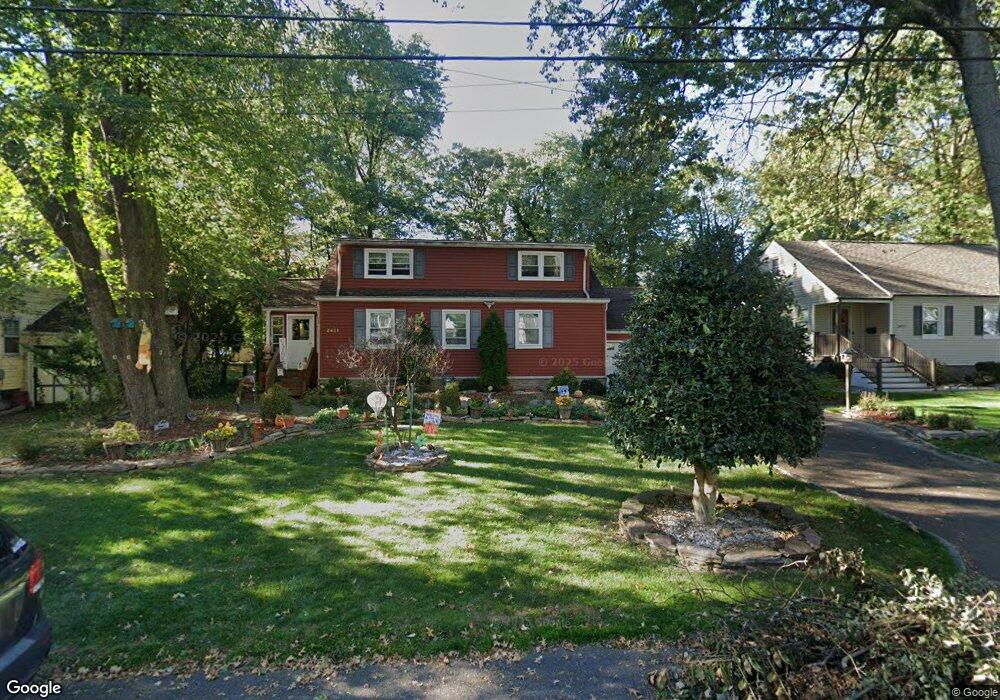
2421 Hill Rd Scotch Plains, NJ 07076
Estimated Value: $529,000 - $996,000
--
Bed
--
Bath
1,632
Sq Ft
$447/Sq Ft
Est. Value
About This Home
This home is located at 2421 Hill Rd, Scotch Plains, NJ 07076 and is currently estimated at $730,044, approximately $447 per square foot. 2421 Hill Rd is a home located in Union County with nearby schools including Howard B. Brunner Elementary School, Nettingham Middle School, and Scotch Plains-Fanwood High School.
Ownership History
Date
Name
Owned For
Owner Type
Purchase Details
Closed on
Nov 29, 2004
Sold by
Mcgann Thomas
Bought by
Flood David and Flood Jane
Current Estimated Value
Home Financials for this Owner
Home Financials are based on the most recent Mortgage that was taken out on this home.
Original Mortgage
$323,500
Outstanding Balance
$161,577
Interest Rate
5.69%
Estimated Equity
$568,467
Purchase Details
Closed on
Mar 24, 1998
Sold by
Moren Gary A and Healy Moren Cora
Bought by
Mcgann Thomas J and Mcgann Maureen C
Home Financials for this Owner
Home Financials are based on the most recent Mortgage that was taken out on this home.
Original Mortgage
$171,500
Interest Rate
7.11%
Create a Home Valuation Report for This Property
The Home Valuation Report is an in-depth analysis detailing your home's value as well as a comparison with similar homes in the area
Home Values in the Area
Average Home Value in this Area
Purchase History
| Date | Buyer | Sale Price | Title Company |
|---|---|---|---|
| Flood David | $415,000 | -- | |
| Mcgann Thomas J | $191,500 | Colonial Title & Abstract |
Source: Public Records
Mortgage History
| Date | Status | Borrower | Loan Amount |
|---|---|---|---|
| Open | Flood David | $323,500 | |
| Previous Owner | Mcgann Thomas J | $171,500 |
Source: Public Records
Tax History Compared to Growth
Tax History
| Year | Tax Paid | Tax Assessment Tax Assessment Total Assessment is a certain percentage of the fair market value that is determined by local assessors to be the total taxable value of land and additions on the property. | Land | Improvement |
|---|---|---|---|---|
| 2025 | $10,438 | $88,700 | $38,500 | $50,200 |
| 2024 | $10,130 | $88,700 | $38,500 | $50,200 |
| 2023 | $10,130 | $88,700 | $38,500 | $50,200 |
| 2022 | $10,010 | $88,700 | $38,500 | $50,200 |
| 2021 | $9,993 | $88,700 | $38,500 | $50,200 |
| 2020 | $9,945 | $88,700 | $38,500 | $50,200 |
| 2019 | $9,871 | $88,700 | $38,500 | $50,200 |
| 2018 | $9,706 | $88,700 | $38,500 | $50,200 |
| 2017 | $9,490 | $88,700 | $38,500 | $50,200 |
| 2016 | $9,307 | $88,700 | $38,500 | $50,200 |
| 2015 | $9,155 | $88,700 | $38,500 | $50,200 |
| 2014 | $8,853 | $88,700 | $38,500 | $50,200 |
Source: Public Records
Map
Nearby Homes
- 2286 Stocker Ln
- 869 Ternay Ave
- 2406 Park Place
- 2314 Longfellow Ave
- 2219 North Ave Unit 6
- 2398 Hamlette Place
- 2269 Redwood Rd
- 4 Lois Place
- 9 Timberline Dr
- 629 Clark St
- 143 Stanmore Place
- 2116 Newark Ave
- 24 Deborah Way
- 21 Old South Ave
- 54 Oakwood Ct
- 608 Hort St
- 2588 Liberty Ave
- 26 Riga Ct Unit 3A
- 177 Pleasant Ave
- 16 Riga Ct Unit 2B