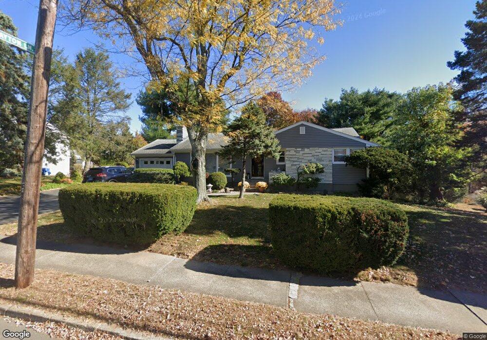
2421 Stanley St New Britain, CT 06053
Estimated Value: $305,000 - $326,000
2
Beds
3
Baths
1,181
Sq Ft
$267/Sq Ft
Est. Value
About This Home
This home is located at 2421 Stanley St, New Britain, CT 06053 and is currently estimated at $315,876, approximately $267 per square foot. 2421 Stanley St is a home located in Hartford County with nearby schools including Holmes School, Pulaski Middle School, and St. Francis of Assisi Middle School.
Ownership History
Date
Name
Owned For
Owner Type
Purchase Details
Closed on
Jan 11, 1995
Sold by
Ferris Miriam T Est
Bought by
Jain Sanjeev and Jain Susan P
Current Estimated Value
Purchase Details
Closed on
Dec 24, 1992
Sold by
Webb George and Webb Stanley
Bought by
Hubeny Andrew and Hubeny Dorothy
Purchase Details
Closed on
Oct 13, 1992
Sold by
Lavoie Gilles and Lavoie Maria
Bought by
Sauve James and Sauve Doreen
Purchase Details
Closed on
Oct 26, 1988
Sold by
Est Lucy R Vallee
Bought by
Malinowski Aleksander
Purchase Details
Closed on
Aug 1, 1988
Sold by
Wynfield Assoc
Bought by
Romer Jon
Create a Home Valuation Report for This Property
The Home Valuation Report is an in-depth analysis detailing your home's value as well as a comparison with similar homes in the area
Home Values in the Area
Average Home Value in this Area
Purchase History
| Date | Buyer | Sale Price | Title Company |
|---|---|---|---|
| Jain Sanjeev | $139,000 | -- | |
| Hubeny Andrew | $200,000 | -- | |
| Sauve James | $53,700 | -- | |
| Malinowski Aleksander | $160,000 | -- | |
| Romer Jon | $151,900 | -- |
Source: Public Records
Mortgage History
| Date | Status | Borrower | Loan Amount |
|---|---|---|---|
| Closed | Romer Jon | $55,000 | |
| Closed | Romer Jon | $25,000 | |
| Closed | Romer Jon | $83,000 |
Source: Public Records
Tax History Compared to Growth
Tax History
| Year | Tax Paid | Tax Assessment Tax Assessment Total Assessment is a certain percentage of the fair market value that is determined by local assessors to be the total taxable value of land and additions on the property. | Land | Improvement |
|---|---|---|---|---|
| 2025 | $6,865 | $175,210 | $72,590 | $102,620 |
| 2024 | $6,937 | $175,210 | $72,590 | $102,620 |
| 2023 | $6,707 | $175,210 | $72,590 | $102,620 |
| 2022 | $5,825 | $117,670 | $33,460 | $84,210 |
| 2021 | $5,825 | $117,670 | $33,460 | $84,210 |
| 2020 | $5,942 | $117,670 | $33,460 | $84,210 |
| 2019 | $5,942 | $117,670 | $33,460 | $84,210 |
| 2018 | $5,942 | $117,670 | $33,460 | $84,210 |
| 2017 | $5,907 | $116,970 | $30,450 | $86,520 |
| 2016 | $5,907 | $116,970 | $30,450 | $86,520 |
| 2015 | $5,732 | $116,970 | $30,450 | $86,520 |
| 2014 | $5,732 | $116,970 | $30,450 | $86,520 |
Source: Public Records
Map
Nearby Homes
- 180 Brittany Farms Rd Unit D
- 2337 Stanley St
- 198 Brittany Farms Rd Unit D
- 123 Brittany Farms Rd Unit B
- 123 Brittany Farms Rd Unit C
- 40 Varmor Dr
- 200 Belridge Rd
- 182 Batterson Park Rd
- 180 Batterson Park Rd
- 46 Robin Rd
- 10 Garden Gate
- 187 Miriam Rd
- 140 Lewis Rd
- 801 Farmington Ave
- 236 Sterling Dr Unit 236
- 239 Sterling Dr Unit 239
- 34 Hutchinson St
- 228 Reservoir Rd
- 28 SyMcO Dr
- 93 South Rd
- 2411 Stanley St
- 2433 Stanley St
- 2414 Stanley St
- 2430 Stanley St
- 2399 Stanley St
- 190 Brittany Farms Rd Unit B
- 190 Brittany Farms Rd Unit H
- 190 Brittany Farms Rd Unit G
- 190 Brittany Farms Rd Unit F
- 190 Brittany Farms Rd Unit E
- 190 Brittany Farms Rd Unit D
- 190 Brittany Farms Rd Unit C
- 190 Brittany Farms Rd Unit B
- 190 Brittany Farms Rd Unit A
- 190 Brittany Farms Rd
- 2443 Stanley St
- 180 Brittany Farms Rd Unit E
- 180 Brittany Farms Rd Unit D
- 180 Brittany Farms Rd Unit C
- 180 Brittany Farms Rd Unit B