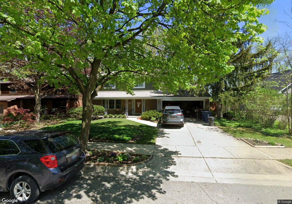
2425 Powell Ave Unit Bldg-Unit Ann Arbor, MI 48104
Kimberly Hills NeighborhoodEstimated Value: $551,000 - $625,000
4
Beds
3
Baths
1,998
Sq Ft
$297/Sq Ft
Est. Value
About This Home
This home is located at 2425 Powell Ave Unit Bldg-Unit, Ann Arbor, MI 48104 and is currently estimated at $592,608, approximately $296 per square foot. 2425 Powell Ave Unit Bldg-Unit is a home located in Washtenaw County with nearby schools including Pattengill Elementary School, Bryant Elementary School, and Tappan Middle School.
Ownership History
Date
Name
Owned For
Owner Type
Purchase Details
Closed on
Jul 12, 2018
Sold by
Vinokur Amiram D and Vinokur Diane R K
Bought by
Cronin Daniel T and Cronin Mary R
Current Estimated Value
Home Financials for this Owner
Home Financials are based on the most recent Mortgage that was taken out on this home.
Original Mortgage
$388,000
Outstanding Balance
$336,260
Interest Rate
4.5%
Mortgage Type
New Conventional
Estimated Equity
$256,348
Purchase Details
Closed on
Aug 18, 2014
Sold by
Kooi Lucy Anne and The Kenneth A Kooi Trust
Bought by
Kooi Lucy Anne
Create a Home Valuation Report for This Property
The Home Valuation Report is an in-depth analysis detailing your home's value as well as a comparison with similar homes in the area
Home Values in the Area
Average Home Value in this Area
Purchase History
| Date | Buyer | Sale Price | Title Company |
|---|---|---|---|
| Cronin Daniel T | $403,000 | Ata National Ttile Group Llc | |
| Kooi Lucy Anne | -- | None Available |
Source: Public Records
Mortgage History
| Date | Status | Borrower | Loan Amount |
|---|---|---|---|
| Open | Cronin Daniel T | $388,000 |
Source: Public Records
Tax History
| Year | Tax Paid | Tax Assessment Tax Assessment Total Assessment is a certain percentage of the fair market value that is determined by local assessors to be the total taxable value of land and additions on the property. | Land | Improvement |
|---|---|---|---|---|
| 2025 | $9,157 | $243,300 | $0 | $0 |
| 2024 | $8,931 | $220,700 | $0 | $0 |
| 2023 | $8,235 | $193,400 | $0 | $0 |
| 2022 | $8,974 | $197,400 | $0 | $0 |
| 2021 | $8,762 | $191,800 | $0 | $0 |
| 2020 | $8,585 | $182,400 | $0 | $0 |
| 2019 | $8,170 | $165,300 | $165,300 | $0 |
| 2018 | $6,209 | $162,400 | $0 | $0 |
| 2017 | $6,040 | $155,900 | $0 | $0 |
| 2016 | $5,827 | $120,772 | $0 | $0 |
| 2015 | $5,549 | $120,411 | $0 | $0 |
| 2014 | $5,549 | $116,649 | $0 | $0 |
| 2013 | -- | $116,649 | $0 | $0 |
Source: Public Records
Map
Nearby Homes
- 2153 Independence Blvd
- 2115 Nature Cove Ct Unit 206
- 2115 Nature Cove Ct Unit 210
- 2650 Kimberley Rd
- 2411 Packard St Unit 53E
- 2407 Packard 43e St
- 2505 Brockman Blvd
- 2867 Page Ave
- 1905 Steere Place
- 2316 Brockman Blvd
- 2781 Washtenaw Ave
- 1709 South Blvd
- 2784 Page Ave Unit 43
- 2748 Page Ave
- 1407 Marlborough Dr
- 1864 Arlington Blvd
- 1434 Pine Valley Blvd
- 2424 Londonderry Rd
- 2427 Londonderry Rd
- 2840 Canterbury Rd
- 2425 Powell Ave
- 2435 Powell Ave
- 2423 Powell Ave
- 2240 Needham Rd
- 2421 Powell Ave
- 2430 Powell Ave
- 2138 Ridge Ave
- 2302 Manchester Rd
- 2234 Needham Rd
- 2308 Manchester Rd
- 2127 Camelot Rd
- 2126 Ridge Ave
- 2222 Needham Rd
- 2145 Ridge Ave
- 2320 Manchester Rd
- 2115 Camelot Rd
- 2114 Ridge Ave
- 2135 Ridge Ave
- 2237 Needham Rd
- 2301 Manchester Rd
Your Personal Tour Guide
Ask me questions while you tour the home.