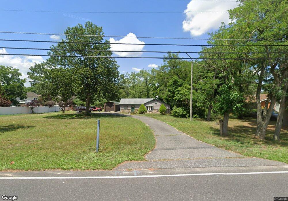
2426 Newcombtown Rd Millville, NJ 08332
Estimated Value: $213,000 - $295,000
3
Beds
2
Baths
962
Sq Ft
$274/Sq Ft
Est. Value
About This Home
This home is located at 2426 Newcombtown Rd, Millville, NJ 08332 and is currently estimated at $263,581, approximately $273 per square foot. 2426 Newcombtown Rd is a home located in Cumberland County with nearby schools including Holly Heights Elementary School, Lakeside Middle School, and Millville Senior High School.
Ownership History
Date
Name
Owned For
Owner Type
Purchase Details
Closed on
May 30, 2006
Sold by
Rosa John M
Bought by
Marti Angelo
Current Estimated Value
Purchase Details
Closed on
Aug 9, 1996
Sold by
Rosa Robinson Suzanne M and Rosa Suzanne M
Bought by
Rosa John M
Home Financials for this Owner
Home Financials are based on the most recent Mortgage that was taken out on this home.
Original Mortgage
$43,450
Interest Rate
8.08%
Create a Home Valuation Report for This Property
The Home Valuation Report is an in-depth analysis detailing your home's value as well as a comparison with similar homes in the area
Home Values in the Area
Average Home Value in this Area
Purchase History
| Date | Buyer | Sale Price | Title Company |
|---|---|---|---|
| Marti Angelo | $165,500 | -- | |
| Rosa John M | $55,000 | Dominion Title Services Inc |
Source: Public Records
Mortgage History
| Date | Status | Borrower | Loan Amount |
|---|---|---|---|
| Previous Owner | Rosa John M | $43,450 |
Source: Public Records
Tax History Compared to Growth
Tax History
| Year | Tax Paid | Tax Assessment Tax Assessment Total Assessment is a certain percentage of the fair market value that is determined by local assessors to be the total taxable value of land and additions on the property. | Land | Improvement |
|---|---|---|---|---|
| 2025 | $4,015 | $102,300 | $36,900 | $65,400 |
| 2024 | $4,015 | $102,300 | $36,900 | $65,400 |
| 2023 | $3,982 | $102,300 | $36,900 | $65,400 |
| 2022 | $3,878 | $102,300 | $36,900 | $65,400 |
| 2021 | $3,565 | $102,300 | $36,900 | $65,400 |
| 2020 | $3,690 | $102,300 | $36,900 | $65,400 |
| 2019 | $3,519 | $102,300 | $36,900 | $65,400 |
| 2018 | $3,446 | $102,300 | $36,900 | $65,400 |
| 2017 | $3,315 | $99,300 | $36,900 | $62,400 |
| 2016 | $3,273 | $99,300 | $36,900 | $62,400 |
| 2015 | $3,199 | $99,300 | $36,900 | $62,400 |
| 2014 | $3,205 | $99,300 | $36,900 | $62,400 |
Source: Public Records
Map
Nearby Homes
- 9 Greenlawn Ct
- 5691 High Ridge Rd
- 429 Manor Ave
- 1921 Mountain Dr
- 447 Manor Ave
- 2801 Leaming Mill Rd
- 4225 Mays Landing Rd
- 1916 Bessie Way
- 2402 Shelburn Rd
- 1716 Coventry Way
- 1906 E Main St
- 2237 N Wedgewood Ct
- 2438 E Main St
- 201 Crescent Blvd
- 4770 Stoney Bridge Rd
- 2110 Mays Landing Rd Unit 317
- 2110 Mays Landing Rd Unit 77
- 2110 Mays Landing Rd Unit 199
- 2110 Mays Landing Rd Unit 169
- 2110 Mays Landing Rd Unit 232
- 2430 Newcombtown Rd
- 3 Greenlawn Ct
- 15 Greenlawn Ct
- 0 Newcombtown Rd
- 525 Newcombtown Rd
- 2419 Newcombtown Rd
- 2432 Newcombtown Rd
- 2435 Newcombtown Rd
- 10 Greenlawn Ct
- 21 Greenlawn Ct
- 16 Greenlawn Ct
- 2437 Newcombtown Rd
- 2408 Newcombtown Rd
- 2433 Newcombtown Rd
- 22 Greenlawn Ct
- 324 Burns Rd
- 2444 Newcombtown Rd
- 27 Greenlawn Ct
- 2404 Newcombtown Rd
- 322 Burns Rd