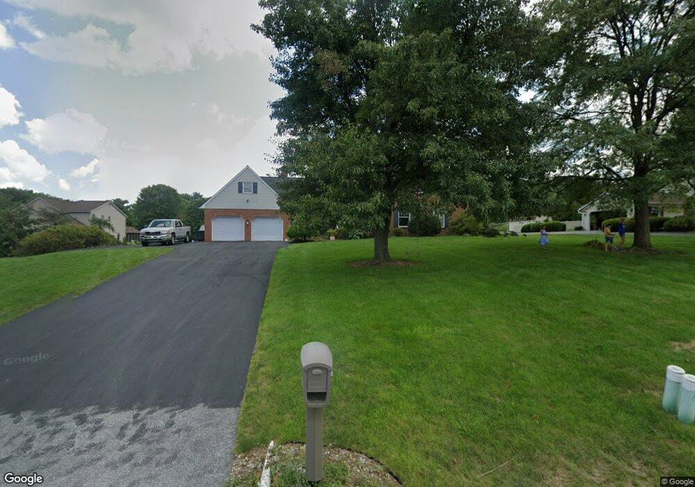
2426 Stumptown Rd Bird In Hand, PA 17505
Estimated Value: $652,000 - $830,000
4
Beds
3
Baths
2,550
Sq Ft
$276/Sq Ft
Est. Value
About This Home
This home is located at 2426 Stumptown Rd, Bird In Hand, PA 17505 and is currently estimated at $703,929, approximately $276 per square foot. 2426 Stumptown Rd is a home located in Lancaster County with nearby schools including Smoketown Elementary School, Gerald G. Huesken Middle School, and Conestoga Valley High School.
Ownership History
Date
Name
Owned For
Owner Type
Purchase Details
Closed on
Jul 16, 2018
Sold by
Miller Leonard C and Miller Audrey H
Bought by
Stoltzfoos Keith L and Stoltzfoos Chelsey L
Current Estimated Value
Home Financials for this Owner
Home Financials are based on the most recent Mortgage that was taken out on this home.
Original Mortgage
$331,200
Outstanding Balance
$287,034
Interest Rate
4.5%
Mortgage Type
New Conventional
Estimated Equity
$416,895
Create a Home Valuation Report for This Property
The Home Valuation Report is an in-depth analysis detailing your home's value as well as a comparison with similar homes in the area
Home Values in the Area
Average Home Value in this Area
Purchase History
| Date | Buyer | Sale Price | Title Company |
|---|---|---|---|
| Stoltzfoos Keith L | $414,000 | None Available |
Source: Public Records
Mortgage History
| Date | Status | Borrower | Loan Amount |
|---|---|---|---|
| Open | Stoltzfoos Keith L | $331,200 |
Source: Public Records
Tax History Compared to Growth
Tax History
| Year | Tax Paid | Tax Assessment Tax Assessment Total Assessment is a certain percentage of the fair market value that is determined by local assessors to be the total taxable value of land and additions on the property. | Land | Improvement |
|---|---|---|---|---|
| 2025 | $6,643 | $328,100 | $87,500 | $240,600 |
| 2024 | $6,643 | $328,100 | $87,500 | $240,600 |
| 2023 | $6,489 | $328,100 | $87,500 | $240,600 |
| 2022 | $6,327 | $328,100 | $87,500 | $240,600 |
| 2021 | $6,104 | $328,100 | $87,500 | $240,600 |
| 2020 | $6,104 | $328,100 | $87,500 | $240,600 |
| 2019 | $5,973 | $328,100 | $87,500 | $240,600 |
| 2018 | $8,597 | $328,100 | $87,500 | $240,600 |
| 2017 | $4,847 | $223,900 | $66,100 | $157,800 |
| 2016 | $4,789 | $223,900 | $66,100 | $157,800 |
| 2015 | $1,224 | $223,900 | $66,100 | $157,800 |
| 2014 | $3,225 | $223,900 | $66,100 | $157,800 |
Source: Public Records
Map
Nearby Homes
- 425 Mill Creek Rd
- 103 Fairhill Dr
- 2498 Old Philadelphia Park
- 2596 Old Philadelphia Pike
- 339 Enterprise Dr
- 323 Enterprise Dr
- 70 Hellers Church Rd
- 2453 Lincoln Hwy E
- 7 Pleasant Dr
- 71 Apricot Ave
- 466 Eastwood Ln
- 259 Raspberry Rd
- 403 Eastwood Ln
- 68 Horseshoe Rd
- 33 Black Oak Dr
- 1999 Old Philadelphia Pike
- 117 Summers Dr
- 37 Black Oak Dr
- 71 Black Oak Dr Unit 71
- 347 Greenland Dr
- 2422 Stumptown Rd
- 2428 Stumptown Rd
- 2418 Stumptown Rd
- 2353 Stumptown Rd
- 2430 Stumptown Rd
- 2414 Stumptown Rd
- 2410 Stumptown Rd
- 2411 Stumptown Rd
- 2434 Stumptown Rd
- 2406 Stumptown Rd
- 2401 Stumptown Rd
- 2402 Stumptown Rd
- 2395 Stumptown Rd
- 2400 Stumptown Rd
- 2398 Stumptown Rd
- 2391 Stumptown Rd
- 2387 Stumptown Rd
- 2383 Stumptown Rd
- 2388 Stumptown Rd
- 2379 Stumptown Rd