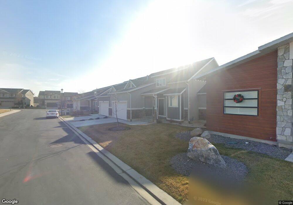
2427 N Sunset View Unit 355 Lehi, UT 84043
Thanksgiving NeighborhoodEstimated Value: $461,000 - $538,000
1
Bed
2
Baths
1,563
Sq Ft
$321/Sq Ft
Est. Value
About This Home
This home is located at 2427 N Sunset View Unit 355, Lehi, UT 84043 and is currently estimated at $502,115, approximately $321 per square foot. 2427 N Sunset View Unit 355 is a home located in Utah County with nearby schools including Liberty Hills Elementary School, Skyridge High School, and Ascent Academies of Utah - Lehi Campus.
Ownership History
Date
Name
Owned For
Owner Type
Purchase Details
Closed on
Mar 27, 2015
Sold by
Lantana Llc
Bought by
Sunset On The 12Th Inc and Lantana Llc
Current Estimated Value
Home Financials for this Owner
Home Financials are based on the most recent Mortgage that was taken out on this home.
Original Mortgage
$316,812
Outstanding Balance
$244,065
Interest Rate
3.76%
Mortgage Type
Credit Line Revolving
Estimated Equity
$258,050
Purchase Details
Closed on
Dec 16, 2011
Sold by
First Utah Bank
Bought by
First Utah Bank
Purchase Details
Closed on
Nov 21, 2008
Sold by
Castlewood Thanksgiving Point Llc
Bought by
First Utah Bank
Create a Home Valuation Report for This Property
The Home Valuation Report is an in-depth analysis detailing your home's value as well as a comparison with similar homes in the area
Home Values in the Area
Average Home Value in this Area
Purchase History
| Date | Buyer | Sale Price | Title Company |
|---|---|---|---|
| Sunset On The 12Th Inc | -- | Utah First Title Ins Ag | |
| First Utah Bank | -- | First American Ncs South Te | |
| First Utah Bank | -- | First American Ncs South |
Source: Public Records
Mortgage History
| Date | Status | Borrower | Loan Amount |
|---|---|---|---|
| Open | Sunset On The 12Th Inc | $316,812 |
Source: Public Records
Tax History Compared to Growth
Tax History
| Year | Tax Paid | Tax Assessment Tax Assessment Total Assessment is a certain percentage of the fair market value that is determined by local assessors to be the total taxable value of land and additions on the property. | Land | Improvement |
|---|---|---|---|---|
| 2025 | $2,368 | $275,165 | $73,500 | $426,800 |
| 2024 | $2,368 | $277,145 | $0 | $0 |
| 2023 | $2,198 | $279,345 | $0 | $0 |
| 2022 | $1,905 | $234,630 | $0 | $0 |
| 2021 | $1,790 | $333,300 | $127,600 | $205,700 |
| 2020 | $1,758 | $323,600 | $127,600 | $196,000 |
| 2019 | $1,212 | $127,600 | $127,600 | $0 |
| 2018 | $1,251 | $124,500 | $124,500 | $0 |
| 2017 | $1,014 | $97,500 | $0 | $0 |
| 2016 | $891 | $79,500 | $0 | $0 |
| 2015 | $885 | $75,000 | $0 | $0 |
| 2014 | $564 | $47,500 | $0 | $0 |
Source: Public Records
Map
Nearby Homes
- 2464 W 2400 N
- 2189 N 2600 W
- 2998 Crooked Stick Dr
- 2673 N Double Eagle Dr
- 2669 N Turnberry Ct
- 2433 N 3130 W
- 3185 W 2400 N
- 3199 W 2450 N
- 2886 Desert Forest Ln
- 3217 W 2450 N
- 2013 N 2040 W
- 2012 N 2040 W
- 1969 N 2040 St W
- 1968 N 2040 W
- 1990 N 2040 W
- 2424 N Lazy j Ln
- Huntington Plan at Pioneer Meadows
- Silver Lake Plan at Pioneer Meadows
- Summit Plan at Pioneer Meadows
- Palisade Plan at Pioneer Meadows
- 2439 N Sunset View Unit 356
- 2439 N Sunset View
- 2413 N Sunset View Unit 354
- 2401 N Sunset View Unit 353
- 2453 N Sunset View Unit 357
- 2453 N Sunset View Unit 356
- 2453 N Sunset View
- 2761 W Maple Dr
- 2465 N Sunset View Unit 358
- 2465 N Sunset View
- 2759 W Maple Dr
- 2474 N Sunset View
- 2742 W Cottonwood Dr
- 2476 N Sunset View
- 2478 N Sunset View
- 2733 W Maple Dr
- 2738 W Cottonwood Dr
- 2479 N Sunset View Unit 359
- 2479 N Sunset View
- 2769 W Cottonwood Dr