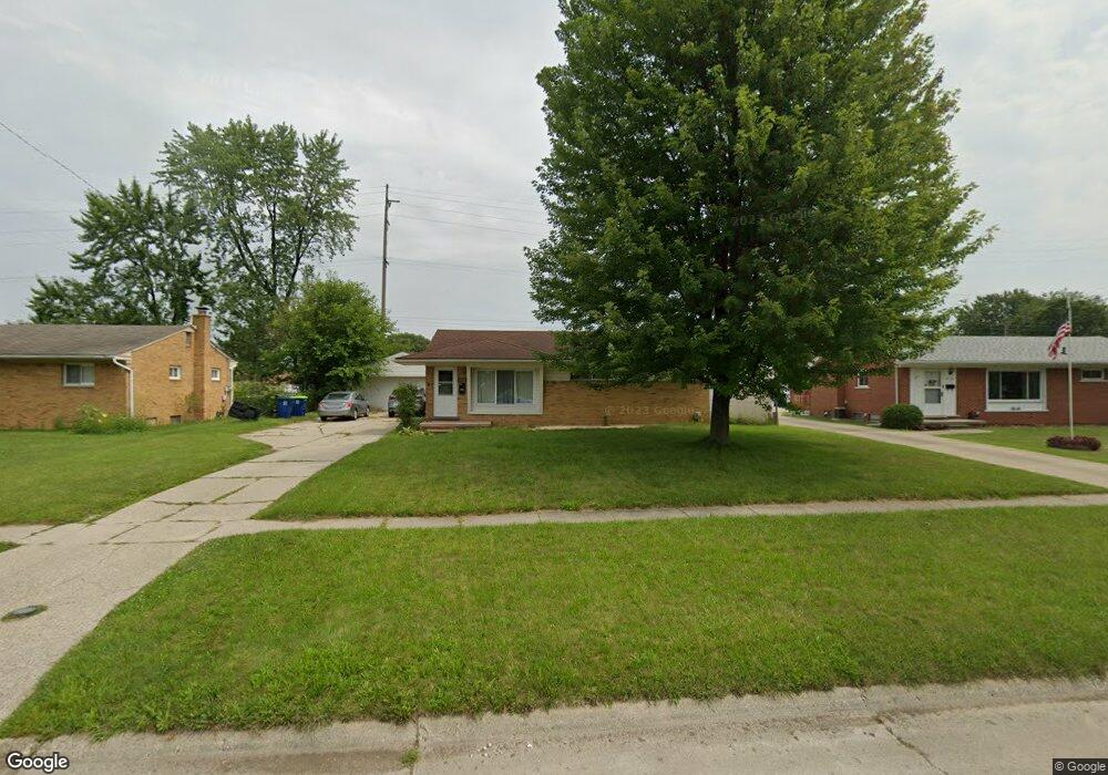
2428 Anderson Rd Saginaw, MI 48603
Estimated Value: $171,111 - $194,000
3
Beds
2
Baths
1,246
Sq Ft
$144/Sq Ft
Est. Value
About This Home
This home is located at 2428 Anderson Rd, Saginaw, MI 48603 and is currently estimated at $180,028, approximately $144 per square foot. 2428 Anderson Rd is a home located in Saginaw County with nearby schools including Weiss Elementary School, Sherwood Elementary School, and White Pine Middle School.
Ownership History
Date
Name
Owned For
Owner Type
Purchase Details
Closed on
Oct 3, 2008
Sold by
Mahony M J
Bought by
Us Bank National Association
Current Estimated Value
Purchase Details
Closed on
Oct 29, 2003
Sold by
Anger A M and P M
Bought by
Mahony M J
Home Financials for this Owner
Home Financials are based on the most recent Mortgage that was taken out on this home.
Original Mortgage
$104,000
Interest Rate
5.88%
Mortgage Type
Purchase Money Mortgage
Create a Home Valuation Report for This Property
The Home Valuation Report is an in-depth analysis detailing your home's value as well as a comparison with similar homes in the area
Home Values in the Area
Average Home Value in this Area
Purchase History
| Date | Buyer | Sale Price | Title Company |
|---|---|---|---|
| Us Bank National Association | $55,800 | -- | |
| Mahony M J | $104,000 | -- | |
| Mahony Michael J | $104,000 | Ltic |
Source: Public Records
Mortgage History
| Date | Status | Borrower | Loan Amount |
|---|---|---|---|
| Previous Owner | Mahony Michael J | $104,000 |
Source: Public Records
Tax History Compared to Growth
Tax History
| Year | Tax Paid | Tax Assessment Tax Assessment Total Assessment is a certain percentage of the fair market value that is determined by local assessors to be the total taxable value of land and additions on the property. | Land | Improvement |
|---|---|---|---|---|
| 2025 | $1,991 | $75,000 | $0 | $0 |
| 2024 | $992 | $64,500 | $0 | $0 |
| 2023 | $944 | $58,800 | $0 | $0 |
| 2022 | $1,728 | $50,100 | $0 | $0 |
| 2021 | $1,595 | $46,400 | $0 | $0 |
| 2020 | $1,555 | $44,800 | $0 | $0 |
| 2019 | $1,487 | $41,400 | $4,900 | $36,500 |
| 2018 | $700 | $40,300 | $0 | $0 |
| 2017 | $1,321 | $39,200 | $0 | $0 |
| 2016 | $1,305 | $38,200 | $0 | $0 |
| 2014 | $1,252 | $40,000 | $0 | $33,700 |
| 2013 | -- | $41,100 | $0 | $0 |
Source: Public Records
Map
Nearby Homes
- 2611 Bradford Dr
- 2090 -2092 Anderson
- 4415 Bradford Dr
- 2400 Linda St
- 19 Cobblestone Place Unit 19
- 4396 Bradford Dr
- 5287 Weiss St
- 2201 Augsburg Dr
- 2105 Marlou Ct
- 2588 E Greendale Dr
- 2688 Linda St
- 1908 W Packard Dr
- 5105 Cardington Dr
- 4810 Nimitz St
- 2606 Duane Dr
- 1807 Hemmeter Rd
- 4168 Vera St
- 1735 Hemmeter Rd
- 2671 Haenlein Dr
- 3716 Weiss St
- 2442 Anderson Rd
- 2414 Anderson Rd
- 2400 Anderson Rd
- 2456 Anderson Rd
- 2425 Anderson Rd
- 2411 Anderson Rd
- 2470 Anderson Rd
- 4794 Buckthorne Dr
- 2386 Anderson Rd
- 2397 Anderson Rd
- 2482 Anderson Rd
- 2370 Anderson Rd
- 2381 Anderson Rd
- 4795 Weiss St
- 4824 Buckthorne Dr
- 2356 Anderson Rd
- 2410 Bock Rd
- 4811 Weiss St
- 2396 Bock Rd
- 4838 Buckthorne Dr