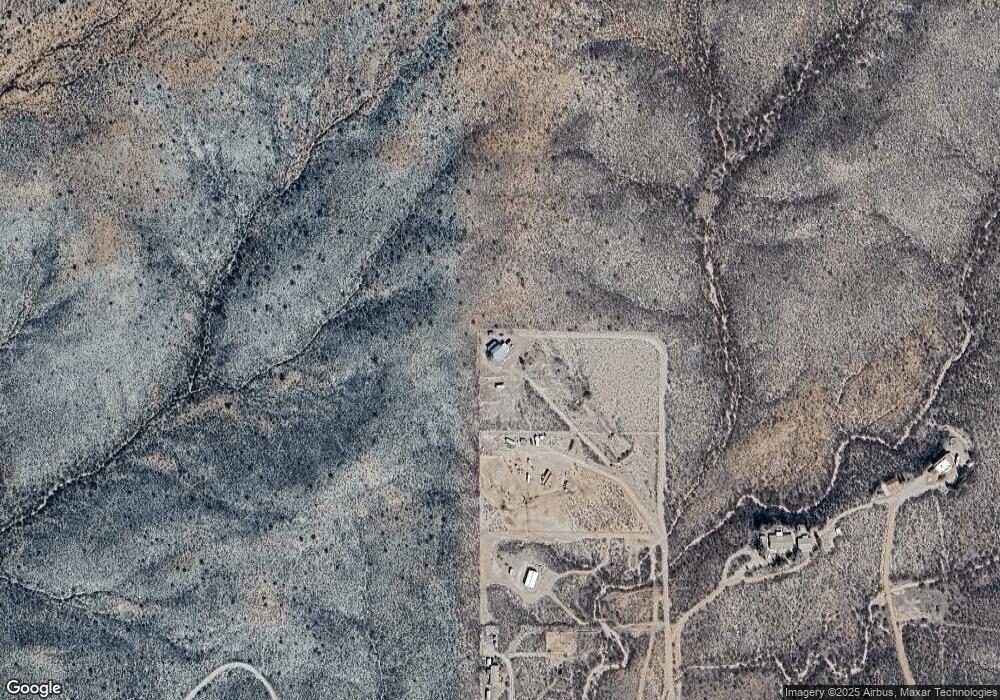
2428 E Colt Rd Tombstone, AZ 85638
Estimated Value: $287,574 - $371,000
Studio
--
Bath
1,793
Sq Ft
$189/Sq Ft
Est. Value
About This Home
This home is located at 2428 E Colt Rd, Tombstone, AZ 85638 and is currently estimated at $339,144, approximately $189 per square foot. 2428 E Colt Rd is a home located in Cochise County with nearby schools including Tombstone High School.
Ownership History
Date
Name
Owned For
Owner Type
Purchase Details
Closed on
Feb 13, 2023
Sold by
Cardoza Shawnna
Bought by
Cardoza Shawnna
Current Estimated Value
Purchase Details
Closed on
Nov 27, 2019
Sold by
Carol E Cowan Living Trust and Cowan Carol E
Bought by
Baldwin Daniel A and Baldwin Shawnna P
Home Financials for this Owner
Home Financials are based on the most recent Mortgage that was taken out on this home.
Original Mortgage
$209,000
Interest Rate
3.6%
Mortgage Type
New Conventional
Purchase Details
Closed on
Sep 24, 2014
Sold by
Cowan Carol E
Bought by
Cowan Carol E
Home Financials for this Owner
Home Financials are based on the most recent Mortgage that was taken out on this home.
Original Mortgage
$121,947
Interest Rate
4.09%
Mortgage Type
FHA
Purchase Details
Closed on
Oct 2, 2012
Sold by
Cowan Carol E
Bought by
Cowan Carol E
Purchase Details
Closed on
Jul 25, 2008
Sold by
Whitman Catherine A
Bought by
Cowan Carol E
Create a Home Valuation Report for This Property
The Home Valuation Report is an in-depth analysis detailing your home's value as well as a comparison with similar homes in the area
Purchase History
| Date | Buyer | Sale Price | Title Company |
|---|---|---|---|
| Cardoza Shawnna | -- | -- | |
| Baldwin Daniel A | -- | Pioneer Title | |
| Cowan Carol E | -- | Pioneer Title Agency | |
| Cowan Carol E | -- | None Available | |
| Cowan Carol E | -- | None Available | |
| Cowan Carol E | $230,000 | Pioneer Title Agency |
Source: Public Records
Mortgage History
| Date | Status | Borrower | Loan Amount |
|---|---|---|---|
| Previous Owner | Baldwin Daniel A | $209,000 | |
| Previous Owner | Cowan Carol E | $121,947 |
Source: Public Records
Tax History
| Year | Tax Paid | Tax Assessment Tax Assessment Total Assessment is a certain percentage of the fair market value that is determined by local assessors to be the total taxable value of land and additions on the property. | Land | Improvement |
|---|---|---|---|---|
| 2025 | $1,375 | $22,703 | $3,178 | $19,525 |
| 2024 | $1,375 | $22,541 | $3,178 | $19,363 |
| 2023 | $1,288 | $19,465 | $3,178 | $16,287 |
| 2022 | $1,262 | $18,537 | $3,178 | $15,359 |
| 2021 | $1,324 | $18,266 | $3,178 | $15,088 |
| 2020 | $833 | $0 | $0 | $0 |
| 2019 | $1,194 | $0 | $0 | $0 |
| 2018 | $1,222 | $0 | $0 | $0 |
| 2017 | $1,169 | $0 | $0 | $0 |
| 2016 | $1,149 | $0 | $0 | $0 |
| 2015 | -- | $0 | $0 | $0 |
Source: Public Records
Map
Nearby Homes
- 87 E Desert Meadow Rd
- 2535 E Roadrunner Ridge
- 1484 N Cochise Ct
- TBD E Rainbow Rd Unit 23
- 1287 N Camino San Rafael
- 1346 N Cortez Place
- 1498 N Saddleback Cir
- 977 N Saddleback Cir
- 1387 N Saddleback Cir
- 1383 N Saddleback Cir
- 2383 N Middlemarch Rd Unit 1
- 0 Lot 112 Kino Place Unit 112
- 117 N Pima Place
- Lot 81 Apache Dr
- Lot 81 Apache Dr Unit 81
- 0 N Navajo Place Unit 26 6814733
- 00 N North Dr Unit 27
- 0 N Navaho Place Unit 26 22503323
- 127 N Gila Dr
- 0 North Dr Unit 27 22503324
- 2424 E Colt Rd
- 2440 E Colt Rd
- 2421 E Colt Rd
- 2470 E Colt Rd
- 1745 N Curly Bill Dr
- TBD N Curly Bill Dr
- 2496 E Colt Rd
- 1621 N Marshall White Rd
- 1707 N Curly Bill Dr
- 1616 N Bent Barrell Trail
- 1604 N Schieffelin Dr
- TBD 2 3 Acres E Buckskin Frank Rd Unit Lot 6
- 2431 E Buckskin Frank Rd
- 1738 N Curly Bill Dr
- 1688 N Curly Bill Dr
- 1603 N Bent Barrell Trail
- 1595 N Bent Barrell Trail
- 2530 E Colt Rd
- 1589 N Bent Barrell Trail
- 1577 N Bent Barrell Trail
