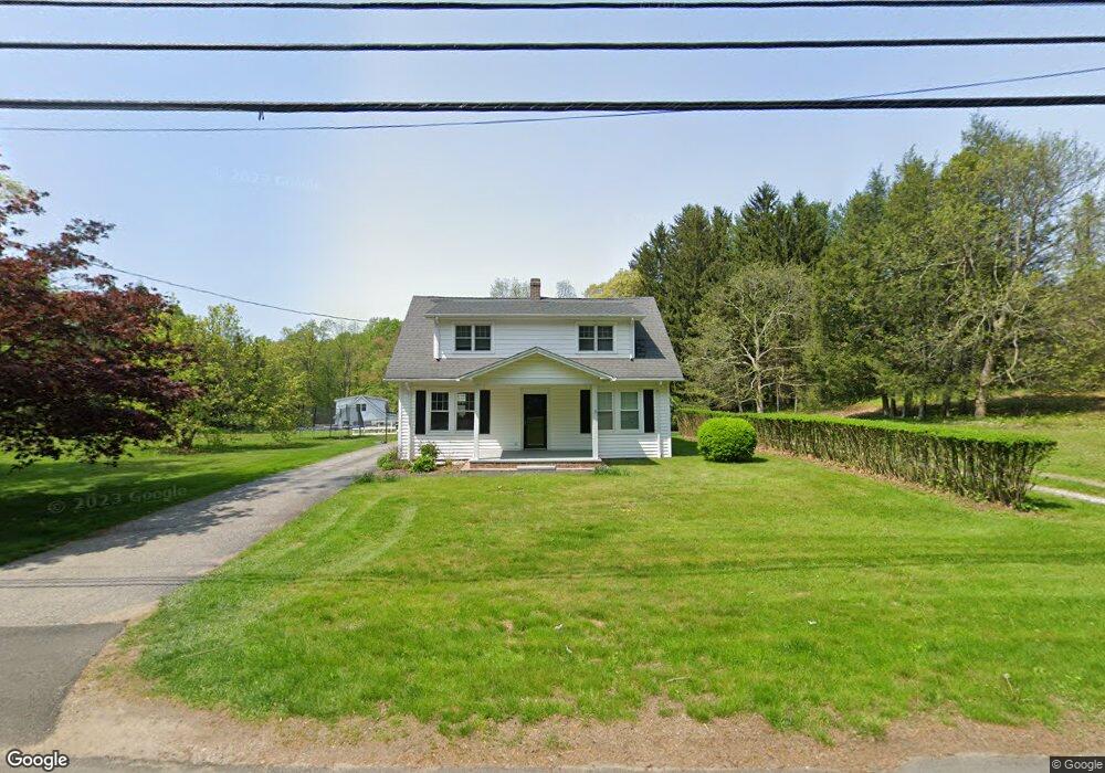
243 Adams Rd Easton, CT 06612
Estimated Value: $639,000 - $774,640
2
Beds
3
Baths
2,079
Sq Ft
$347/Sq Ft
Est. Value
About This Home
This home is located at 243 Adams Rd, Easton, CT 06612 and is currently estimated at $722,160, approximately $347 per square foot. 243 Adams Rd is a home located in Fairfield County with nearby schools including Samuel Staples Elementary School, Helen Keller Middle School, and Joel Barlow High School.
Ownership History
Date
Name
Owned For
Owner Type
Purchase Details
Closed on
Dec 1, 2004
Sold by
Donahue Alphonsos J and Donahue Dana A
Bought by
Palumbo Ryan B
Current Estimated Value
Purchase Details
Closed on
Apr 1, 2002
Sold by
Kerigan James W
Bought by
Donahue Alphonsos J and Donahue Dana H
Purchase Details
Closed on
Sep 25, 1998
Sold by
Beno George A and Jedow Maryann B
Bought by
Kerigan James W
Create a Home Valuation Report for This Property
The Home Valuation Report is an in-depth analysis detailing your home's value as well as a comparison with similar homes in the area
Home Values in the Area
Average Home Value in this Area
Purchase History
| Date | Buyer | Sale Price | Title Company |
|---|---|---|---|
| Palumbo Ryan B | $500,000 | -- | |
| Palumbo Ryan B | $500,000 | -- | |
| Donahue Alphonsos J | $382,500 | -- | |
| Donahue Alphonsos J | $382,500 | -- | |
| Kerigan James W | $269,000 | -- | |
| Kerigan James W | $269,000 | -- |
Source: Public Records
Mortgage History
| Date | Status | Borrower | Loan Amount |
|---|---|---|---|
| Open | Kerigan James W | $383,551 | |
| Closed | Kerigan James W | $400,000 |
Source: Public Records
Tax History Compared to Growth
Tax History
| Year | Tax Paid | Tax Assessment Tax Assessment Total Assessment is a certain percentage of the fair market value that is determined by local assessors to be the total taxable value of land and additions on the property. | Land | Improvement |
|---|---|---|---|---|
| 2025 | $11,147 | $359,590 | $150,500 | $209,090 |
| 2024 | $10,622 | $359,590 | $150,500 | $209,090 |
| 2023 | $9,970 | $344,260 | $150,500 | $193,760 |
| 2022 | $9,791 | $344,260 | $150,500 | $193,760 |
| 2021 | $11,072 | $342,250 | $196,000 | $146,250 |
| 2020 | $10,362 | $334,260 | $196,000 | $138,260 |
| 2019 | $10,003 | $319,290 | $196,000 | $123,290 |
| 2018 | $10,019 | $319,290 | $196,000 | $123,290 |
| 2017 | $10,529 | $315,430 | $196,010 | $119,420 |
| 2016 | $9,994 | $324,360 | $216,130 | $108,230 |
| 2015 | $9,854 | $324,360 | $216,130 | $108,230 |
| 2014 | $9,698 | $324,360 | $216,130 | $108,230 |
Source: Public Records
Map
Nearby Homes
- 218 Adams Rd
- 103 Deepwood Rd
- 108 Northwood Dr
- 85 Westport Rd
- 63 Flat Rock Dr
- 60 Normandy Rd
- 42 Captains Walk
- 132 Merrimac Dr
- 138 Merrimac Dr
- 305 Sport Hill Rd
- 4874 Madison Ave
- 897 Sport Hill Rd
- 43 Hall Rd
- 67 Limerick Rd
- 48 Sunset Rd
- 73 Buck Hill Rd
- 83 Buck Hill Rd
- 62 Gatehouse Rd
- 125 Buck Hill Rd
- 35 Sturbridge Rd