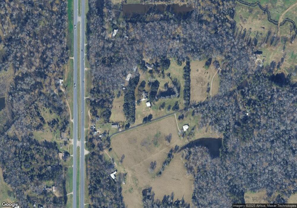
243 Antique Ln Lufkin, TX 75901
Estimated Value: $111,000 - $262,000
2
Beds
2
Baths
1,242
Sq Ft
$137/Sq Ft
Est. Value
About This Home
This home is located at 243 Antique Ln, Lufkin, TX 75901 and is currently estimated at $170,258, approximately $137 per square foot. 243 Antique Ln is a home located in Angelina County with nearby schools including Garrett Primary School, Dunbar Primary School, and Brandon Elementary School.
Ownership History
Date
Name
Owned For
Owner Type
Purchase Details
Closed on
Jun 5, 2013
Sold by
Moors Debbie Kay and Carroll Bernice
Bought by
Kerr Joe and Kerr Adrianne
Current Estimated Value
Purchase Details
Closed on
Oct 3, 2008
Sold by
Carroll Donald J and Carroll Bernice
Bought by
Moors Ronald
Home Financials for this Owner
Home Financials are based on the most recent Mortgage that was taken out on this home.
Original Mortgage
$46,400
Interest Rate
6.52%
Mortgage Type
New Conventional
Create a Home Valuation Report for This Property
The Home Valuation Report is an in-depth analysis detailing your home's value as well as a comparison with similar homes in the area
Home Values in the Area
Average Home Value in this Area
Purchase History
| Date | Buyer | Sale Price | Title Company |
|---|---|---|---|
| Kerr Joe | -- | None Available | |
| Moors Ronald | $46,400 | None Available |
Source: Public Records
Mortgage History
| Date | Status | Borrower | Loan Amount |
|---|---|---|---|
| Previous Owner | Moors Ronald | $46,400 |
Source: Public Records
Tax History Compared to Growth
Tax History
| Year | Tax Paid | Tax Assessment Tax Assessment Total Assessment is a certain percentage of the fair market value that is determined by local assessors to be the total taxable value of land and additions on the property. | Land | Improvement |
|---|---|---|---|---|
| 2025 | $1,425 | $90,070 | $5,600 | $84,470 |
| 2024 | $1,419 | $89,720 | $5,600 | $84,120 |
| 2023 | $1,357 | $89,960 | $5,600 | $84,360 |
| 2022 | $1,535 | $87,610 | $5,600 | $82,010 |
| 2021 | $1,538 | $81,010 | $5,600 | $75,410 |
| 2020 | $1,394 | $72,380 | $5,950 | $66,430 |
| 2019 | $1,541 | $74,510 | $5,950 | $68,560 |
| 2018 | $1,021 | $73,470 | $5,950 | $67,520 |
| 2017 | $1,021 | $71,480 | $5,950 | $65,530 |
| 2016 | $1,298 | $70,020 | $5,950 | $64,070 |
| 2015 | $1,170 | $70,020 | $5,950 | $64,070 |
| 2014 | $1,170 | $72,080 | $5,950 | $66,130 |
Source: Public Records
Map
Nearby Homes
- PID 10212 Fm 843 E
- 6446 Farm To Market 2251
- 6406 Farm To Market 2251
- 5421 Fm 2251
- 389 Byrd Dr
- 380 Byrd Dr
- 379 Byrd Dr
- 369 Byrd Dr
- 548 Saint Clair St
- 1059 Allentown Loop
- 356 Rainwood Dr
- LOT 188 Saint Clair St
- LOT 56 Saint Clair St
- LOT 184 Saint Clair St
- 402 Saint Clair St
- 140 Byrd Dr
- 170 Byrd Dr
- 160 Byrd Dr
- 645 Hh Allen Rd
- 150 Byrd Dr
- 166 Antique Ln
- 260 Antique Ln
- 3663 Bates Rd
- 7832 Us Highway 59 N
- 7930 Us Highway 59 N
- 7730 Us Highway 59 N
- 7730 Us Highway 59 N
- 317 Bates Rd
- 179 Bates Rd
- 7723 Us Highway 59 N
- 351 Bates Rd
- 7679 Us Highway 59 N
- 166 Bates Rd
- 7643 Us Highway 59 N
- 360 Bates Rd
- 7552 Us Highway 59 N
- 7552 Us Highway 59 N
- 7552 Us Highway 59 N
- 9013 U S 59
- 7585 Us Highway 59 N
