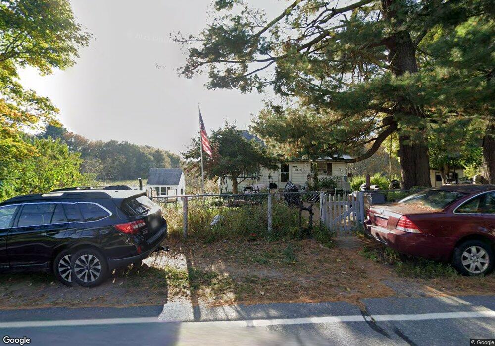
243 Berlin Rd Bolton, MA 01740
Estimated Value: $409,000 - $641,000
Studio
1
Bath
1,280
Sq Ft
$402/Sq Ft
Est. Value
About This Home
This home is located at 243 Berlin Rd, Bolton, MA 01740 and is currently estimated at $515,131, approximately $402 per square foot. 243 Berlin Rd is a home located in Worcester County with nearby schools including Florence Sawyer School and Nashoba Regional High School.
Ownership History
Date
Name
Owned For
Owner Type
Purchase Details
Closed on
Dec 13, 2013
Sold by
Brazeau Ronald A and Brazeau Dorothy A
Bought by
Brazeau Joseph
Current Estimated Value
Purchase Details
Closed on
Nov 20, 2012
Sold by
Brazeau Ronald A and Brazeau Thomas
Bought by
Brazeau Ronald A and Brazeau Dorothy A
Purchase Details
Closed on
Jun 29, 2004
Sold by
Brazeau Dorothy A and Brazeau Ronald A
Bought by
Brazeau Daniel and Brazeau James
Purchase Details
Closed on
Oct 28, 1963
Bought by
Brazeau Joseph and Brazeau Ronald A
Create a Home Valuation Report for This Property
The Home Valuation Report is an in-depth analysis detailing your home's value as well as a comparison with similar homes in the area
Home Values in the Area
Average Home Value in this Area
Purchase History
| Date | Buyer | Sale Price | Title Company |
|---|---|---|---|
| Brazeau Joseph | -- | -- | |
| Brazeau Joseph | -- | -- | |
| Brazeau Ronald A | -- | -- | |
| Brazeau Daniel | -- | -- | |
| Brazeau Joseph | -- | -- | |
| Brazeau Joseph | -- | -- |
Source: Public Records
Mortgage History
| Date | Status | Borrower | Loan Amount |
|---|---|---|---|
| Previous Owner | Brazeau Joseph | $21,934 | |
| Previous Owner | Brazeau Joseph | $27,000 |
Source: Public Records
Tax History
| Year | Tax Paid | Tax Assessment Tax Assessment Total Assessment is a certain percentage of the fair market value that is determined by local assessors to be the total taxable value of land and additions on the property. | Land | Improvement |
|---|---|---|---|---|
| 2025 | $6,691 | $402,600 | $202,200 | $200,400 |
| 2024 | $6,028 | $370,700 | $187,200 | $183,500 |
| 2023 | $6,468 | $369,600 | $187,200 | $182,400 |
| 2022 | $6,297 | $316,900 | $177,200 | $139,700 |
| 2021 | $6,298 | $301,900 | $177,200 | $124,700 |
| 2020 | $5,989 | $293,700 | $177,200 | $116,500 |
| 2019 | $5,834 | $285,000 | $172,200 | $112,800 |
| 2018 | $5,679 | $274,900 | $167,200 | $107,700 |
| 2017 | $5,535 | $261,100 | $162,200 | $98,900 |
| 2016 | $5,414 | $258,900 | $152,200 | $106,700 |
| 2015 | $5,090 | $242,600 | $142,200 | $100,400 |
| 2014 | $5,306 | $250,300 | $157,200 | $93,100 |
Source: Public Records
Map
Nearby Homes
- 0 Wattaquadock Hill Rd
- 54 Main St
- 12 Sanders Ln
- 15 Mallard Ln Unit 7
- 1A Sanders Ln
- 104 Randall Rd
- 118 Randall Rd
- 339 Old Central St
- 315 Central St
- 146 Randall Rd
- 114 Oak Trail
- 47 Sugar Rd
- 11 Pondside Ln Unit 11
- 167 Lancaster Rd
- 3 Gerry Dr Unit 15
- 6 Mcnulty Rd
- 3 Highland Park Ave
- 18 Sargent Rd
- 136 Central St Unit C6
- 144 Nourse Rd
Your Personal Tour Guide
Ask me questions while you tour the home.