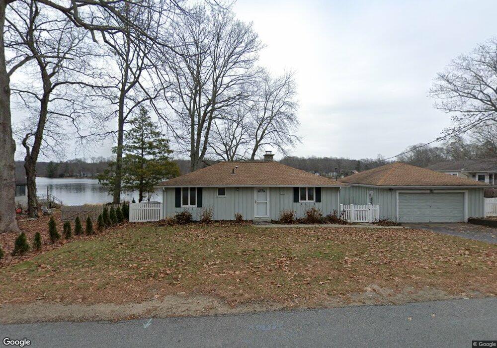
243 Deepwood Dr Amston, CT 06231
Estimated Value: $388,000 - $581,000
3
Beds
1
Bath
1,239
Sq Ft
$385/Sq Ft
Est. Value
About This Home
This home is located at 243 Deepwood Dr, Amston, CT 06231 and is currently estimated at $477,634, approximately $385 per square foot. 243 Deepwood Dr is a home located in Tolland County with nearby schools including Gilead Hill School, Hebron Elementary School, and RHAM Middle School.
Ownership History
Date
Name
Owned For
Owner Type
Purchase Details
Closed on
May 15, 2013
Sold by
Snell Wendell D and Snell Virginia A
Bought by
Greco Christopher and Greco Callie
Current Estimated Value
Home Financials for this Owner
Home Financials are based on the most recent Mortgage that was taken out on this home.
Original Mortgage
$235,200
Outstanding Balance
$167,337
Interest Rate
3.57%
Estimated Equity
$310,297
Purchase Details
Closed on
Sep 20, 1993
Sold by
Bussey James
Bought by
Snell Wendell and Snell Virginia
Home Financials for this Owner
Home Financials are based on the most recent Mortgage that was taken out on this home.
Original Mortgage
$125,600
Interest Rate
7.16%
Mortgage Type
Unknown
Create a Home Valuation Report for This Property
The Home Valuation Report is an in-depth analysis detailing your home's value as well as a comparison with similar homes in the area
Home Values in the Area
Average Home Value in this Area
Purchase History
| Date | Buyer | Sale Price | Title Company |
|---|---|---|---|
| Greco Christopher | $294,000 | -- | |
| Snell Wendell | $157,000 | -- |
Source: Public Records
Mortgage History
| Date | Status | Borrower | Loan Amount |
|---|---|---|---|
| Open | Snell Wendell | $235,200 | |
| Previous Owner | Snell Wendell | $164,000 | |
| Previous Owner | Snell Wendell | $125,600 |
Source: Public Records
Tax History Compared to Growth
Tax History
| Year | Tax Paid | Tax Assessment Tax Assessment Total Assessment is a certain percentage of the fair market value that is determined by local assessors to be the total taxable value of land and additions on the property. | Land | Improvement |
|---|---|---|---|---|
| 2025 | $9,090 | $246,680 | $136,710 | $109,970 |
| 2024 | $8,510 | $246,680 | $136,710 | $109,970 |
| 2023 | $8,187 | $246,680 | $136,710 | $109,970 |
| 2022 | $7,820 | $246,680 | $136,710 | $109,970 |
| 2021 | $6,456 | $177,710 | $90,300 | $87,410 |
| 2020 | $6,456 | $177,710 | $90,300 | $87,410 |
| 2019 | $6,584 | $177,710 | $90,300 | $87,410 |
| 2018 | $6,653 | $177,710 | $90,300 | $87,410 |
| 2017 | $6,575 | $177,710 | $90,300 | $87,410 |
| 2016 | $6,095 | $171,010 | $111,440 | $59,570 |
| 2015 | $6,156 | $171,010 | $111,440 | $59,570 |
| 2014 | $6,114 | $171,010 | $111,440 | $59,570 |
Source: Public Records
Map
Nearby Homes
- 282 Deepwood Dr
- 185 Deepwood Dr
- 24 Wood Acres Rd
- 0 Park Rd Unit 24130670
- 2 Lots on Deepwood Dr
- 30 Island Beach Rd
- 76 Park Rd
- 25 Woodland Dr
- 18 Spring Hill Rd
- 37 Andrews St
- 0 Wildwood Dr
- 0 Deepwood Dr
- 34 Spafford Dr
- 0 Kellys Corner
- 101 Levita Rd
- 6 Deepwood Dr
- 30 Pepperbush Dr
- 283 Windham Ave
- 161 Lake Williams Dr
- 221 Lake Williams Dr
- 247 Deepwood Dr
- 239 Deepwood Dr
- 249 Deepwood Dr
- 242 Deepwood Dr
- 246 Deepwood Dr
- 252 Deepwood Dr
- 233 Deepwood Dr
- 251 Deepwood Dr
- 250 Deepwood Dr
- 253 Deepwood Dr
- 231 Deepwood Dr
- 234 Deepwood Dr
- 255 Deepwood Dr
- 232 Deepwood Dr
- 254 Deepwood Dr
- 227 Deepwood Dr
- 228 Deepwood Dr
- 259 Deepwood Dr
- 258 Deepwood Dr
- 15 Meadow Brook Rd