Studio
--
Bath
3,750
Sq Ft
2,614
Sq Ft
About This Home
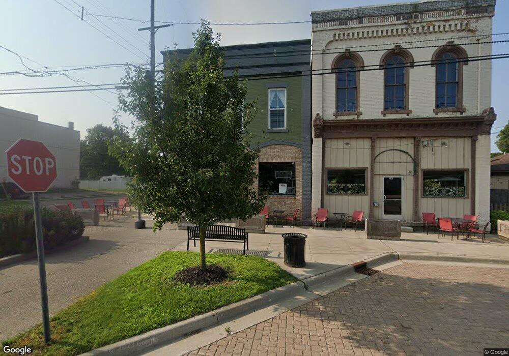
This home is located at 243 E Bridge St, Lyons, MI 48851. 243 E Bridge St is a home located in Ionia County with nearby schools including Ionia High School.
Ownership History
Date
Name
Owned For
Owner Type
Purchase Details
Closed on
Apr 29, 2013
Sold by
Firstbank
Bought by
Farrington Joseph
Purchase Details
Closed on
Sep 26, 2012
Sold by
Ralston Donald
Bought by
Firstbank & West Michigan
Purchase Details
Closed on
Jan 9, 2006
Sold by
Leland Dureen L and Needham Dureen L
Bought by
Ralston Donald
Purchase Details
Closed on
Aug 12, 2003
Sold by
Hoppes Brian E and Hoppes Derry D
Bought by
Needham Ralston Corp
Home Financials for this Owner
Home Financials are based on the most recent Mortgage that was taken out on this home.
Original Mortgage
$57,461
Interest Rate
5.69%
Mortgage Type
Commercial
Purchase Details
Closed on
Nov 16, 2001
Bought by
Farrington Joseph
Create a Home Valuation Report for This Property
The Home Valuation Report is an in-depth analysis detailing your home's value as well as a comparison with similar homes in the area
Purchase History
| Date | Buyer | Sale Price | Title Company |
|---|---|---|---|
| Farrington Joseph | $8,999 | Sun Title Agency Of Michigan | |
| Firstbank & West Michigan | -- | -- | |
| Ralston Donald | $100,000 | None Available | |
| Needham Ralston Corp | $56,105 | Metropolitan Title Company | |
| Farrington Joseph | $125,000 | -- |
Source: Public Records
Mortgage History
| Date | Status | Borrower | Loan Amount |
|---|---|---|---|
| Previous Owner | Needham Ralston Corp | $57,461 |
Source: Public Records
Tax History
| Year | Tax Paid | Tax Assessment Tax Assessment Total Assessment is a certain percentage of the fair market value that is determined by local assessors to be the total taxable value of land and additions on the property. | Land | Improvement |
|---|---|---|---|---|
| 2025 | $842 | $23,300 | $900 | $22,400 |
| 2024 | $4 | $23,300 | $900 | $22,400 |
| 2023 | $365 | $17,800 | $800 | $17,000 |
| 2022 | $348 | $17,800 | $800 | $17,000 |
| 2021 | $937 | $19,200 | $900 | $18,300 |
| 2020 | $338 | $19,200 | $900 | $18,300 |
| 2019 | $753 | $18,900 | $800 | $18,100 |
| 2018 | $898 | $35,500 | $900 | $34,600 |
| 2017 | $319 | $35,500 | $900 | $34,600 |
| 2016 | $753 | $33,600 | $1,800 | $31,800 |
| 2015 | -- | $33,600 | $1,800 | $31,800 |
| 2014 | -- | $35,600 | $7,200 | $28,400 |
Source: Public Records
Map
Nearby Homes
- 134 Prairie St
- 93 N Robinson St
- 1273 E Bridge St
- 1100 Hayes Rd
- 781 Hopkins Rd
- 1067 Somers Rd
- 1170 Somers Rd
- 214 Wilson Ln
- 8435 E Point Dr
- 10400 E Pewamo Rd Unit 19
- 2275 Kingston Farm Ln
- 735 Prairie Creek Rd
- 2239 Kingston Farm Ln
- Lot 17 Field Crest Point
- Lot 17 of Field Crescent
- 0 Parcel 2 Kingston Rd
- 0 Parcel 3 Kingston Rd
- 0 Parcel 1 Kingston Rd
- 0 Parcel 4 Kingston Rd
- 0 Parcel 7 Kingston Rd
- 104 N Prairie 1c
- 104 N Prairie St 2c
- 104 Prairie St
- 137 Prairie St
- 304 E Bridge St
- 319 E Bridge St
- 320 E Bridge St
- 153 Prairie St
- 152 John St
- 150 Prairie St
- 331 W Bridge St
- 345 E Bridge St
- 151 S King St
- 342 E Bridge St
- 205 Prairie St
- 125 N King St
- 121 E Bridge St
- 133 N King St
- 536 Isham St
- 204 Water St
Your Personal Tour Guide
Ask me questions while you tour the home.