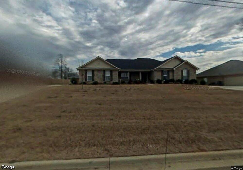
243 Grasslands Rd Huntsville, AL 35811
Estimated Value: $314,501 - $363,000
--
Bed
--
Bath
2,019
Sq Ft
$169/Sq Ft
Est. Value
About This Home
This home is located at 243 Grasslands Rd, Huntsville, AL 35811 and is currently estimated at $341,875, approximately $169 per square foot. 243 Grasslands Rd is a home with nearby schools including Central School and Madison County High School.
Ownership History
Date
Name
Owned For
Owner Type
Purchase Details
Closed on
Nov 25, 2024
Sold by
Moore Gregory L
Bought by
Gregory L Moore Revocable Living Trust and Moore
Current Estimated Value
Purchase Details
Closed on
Apr 29, 2005
Sold by
Newmark Homes Inc
Bought by
Moore Ruth B and Moore Gregory L
Home Financials for this Owner
Home Financials are based on the most recent Mortgage that was taken out on this home.
Original Mortgage
$147,584
Interest Rate
5.88%
Mortgage Type
FHA
Create a Home Valuation Report for This Property
The Home Valuation Report is an in-depth analysis detailing your home's value as well as a comparison with similar homes in the area
Home Values in the Area
Average Home Value in this Area
Purchase History
| Date | Buyer | Sale Price | Title Company |
|---|---|---|---|
| Gregory L Moore Revocable Living Trust | -- | None Listed On Document | |
| Gregory L Moore Revocable Living Trust | -- | None Listed On Document | |
| Moore Ruth B | -- | -- |
Source: Public Records
Mortgage History
| Date | Status | Borrower | Loan Amount |
|---|---|---|---|
| Previous Owner | Moore Ruth B | $147,584 |
Source: Public Records
Tax History Compared to Growth
Tax History
| Year | Tax Paid | Tax Assessment Tax Assessment Total Assessment is a certain percentage of the fair market value that is determined by local assessors to be the total taxable value of land and additions on the property. | Land | Improvement |
|---|---|---|---|---|
| 2024 | $842 | $28,600 | $6,000 | $22,600 |
| 2023 | $818 | $28,600 | $6,000 | $22,600 |
| 2022 | $721 | $25,180 | $4,260 | $20,920 |
| 2021 | $647 | $22,720 | $4,260 | $18,460 |
| 2020 | $542 | $19,150 | $3,500 | $15,650 |
| 2019 | $525 | $18,570 | $3,500 | $15,070 |
| 2018 | $503 | $17,860 | $0 | $0 |
| 2017 | $490 | $17,420 | $0 | $0 |
| 2016 | $490 | $17,420 | $0 | $0 |
| 2015 | $490 | $17,420 | $0 | $0 |
| 2014 | $486 | $17,280 | $0 | $0 |
Source: Public Records
Map
Nearby Homes
- 235 Grasslands Rd
- 221 Grasslands Rd
- 216 Grasslands Rd
- 1519 Ryland Pike
- 211 Powell St
- 3608 Maysville Rd NE
- 218 Powell St
- 0 Gilliam Rd
- 309 Gilliam Rd
- 102 Peyton Cir
- 107 Nolan Dr
- 172 Day Dr
- 483 Moontown Rd
- 111 Cool Cir
- 477 Moontown Rd
- 362 Moontown Rd
- 350 Moontown Rd
- 506 Moontown Rd
- 123 Delta Pine Dr
- 124 Jodie Dr
- 241 Grasslands Rd
- 245 Grasslands Rd
- 112 Cherry Glen
- 239 Grasslands Rd
- 110 Cherry Glen
- 246 Grasslands Rd
- 114 Cherry Glen Cir
- 114 Cherry Glen
- 108 Cherry Glen Cir
- 240 Grasslands Rd
- 108 Cherry Glen
- 237 Grasslands Rd
- 238 Grasslands Rd
- 106 Cherry Glen
- 115 Cherry Glen Cir
- 201 Webster Rd
- 115 Cherry Glen
- 113 Cherry Glen Cir
- 111 Cherry Glen Cir
- 113 Cherry Glen