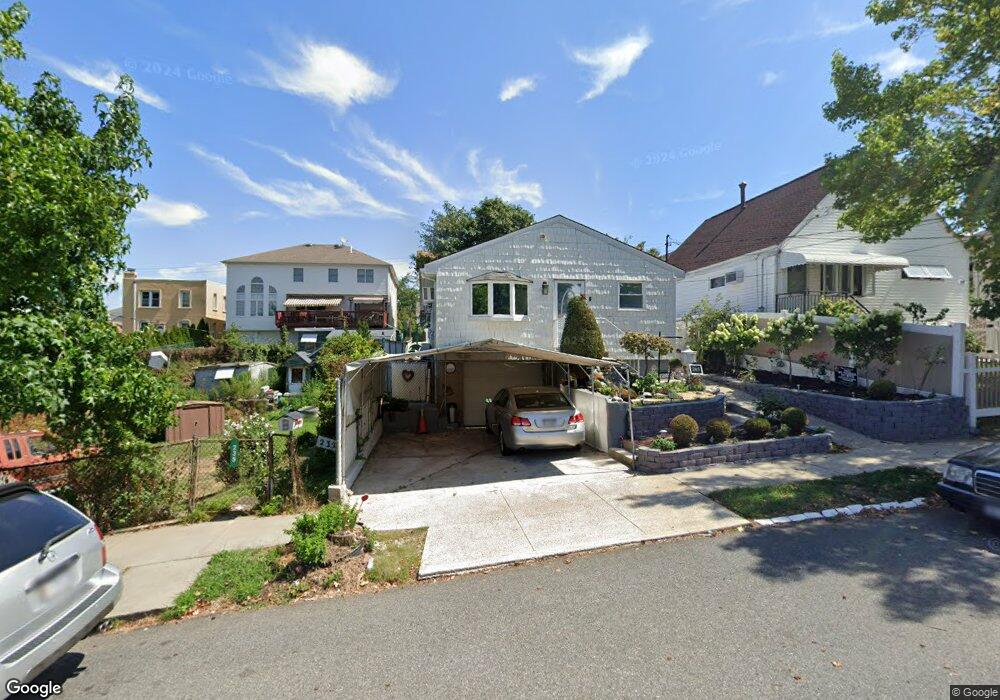
243 Graves St Staten Island, NY 10314
Manor Heights NeighborhoodEstimated Value: $571,000 - $729,000
3
Beds
1
Bath
960
Sq Ft
$682/Sq Ft
Est. Value
About This Home
This home is located at 243 Graves St, Staten Island, NY 10314 and is currently estimated at $655,038, approximately $682 per square foot. 243 Graves St is a home located in Richmond County with nearby schools including P.S. 54 Charles W Leng, Is 72 Rocco Laurie, and Susan E Wagner High School.
Ownership History
Date
Name
Owned For
Owner Type
Purchase Details
Closed on
Jun 23, 2009
Sold by
Delos Reyes Ramil and Delos Reyes Rodel
Bought by
Delos Reyes Ramil
Current Estimated Value
Home Financials for this Owner
Home Financials are based on the most recent Mortgage that was taken out on this home.
Original Mortgage
$26,837
Outstanding Balance
$17,488
Interest Rate
5.36%
Mortgage Type
New Conventional
Estimated Equity
$637,550
Purchase Details
Closed on
Nov 15, 1999
Sold by
Athans Debra
Bought by
Delosreyes Ramil and Delosreyes Rodel
Home Financials for this Owner
Home Financials are based on the most recent Mortgage that was taken out on this home.
Original Mortgage
$187,424
Interest Rate
8.23%
Mortgage Type
FHA
Purchase Details
Closed on
Jul 3, 1996
Sold by
Stagnitta Linda J and Athans Debra
Bought by
Athans Debra
Create a Home Valuation Report for This Property
The Home Valuation Report is an in-depth analysis detailing your home's value as well as a comparison with similar homes in the area
Home Values in the Area
Average Home Value in this Area
Purchase History
| Date | Buyer | Sale Price | Title Company |
|---|---|---|---|
| Delos Reyes Ramil | -- | Stewart Title Insurance Co | |
| Delosreyes Ramil | -- | Columbia Title & Abstract Co | |
| Athans Debra | -- | -- |
Source: Public Records
Mortgage History
| Date | Status | Borrower | Loan Amount |
|---|---|---|---|
| Open | Delos Reyes Ramil | $26,837 | |
| Previous Owner | Delosreyes Ramil | $187,424 |
Source: Public Records
Tax History Compared to Growth
Tax History
| Year | Tax Paid | Tax Assessment Tax Assessment Total Assessment is a certain percentage of the fair market value that is determined by local assessors to be the total taxable value of land and additions on the property. | Land | Improvement |
|---|---|---|---|---|
| 2025 | $5,353 | $40,980 | $7,793 | $33,187 |
| 2024 | $5,366 | $41,820 | $7,205 | $34,615 |
| 2023 | $5,035 | $26,467 | $6,626 | $19,841 |
| 2022 | $4,698 | $36,240 | $10,740 | $25,500 |
| 2021 | $4,952 | $38,220 | $10,740 | $27,480 |
| 2020 | $4,949 | $37,200 | $10,740 | $26,460 |
| 2019 | $4,598 | $33,780 | $10,740 | $23,040 |
| 2018 | $4,198 | $22,056 | $7,696 | $14,360 |
| 2017 | $3,942 | $20,808 | $9,477 | $11,331 |
| 2016 | $3,850 | $20,808 | $8,465 | $12,343 |
| 2015 | $3,434 | $20,650 | $7,789 | $12,861 |
| 2014 | $3,434 | $19,482 | $7,619 | $11,863 |
Source: Public Records
Map
Nearby Homes
- 243 Wellbrook Ave
- 240 Harold St
- 153 Graves St
- 17 Bradley Ct Unit A
- 158 Portage Ave
- 236 Queen St
- 371 Bradley Ave
- 33 Bradley Ct Unit A
- 50 Bradley Ct Unit 52
- 380 Gansevoort Blvd
- 566 Buchanan Ave Unit B
- 15 Soren St
- 148 Roosevelt Ave
- 337 Gansevoort Blvd
- 99 Harold St
- 244 Gansevoort Blvd
- 364 Elvin St
- 5 Birchard Ave
- 44 Holden Blvd
- 11 Bolivar St
- 235 Graves St
- 247 Graves St
- 233 Graves St
- 246 Livingston Ave
- 248 Livingston Ave
- 242 Livingston Ave
- 255 Graves St
- 252A Livingston Ave
- 252 Livingston Ave Unit B
- 252B Livingston Ave
- 229 Graves St
- 257 Graves St
- 238 Livingston Ave
- 254A Livingston Ave
- 244 Graves St
- 240 Graves St
- 254 Livingston Ave Unit A
- 248 Graves St
- 254B Livingston Ave
- 236 Graves St