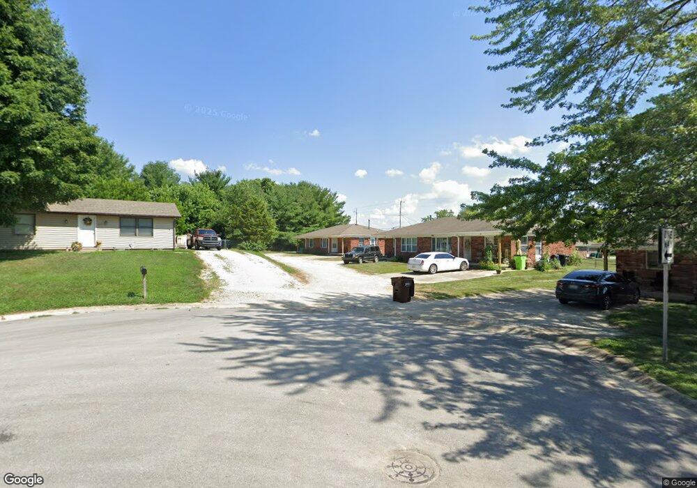
243 Harmony Hill Rd Franklin, IN 46131
Estimated Value: $341,000 - $404,000
2
Beds
1
Bath
1,680
Sq Ft
$220/Sq Ft
Est. Value
About This Home
This home is located at 243 Harmony Hill Rd, Franklin, IN 46131 and is currently estimated at $368,995, approximately $219 per square foot. 243 Harmony Hill Rd is a home located in Johnson County with nearby schools including Union Elementary School, Custer Baker Intermediate School, and Franklin Community Middle School.
Ownership History
Date
Name
Owned For
Owner Type
Purchase Details
Closed on
Apr 27, 2022
Sold by
Stonebrook Of Franklin Apartments Llc
Bought by
New Stonebrook Llc
Current Estimated Value
Home Financials for this Owner
Home Financials are based on the most recent Mortgage that was taken out on this home.
Original Mortgage
$3,015,000
Outstanding Balance
$2,860,565
Interest Rate
5.11%
Mortgage Type
New Conventional
Estimated Equity
-$2,491,570
Purchase Details
Closed on
Sep 22, 2017
Sold by
Plank Rd Duplexes Llc
Bought by
Stonebrook Of Franklin Apartments Llc
Home Financials for this Owner
Home Financials are based on the most recent Mortgage that was taken out on this home.
Original Mortgage
$1,899,000
Interest Rate
3.89%
Mortgage Type
Commercial
Purchase Details
Closed on
Nov 10, 2008
Sold by
Ennis Company Inc
Bought by
Tri Yf Partnership
Create a Home Valuation Report for This Property
The Home Valuation Report is an in-depth analysis detailing your home's value as well as a comparison with similar homes in the area
Home Values in the Area
Average Home Value in this Area
Purchase History
| Date | Buyer | Sale Price | Title Company |
|---|---|---|---|
| New Stonebrook Llc | -- | Kutak Rock Lllp | |
| Stonebrook Of Franklin Apartments Llc | -- | First American Title | |
| Tri Yf Partnership | -- | None Available |
Source: Public Records
Mortgage History
| Date | Status | Borrower | Loan Amount |
|---|---|---|---|
| Open | New Stonebrook Llc | $3,015,000 | |
| Previous Owner | Stonebrook Of Franklin Apartments Llc | $1,899,000 |
Source: Public Records
Tax History Compared to Growth
Tax History
| Year | Tax Paid | Tax Assessment Tax Assessment Total Assessment is a certain percentage of the fair market value that is determined by local assessors to be the total taxable value of land and additions on the property. | Land | Improvement |
|---|---|---|---|---|
| 2025 | $7,896 | $257,100 | $22,300 | $234,800 |
| 2024 | $7,896 | $356,900 | $22,500 | $334,400 |
| 2023 | $2,933 | $131,800 | $22,500 | $109,300 |
| 2022 | $2,939 | $131,800 | $22,500 | $109,300 |
| 2021 | $2,939 | $131,800 | $22,500 | $109,300 |
| 2020 | $2,939 | $131,800 | $22,500 | $109,300 |
| 2019 | $2,939 | $131,800 | $16,600 | $115,200 |
| 2018 | $2,988 | $149,400 | $16,600 | $132,800 |
| 2017 | $2,988 | $149,400 | $16,600 | $132,800 |
| 2016 | $2,988 | $149,400 | $16,600 | $132,800 |
| 2014 | $2,988 | $149,400 | $16,600 | $132,800 |
| 2013 | $2,988 | $149,400 | $16,600 | $132,800 |
Source: Public Records
Map
Nearby Homes
- 930 Belgium Blvd
- 988 Belgium Blvd
- 1007 Belgium Blvd
- 40 Village Rd
- 127 Oxbow Rd
- 31 N Wagon Rd
- 129 S Carlisle St
- 138 S Carlisle St
- 108 S Carlisle St
- 288 S Baldwin St
- 2160 Partridge Dr
- 2150 Partridge Dr
- 2090 Partridge Dr
- 2032 Partridge Dr
- 68 Irma St
- 000 North St
- 00A North St
- 350 North St
- 390 Park Ave
- 3910 N State Road 135
- 227 Cemetery Hill Rd
- 806 Old Plank Rd
- 209 Cemetery Hill Rd
- 722 Indiana 144
- 195 Cemetery Hill Rd
- 797 E Old South St
- 753 E Old Plank Rd
- 175 Cemetery Hill Rd
- 2675 W 300 N
- 741 Old Plank Rd
- 753 Old Plank Rd
- 769 Old Plank Rd
- 174 Cemetery Hill Rd
- 729 Old Plank Rd
- LOT 1 W 300 N
- 0 W 300 N
- LOT 3 W 300 N
- LOT 4 W 300 N
- LOT 2 W 300 N
- 709 Old Plank Rd