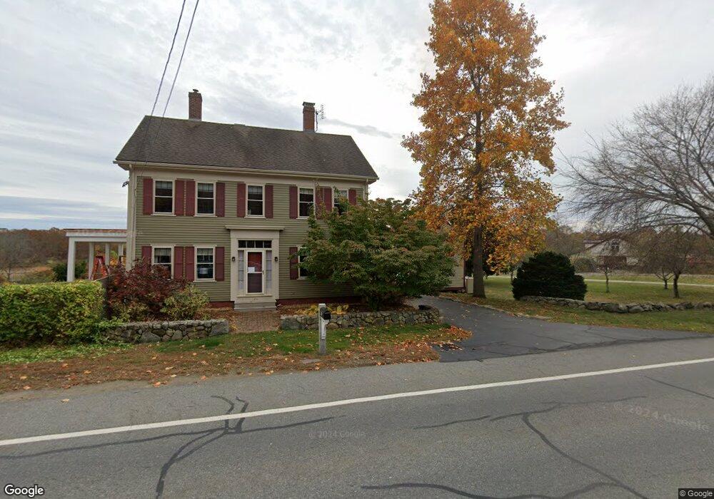
243 High Rd Newbury, MA 01951
Estimated Value: $694,000 - $1,215,000
3
Beds
2
Baths
2,076
Sq Ft
$459/Sq Ft
Est. Value
About This Home
This home is located at 243 High Rd, Newbury, MA 01951 and is currently estimated at $952,435, approximately $458 per square foot. 243 High Rd is a home located in Essex County with nearby schools including Triton Regional High School, River Valley Charter School, and Immaculate Conception School.
Ownership History
Date
Name
Owned For
Owner Type
Purchase Details
Closed on
Sep 24, 2021
Sold by
Dearmond Glen A and Dearmond Jennifer D
Bought by
Merrimac 490 Rt and Metcalf
Current Estimated Value
Purchase Details
Closed on
May 10, 2021
Sold by
Dearmond Glen A and Dearmond Jennifer D
Bought by
Larocque Carol A and Dearmond Jennifer D
Purchase Details
Closed on
Sep 17, 1998
Sold by
Margaret B Kelleher Rt
Bought by
Dearmond Glen A and Dearmond Jennifer D
Create a Home Valuation Report for This Property
The Home Valuation Report is an in-depth analysis detailing your home's value as well as a comparison with similar homes in the area
Home Values in the Area
Average Home Value in this Area
Purchase History
| Date | Buyer | Sale Price | Title Company |
|---|---|---|---|
| Merrimac 490 Rt | $455,000 | None Available | |
| Merrimac 490 Rt | $455,000 | None Available | |
| Merrimac 490 Rt | $455,000 | None Available | |
| Merrimac 490 Rt | $455,000 | None Available | |
| Larocque Carol A | -- | None Available | |
| Dearmond Glen A | -- | None Available | |
| Larocque Carol A | -- | None Available | |
| Dearmond Glen A | -- | None Available | |
| Larocque Carol A | -- | None Available | |
| Dearmond Glen A | $235,000 | -- | |
| Dearmond Glen A | $235,000 | -- |
Source: Public Records
Mortgage History
| Date | Status | Borrower | Loan Amount |
|---|---|---|---|
| Previous Owner | Dearmond Glen A | $200,000 | |
| Previous Owner | Dearmond Glen A | $203,600 | |
| Previous Owner | Dearmond Glen A | $168,000 | |
| Previous Owner | Dearmond Glen A | $75,000 |
Source: Public Records
Tax History Compared to Growth
Tax History
| Year | Tax Paid | Tax Assessment Tax Assessment Total Assessment is a certain percentage of the fair market value that is determined by local assessors to be the total taxable value of land and additions on the property. | Land | Improvement |
|---|---|---|---|---|
| 2025 | $6,972 | $935,800 | $510,700 | $425,100 |
| 2024 | $6,603 | $859,800 | $459,500 | $400,300 |
| 2023 | $6,788 | $782,900 | $416,000 | $366,900 |
| 2022 | $6,966 | $715,900 | $393,600 | $322,300 |
| 2021 | $6,867 | $644,200 | $350,000 | $294,200 |
| 2020 | $6,862 | $624,400 | $341,300 | $283,100 |
| 2019 | $6,750 | $624,400 | $341,300 | $283,100 |
| 2018 | $5,914 | $542,590 | $277,390 | $265,200 |
| 2017 | $5,525 | $520,690 | $264,390 | $256,300 |
| 2016 | $5,329 | $467,491 | $231,091 | $236,400 |
| 2015 | $5,185 | $450,091 | $213,691 | $236,400 |
| 2014 | $5,095 | $450,091 | $213,691 | $236,400 |
Source: Public Records
Map
Nearby Homes
- 239 High Rd
- 222 High Rd
- 66 Cottage Rd
- 54 Cottage Rd
- 182 High Rd
- 24 Seaview Ln
- 7 Pine Island Rd
- 7 Marsh Ave
- 144 High Rd
- 105 High Rd Unit Lot 2
- 24 Old Rowley Rd
- 100 High Rd
- 1 Littles Ln
- 65 Plum Island Turnpike
- 28 & 30 Plum Island Turnpike
- 4 Hanover St
- 1 Lancaster Rd
- 2 Sunset Dr
- 26 Beacon Ave
- 33 Union St