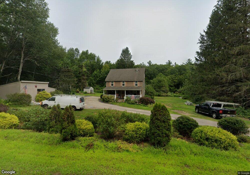
243 Maple Ave Rutland, MA 01543
Estimated Value: $397,000 - $536,000
3
Beds
2
Baths
1,844
Sq Ft
$251/Sq Ft
Est. Value
About This Home
This home is located at 243 Maple Ave, Rutland, MA 01543 and is currently estimated at $462,168, approximately $250 per square foot. 243 Maple Ave is a home located in Worcester County with nearby schools including Wachusett Regional High School.
Ownership History
Date
Name
Owned For
Owner Type
Purchase Details
Closed on
Feb 1, 2019
Sold by
Mullen John M and Mullen Kelly B
Bought by
243 Maple Ave Rt
Current Estimated Value
Purchase Details
Closed on
Apr 7, 2011
Sold by
Mullen John M and Mullen Kelly B
Bought by
Mullen John M and Mullen Kelly B
Home Financials for this Owner
Home Financials are based on the most recent Mortgage that was taken out on this home.
Original Mortgage
$159,000
Interest Rate
4.99%
Mortgage Type
Purchase Money Mortgage
Purchase Details
Closed on
Sep 9, 2008
Sold by
Mullen John M and Mullen Kelly B
Bought by
Mullen John M
Purchase Details
Closed on
May 4, 2005
Sold by
Mullen John M
Bought by
Mullen John M and Mullen Kelly B
Home Financials for this Owner
Home Financials are based on the most recent Mortgage that was taken out on this home.
Original Mortgage
$131,250
Interest Rate
6.01%
Mortgage Type
Purchase Money Mortgage
Create a Home Valuation Report for This Property
The Home Valuation Report is an in-depth analysis detailing your home's value as well as a comparison with similar homes in the area
Home Values in the Area
Average Home Value in this Area
Purchase History
| Date | Buyer | Sale Price | Title Company |
|---|---|---|---|
| 243 Maple Ave Rt | -- | None Available | |
| Mullen John M | -- | -- | |
| Mullen John M | -- | -- | |
| Mullen John M | -- | -- |
Source: Public Records
Mortgage History
| Date | Status | Borrower | Loan Amount |
|---|---|---|---|
| Previous Owner | Mullen John M | $159,000 | |
| Previous Owner | Mullen John M | $131,250 |
Source: Public Records
Tax History Compared to Growth
Tax History
| Year | Tax Paid | Tax Assessment Tax Assessment Total Assessment is a certain percentage of the fair market value that is determined by local assessors to be the total taxable value of land and additions on the property. | Land | Improvement |
|---|---|---|---|---|
| 2025 | $4,877 | $342,500 | $105,600 | $236,900 |
| 2024 | $4,717 | $318,100 | $101,200 | $216,900 |
| 2023 | $4,323 | $315,100 | $95,900 | $219,200 |
| 2022 | $4,082 | $258,500 | $82,200 | $176,300 |
| 2021 | $3,960 | $237,100 | $82,200 | $154,900 |
| 2020 | $3,629 | $206,100 | $78,400 | $127,700 |
| 2019 | $3,599 | $201,200 | $75,000 | $126,200 |
| 2018 | $3,187 | $175,800 | $75,000 | $100,800 |
| 2017 | $3,221 | $175,800 | $75,000 | $100,800 |
| 2016 | $3,366 | $193,800 | $71,700 | $122,100 |
| 2015 | $3,339 | $189,200 | $71,700 | $117,500 |
| 2014 | $3,237 | $189,200 | $71,700 | $117,500 |
Source: Public Records
Map
Nearby Homes
- 189 Maple Ave
- 14 Welch Ave Unit A
- 4 Wilson Way
- 176 Maple Ave Unit 1-38
- 176 Maple Ave Unit 3-25
- 176 Maple Ave Unit 2-26
- 7 Victoria Ave
- 2 Kosta Ave
- 7 Emerald Rd
- 236 Turkey Hill Rd
- 7 Prescott St
- 289 Richards Ave
- 85 Maple Ave Unit A
- 21 Highland Park Rd
- 132 Fidelity Dr Unit 61
- 10 Fidelity Dr Unit 5
- 12 Fidelity Dr Unit 6
- 10 Beechwood Dr
- 2 Forest Hill Dr
- 43 Irish Ln
- 233 Maple Ave
- 229 Maple Ave
- 228 Maple Ave
- Lot 4 Emerald Rd
- 43 Emerald Rd
- Lot 5 Emerald Rd
- Lot 3 Emerald Rd
- Lot 1 Emerald Rd
- 100 Emerald Rd
- 266 Maple Ave
- 221 Maple Ave
- 98 Emerald Rd Unit 14
- 301 Maple Ave ("Devonshire") Unit 301
- 268 Maple Ave
- 265 Maple Ave
- 94 Emerald Rd
- 267 Maple Ave
- 272 Maple Ave Unit 1
- 92 Emerald Rd
- 273 Maple Ave Unit 102