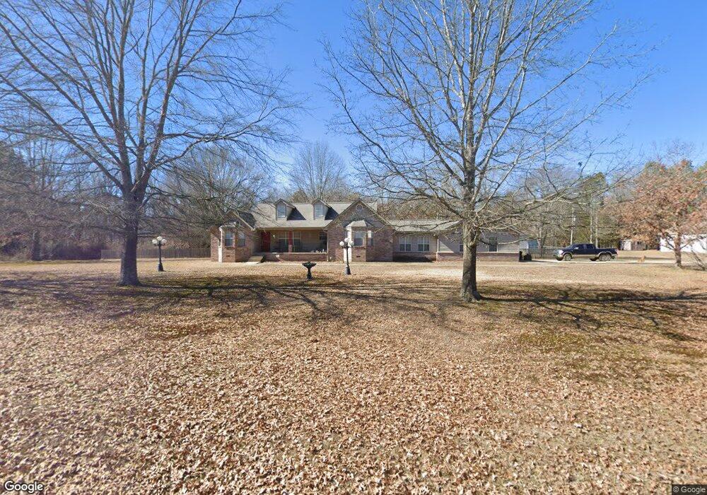
243 Nickie Ave Clinton, AR 72031
Estimated Value: $275,544 - $426,000
Studio
2
Baths
2,399
Sq Ft
$137/Sq Ft
Est. Value
About This Home
This home is located at 243 Nickie Ave, Clinton, AR 72031 and is currently estimated at $328,136, approximately $136 per square foot. 243 Nickie Ave is a home located in Van Buren County with nearby schools including Clinton Elementary School, Clinton Junior High School, and Clinton High School.
Ownership History
Date
Name
Owned For
Owner Type
Purchase Details
Closed on
Aug 16, 2001
Bought by
Entrekin
Current Estimated Value
Purchase Details
Closed on
Aug 22, 2000
Bought by
Adams Adams 1 and Adams 44Ac
Purchase Details
Closed on
Apr 8, 1999
Bought by
48 Adams 1 and 48 Ac
Purchase Details
Closed on
Jun 4, 1998
Bought by
Adams
Purchase Details
Closed on
Dec 11, 1997
Bought by
Adams
Purchase Details
Closed on
Nov 14, 1996
Bought by
Adams
Create a Home Valuation Report for This Property
The Home Valuation Report is an in-depth analysis detailing your home's value as well as a comparison with similar homes in the area
Home Values in the Area
Average Home Value in this Area
Purchase History
| Date | Buyer | Sale Price | Title Company |
|---|---|---|---|
| Entrekin | $4,000 | -- | |
| Adams Adams 1 | -- | -- | |
| 48 Adams 1 | $4,000 | -- | |
| Adams | $4,000 | -- | |
| Adams | -- | -- | |
| Adams | $6,000 | -- |
Source: Public Records
Tax History
| Year | Tax Paid | Tax Assessment Tax Assessment Total Assessment is a certain percentage of the fair market value that is determined by local assessors to be the total taxable value of land and additions on the property. | Land | Improvement |
|---|---|---|---|---|
| 2025 | $1,910 | $58,970 | $5,420 | $53,550 |
| 2024 | $1,319 | $38,700 | $5,420 | $33,280 |
| 2023 | $1,394 | $38,700 | $5,420 | $33,280 |
| 2022 | $964 | $38,700 | $5,420 | $33,280 |
| 2021 | $1,281 | $38,700 | $5,420 | $33,280 |
| 2020 | $789 | $38,700 | $5,420 | $33,280 |
| 2019 | $789 | $40,540 | $5,420 | $35,120 |
| 2018 | $814 | $40,540 | $5,420 | $35,120 |
| 2017 | $1,159 | $40,540 | $5,420 | $35,120 |
| 2015 | -- | $24,770 | $3,250 | $21,520 |
| 2014 | -- | $24,770 | $3,250 | $21,520 |
| 2013 | -- | $24,770 | $3,250 | $21,520 |
Source: Public Records
Map
Nearby Homes
- 240 Huie St
- 229 Richard St
- 936 Cemetery Rd
- 0 Highway 65 S Unit 20037632
- 0000 Highway 65 S
- 2304 Highway 65 S
- 799 Barrens Community Rd
- 3570 Highway 65 S
- Lots 9 &10 Kip Ln
- Clinton Kip Ln
- Clinton Kip Ln
- 000 Donnies Dr
- TBD Highway 65
- 4263 Highway 65 S
- 1174 Highway 65 S
- 715 Jason St
- 4971 Highway 65
- 2 acres Highway 65
- TBD Adrianne Ave
- 155 Edwards St
Your Personal Tour Guide
Ask me questions while you tour the home.