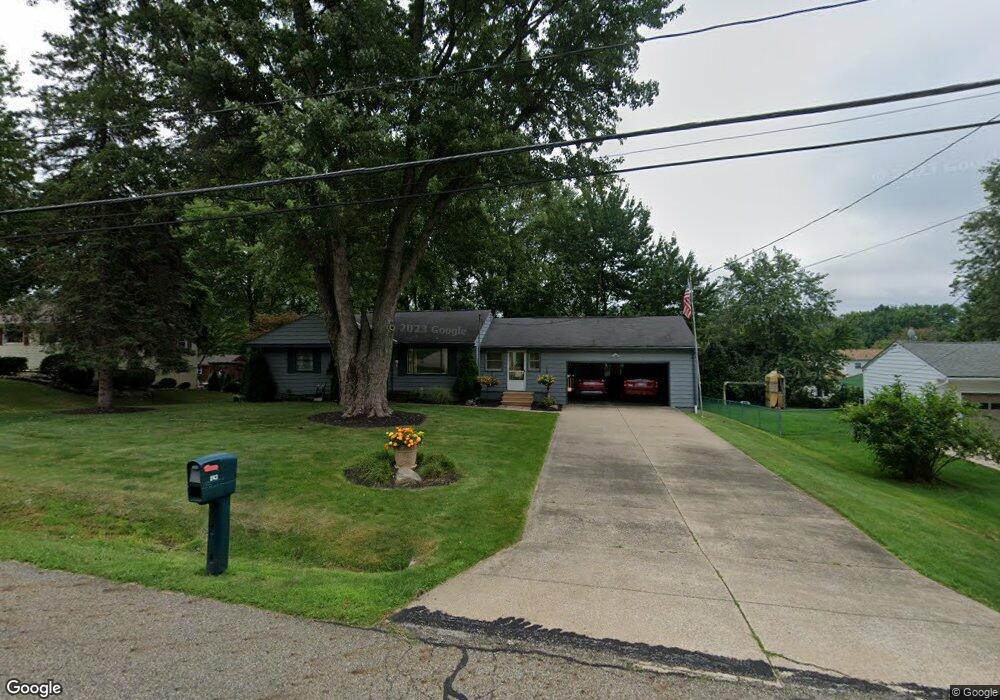
243 S Alling Rd Tallmadge, OH 44278
Estimated Value: $209,000 - $233,000
3
Beds
2
Baths
1,068
Sq Ft
$205/Sq Ft
Est. Value
About This Home
This home is located at 243 S Alling Rd, Tallmadge, OH 44278 and is currently estimated at $218,692, approximately $204 per square foot. 243 S Alling Rd is a home located in Summit County with nearby schools including Tallmadge Middle School, Tallmadge High School, and Steel Academy.
Ownership History
Date
Name
Owned For
Owner Type
Purchase Details
Closed on
Feb 2, 2002
Sold by
Hignite Dana L and Gibitz James R
Bought by
Gibitz James R and Gibitz Dana L
Current Estimated Value
Home Financials for this Owner
Home Financials are based on the most recent Mortgage that was taken out on this home.
Original Mortgage
$104,000
Interest Rate
6.93%
Purchase Details
Closed on
May 24, 1996
Sold by
Francesconi Stacey A
Bought by
Mignite Dana L and Gibitz James R
Home Financials for this Owner
Home Financials are based on the most recent Mortgage that was taken out on this home.
Original Mortgage
$92,600
Interest Rate
8.1%
Mortgage Type
New Conventional
Create a Home Valuation Report for This Property
The Home Valuation Report is an in-depth analysis detailing your home's value as well as a comparison with similar homes in the area
Home Values in the Area
Average Home Value in this Area
Purchase History
| Date | Buyer | Sale Price | Title Company |
|---|---|---|---|
| Gibitz James R | -- | -- | |
| Mignite Dana L | $97,550 | -- |
Source: Public Records
Mortgage History
| Date | Status | Borrower | Loan Amount |
|---|---|---|---|
| Closed | Gibitz James R | $104,000 | |
| Closed | Mignite Dana L | $92,600 |
Source: Public Records
Tax History Compared to Growth
Tax History
| Year | Tax Paid | Tax Assessment Tax Assessment Total Assessment is a certain percentage of the fair market value that is determined by local assessors to be the total taxable value of land and additions on the property. | Land | Improvement |
|---|---|---|---|---|
| 2025 | $2,280 | $54,895 | $8,600 | $46,295 |
| 2024 | $2,280 | $54,895 | $8,600 | $46,295 |
| 2023 | $2,280 | $54,895 | $8,600 | $46,295 |
| 2022 | $2,128 | $43,628 | $6,825 | $36,803 |
| 2021 | $2,138 | $43,628 | $6,825 | $36,803 |
| 2020 | $2,121 | $43,630 | $6,830 | $36,800 |
| 2019 | $1,916 | $36,920 | $7,190 | $29,730 |
| 2018 | $1,688 | $36,920 | $7,190 | $29,730 |
| 2017 | $1,496 | $36,920 | $7,190 | $29,730 |
| 2016 | $1,614 | $33,500 | $7,190 | $26,310 |
| 2015 | $1,496 | $33,500 | $7,190 | $26,310 |
| 2014 | $1,486 | $33,500 | $7,190 | $26,310 |
| 2013 | $1,540 | $34,870 | $7,190 | $27,680 |
Source: Public Records
Map
Nearby Homes
- 353 Southeast Ave
- 331 Southeast Ave
- 313 Southeast Ave
- 213 Green Hill Dr
- 130 Strecker Dr
- 185 Reserve Dr
- 288 S Munroe Rd
- 243 S Munroe Rd
- 500 Dottie Ct Unit 109
- 2333 Eastwood Ave
- 786 Southeast Ave
- 2330 Eastwood Ave
- 523 S Munroe Rd
- 689 Alaho St
- 549 S Munroe Rd
- 810 Norton Dr
- 2354 Savoy Ave
- 0 East Ave
- 315 Fawnwood Dr
- 206 Fawnwood Dr
- 253 S Alling Rd
- 233 S Alling Rd
- 240 High Point Cir
- 248 High Point Cir
- 242 S Alling Rd
- 263 S Alling Rd
- 230 High Point Cir
- 223 S Alling Rd
- 256 High Point Cir
- 252 S Alling Rd
- 232 S Alling Rd
- 220 High Point Cir
- 264 High Point Cir
- 262 S Alling Rd
- 222 S Alling Rd
- 273 S Alling Rd
- 213 S Alling Rd
- 237 High Point Cir
- 253 High Point Cir
- 272 S Alling Rd