Estimated Value: $77,000 - $106,000
4
Beds
1
Bath
1,152
Sq Ft
$79/Sq Ft
Est. Value
About This Home
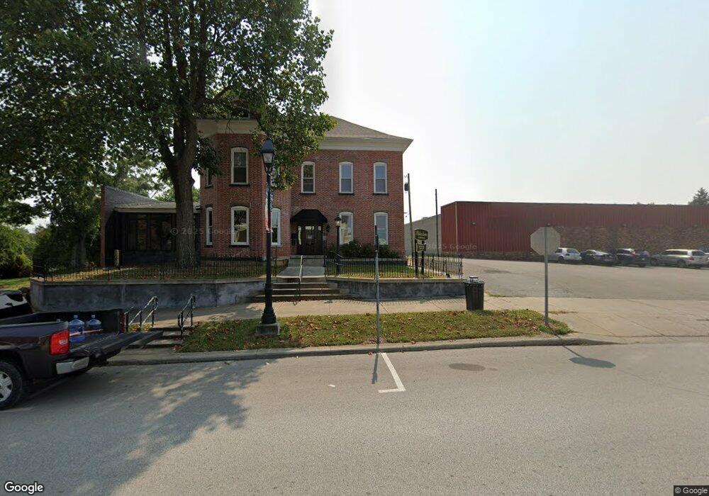
This home is located at 243 S Main St Unit ST24A, Cadiz, OH 43907 and is currently estimated at $91,488, approximately $79 per square foot. 243 S Main St Unit ST24A is a home located in Harrison County with nearby schools including Harrison Central Elementary School and Harrison Central Junior/Senior High School.
Ownership History
Date
Name
Owned For
Owner Type
Purchase Details
Closed on
Mar 22, 2021
Sold by
Freeman Michael David and Freeman Jill Renee
Bought by
Fluharty Shannan
Current Estimated Value
Home Financials for this Owner
Home Financials are based on the most recent Mortgage that was taken out on this home.
Original Mortgage
$63,331
Outstanding Balance
$56,772
Interest Rate
2.7%
Mortgage Type
FHA
Estimated Equity
$34,716
Purchase Details
Closed on
Nov 29, 2004
Purchase Details
Closed on
Jul 15, 1993
Create a Home Valuation Report for This Property
The Home Valuation Report is an in-depth analysis detailing your home's value as well as a comparison with similar homes in the area
Home Values in the Area
Average Home Value in this Area
Purchase History
| Date | Buyer | Sale Price | Title Company |
|---|---|---|---|
| Fluharty Shannan | $64,500 | Nomad Title | |
| -- | $70,000 | -- | |
| -- | -- | -- |
Source: Public Records
Mortgage History
| Date | Status | Borrower | Loan Amount |
|---|---|---|---|
| Open | Fluharty Shannan | $63,331 |
Source: Public Records
Tax History Compared to Growth
Tax History
| Year | Tax Paid | Tax Assessment Tax Assessment Total Assessment is a certain percentage of the fair market value that is determined by local assessors to be the total taxable value of land and additions on the property. | Land | Improvement |
|---|---|---|---|---|
| 2024 | $884 | $22,250 | $2,520 | $19,730 |
| 2023 | $884 | $22,250 | $2,520 | $19,730 |
| 2022 | $1,069 | $25,180 | $2,090 | $23,090 |
| 2021 | $1,034 | $25,180 | $2,090 | $23,090 |
| 2020 | $1,031 | $25,180 | $2,090 | $23,090 |
| 2019 | $884 | $21,340 | $1,770 | $19,570 |
| 2018 | $884 | $21,340 | $1,770 | $19,570 |
| 2017 | $968 | $21,340 | $1,770 | $19,570 |
| 2016 | $1,043 | $23,230 | $1,950 | $21,280 |
| 2015 | $1,042 | $23,230 | $1,950 | $21,280 |
| 2014 | $853 | $22,420 | $1,770 | $20,650 |
| 2013 | $853 | $22,420 | $1,770 | $20,650 |
Source: Public Records
Map
Nearby Homes
- 150 E South St
- 419 Saint Clair Ave
- 254 S Buffalo St
- 203 Roan Ave
- 207 Maplewood Dr
- 216 Charleston St
- 508 Lower Lincoln
- 593 Dewey Ave
- 616 Mccready Ave
- 388 N Main St
- 210 Harrison Ave
- 44208 Meadowlark Ln
- 804 E Market St
- 0 E Market St
- 265 Old Steubenville Pike
- 390 Oak Park Rd
- 273 Old Steubenville Pike
- 0 N Main St Unit 5153554
- 78791 Kanoski Rd
- 0 Brewer Rd
- 243 S Main St
- 243 S Main (Rear) St
- 241 S Main St
- 144 S Main St
- 263 S Main St
- 143 W South St
- 147 W South St
- 305 Grant St
- 251 S Main St
- 256 S Muskingum St
- 260 S Muskingum St
- 307 Grant St
- 266 S Muskingum St
- 252 S Muskingum St
- 246 S Muskingum St
- 242 S Muskingum St
- 313 Grant St
- 232 S Muskingum St
- 222 S Muskingum St
- 232 S Main St