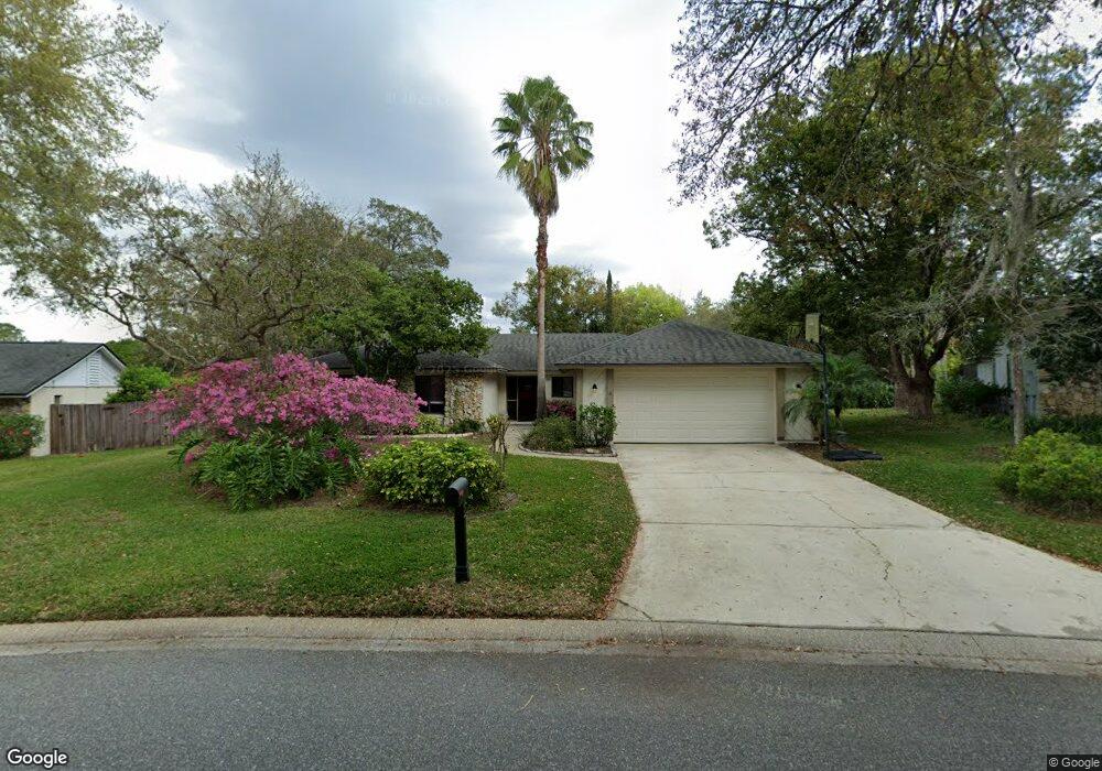
243 Stevenage Dr Longwood, FL 32779
Estimated Value: $465,000 - $502,000
3
Beds
3
Baths
2,196
Sq Ft
$218/Sq Ft
Est. Value
About This Home
This home is located at 243 Stevenage Dr, Longwood, FL 32779 and is currently estimated at $479,486, approximately $218 per square foot. 243 Stevenage Dr is a home located in Seminole County with nearby schools including Wekiva Elementary School, Teague Middle School, and Lake Brantley High School.
Ownership History
Date
Name
Owned For
Owner Type
Purchase Details
Closed on
Apr 18, 2001
Sold by
Merie T Verplank I
Bought by
Sommerio Kevin M
Current Estimated Value
Home Financials for this Owner
Home Financials are based on the most recent Mortgage that was taken out on this home.
Original Mortgage
$132,500
Interest Rate
6.99%
Mortgage Type
New Conventional
Purchase Details
Closed on
Jul 1, 1988
Bought by
Sommerio Kevin H
Purchase Details
Closed on
Apr 1, 1981
Bought by
Sommerio Kevin H
Purchase Details
Closed on
Aug 1, 1979
Bought by
Sommerio Kevin H
Create a Home Valuation Report for This Property
The Home Valuation Report is an in-depth analysis detailing your home's value as well as a comparison with similar homes in the area
Home Values in the Area
Average Home Value in this Area
Purchase History
| Date | Buyer | Sale Price | Title Company |
|---|---|---|---|
| Sommerio Kevin M | $139,500 | -- | |
| Sommerio Kevin H | $109,500 | -- | |
| Sommerio Kevin H | $96,900 | -- | |
| Sommerio Kevin H | $20,500 | -- |
Source: Public Records
Mortgage History
| Date | Status | Borrower | Loan Amount |
|---|---|---|---|
| Open | Sommerio Kevin M | $133,750 | |
| Closed | Sommerio Kevin M | $132,500 |
Source: Public Records
Tax History Compared to Growth
Tax History
| Year | Tax Paid | Tax Assessment Tax Assessment Total Assessment is a certain percentage of the fair market value that is determined by local assessors to be the total taxable value of land and additions on the property. | Land | Improvement |
|---|---|---|---|---|
| 2024 | $2,446 | $197,231 | -- | -- |
| 2023 | $2,386 | $191,486 | $0 | $0 |
| 2021 | $2,250 | $180,494 | $0 | $0 |
| 2020 | $2,228 | $178,002 | $0 | $0 |
| 2019 | $2,204 | $174,000 | $0 | $0 |
| 2018 | $2,181 | $170,756 | $0 | $0 |
| 2017 | $2,164 | $167,244 | $0 | $0 |
| 2016 | $2,204 | $164,951 | $0 | $0 |
| 2015 | $1,927 | $162,665 | $0 | $0 |
| 2014 | $1,927 | $161,374 | $0 | $0 |
Source: Public Records
Map
Nearby Homes
- 1204 Duncan Ct
- 201 Lyndhurst Ct
- 215 Canterclub Trail
- 210 Banbury Ct
- 808 Sweetwater Club Blvd
- 217 Lochberry Place
- 538 Majestic Oak Dr
- 302 Sand Trap Cove
- 290 Queensberry Ct
- 2744 Orchard Dr
- 121 Harrogate Ct
- 2701 Canterclub Trail
- 1957 Saint Andrews Place Unit A
- 300 Churchill Dr
- 1036 Golf Valley Dr
- 1906 Saint Andrews Place
- 935 Ridgeside Ct
- 165 Durham Place
- 193 Durham Place
- 2434 Carol Woods Way
- 241 Stevenage Dr
- 245 Stevenage Dr
- 200 N Mounts Bay Ct
- 239 Stevenage Dr
- 247 Stevenage Dr
- 204 N Mounts Bay Ct
- 242 Stevenage Dr
- 240 Stevenage Dr
- 246 Stevenage Dr
- 237 Stevenage Dr
- 249 Stevenage Dr
- 208 N Mounts Bay Ct
- 200 Coble Dr
- 201 Coble Dr
- 211 N Mounts Bay Ct
- 248 Stevenage Dr
- 246 N Mounts Bay Ct
- 235 Stevenage Dr
- 105 Stevenage Ct
- 100 Stevenage Ct